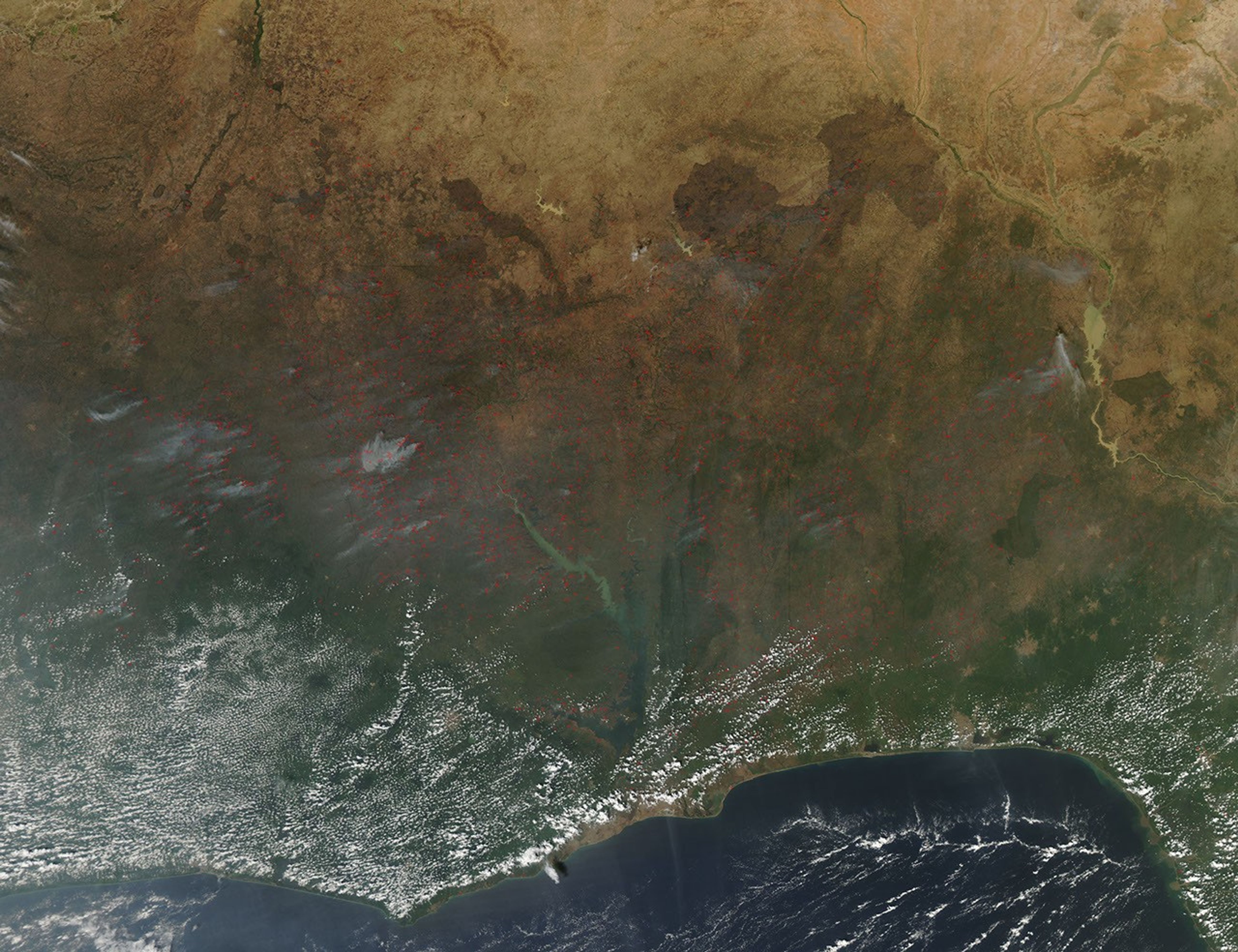
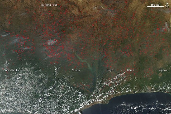
Agricultural fires burned across much of western Africa in early December 2009. The Moderate Resolution Imaging Spectroradiometer (MODIS) on NASA’s Aqua satellite captured this true-color image on December 6, 2009. Red outlines indicate hotspots associated with high surface temperatures, and the fires range from Côte d’Ivoire in the west to Nigeria in the east. Although most of the fires emit no visible smoke plumes, plumes do arise from blazes in Côte d’Ivoire, Ghana, and Nigeria. South of the fires, tiny clouds trace the coastline.
Although agricultural burning such as this is not necessarily immediately hazardous, it can have a major impact on air quality and human health, climate, and natural resources.
References & Resources
NASA image by Jeff Schmaltz, MODIS Rapid Response Team, Goddard Space Flight Center. Caption by Michon Scott, NASA Earth Observatory.