


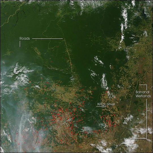
In northern Mato Grosso, Brazil, land cover change from dense rainforest to roads and agricultural land is often achieved through fire. People also use fire to maintain agricultural and pasture land. This image from the Moderate Resolution Imaging Spectroradiometer (MODIS)on NASA’s Terra satellite from July 15, 2004, shows numerous fires (marked in red) surrounding the Xingu Indigenous Peoples Park, located in the headwaters of the Xingu River. To the east is the Bananal Wetlands surrounding the Araguaia River. In the top part of the image, the dense rainforest is a nearly uniform wash of vibrant green. The forest is now laced with roads, which appear as fuzzy, light green lines. The fuzziness comes from clearings that have sprung up along the roads.
The high-resolution image provided above is 500 meters per pixel. The MODIS Rapid Response System provides this image at additional resolutions.
References & Resources
Image courtesy Jacques Descloitres, MODIS Rapid Response Team, NASA-Goddard Space Flight Center


