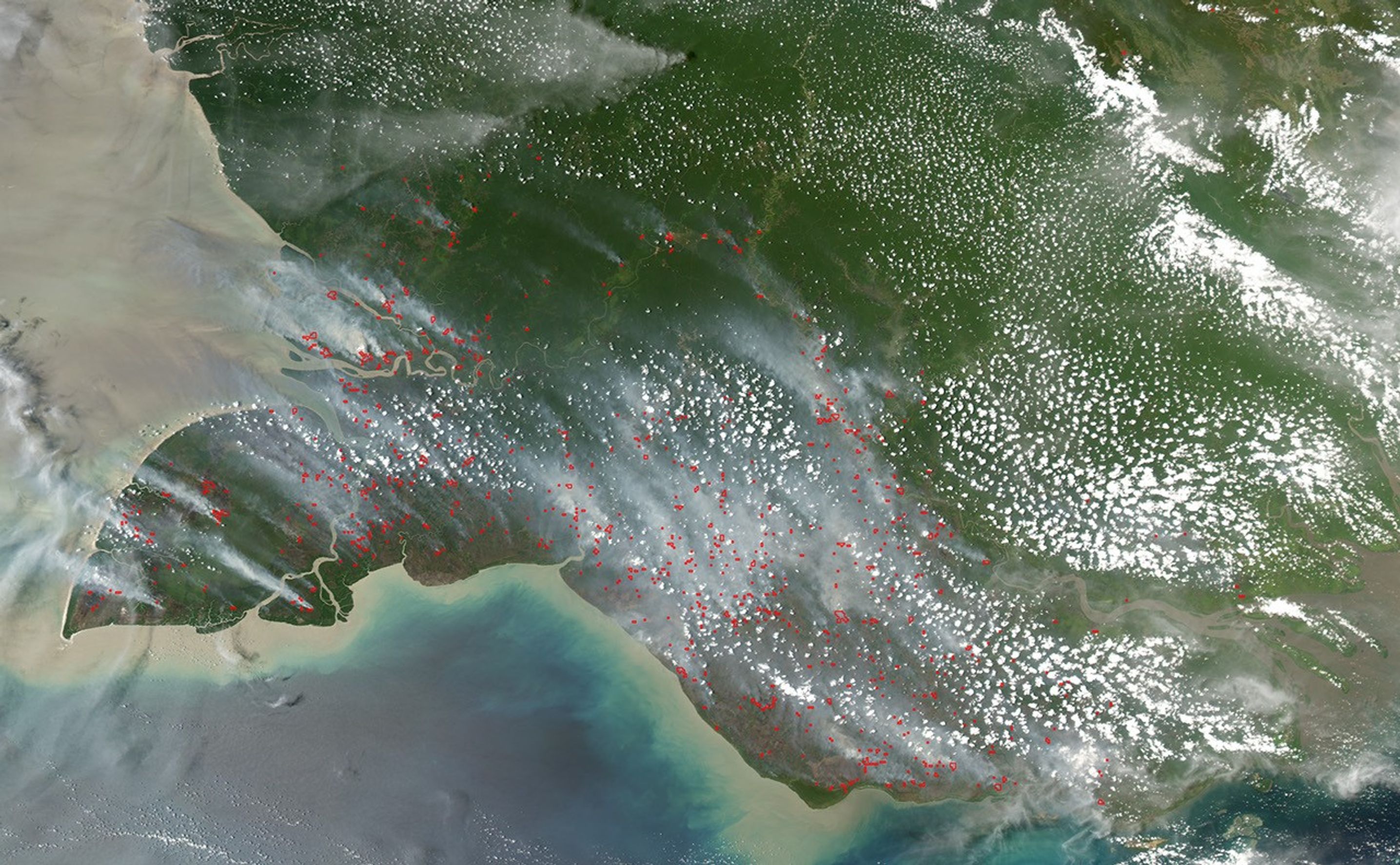
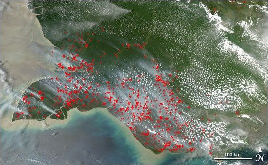
Suggested Searches

1 min read

Fires on Cape York Peninsula and New Guinea

Instruments:
Topics:
2004-10-13 00:00:00
October 13, 2004

Southeasterly winds were aligning the smoke plumes from scores of fires burning on New Guinea on October 13, 2004, when this image was captured by the Moderate Resolution Imaging Spectroradiometer (MODIS) on NASA’s Aqua satellite. Most of the fires (marked in red) appear concentrated between the southern coast and the Fly River (delta at lower right).

References & Resources

NASA image created by Jesse Allen, Earth Observatory, using data obtained from the MODIS Rapid Response team.

You may also be interested in:

Stay up-to-date with the latest content from NASA as we explore the universe and discover more about our home planet.

New Timing for Stubble Burning in India
5 min read

Scientists say the seasonal crop fires are burning later in the day than in previous years.

Article
Fires Erupt in South-Central Chile 
2 min read

Tens of thousands of people fled to safety as blazes spread throughout the country’s Biobío and Ñuble regions.

Article
Winds Whip Up Fires and Dust on the Southern Plains
3 min read

Dry, gusty conditions spurred fast-growing fires in Oklahoma and Kansas, along with dangerous dust storms across the region.

Article