
Persistent drought, high temperatures, and strong winds have come together to produce what forecasters are calling “historic fire danger” in western Oklahoma.
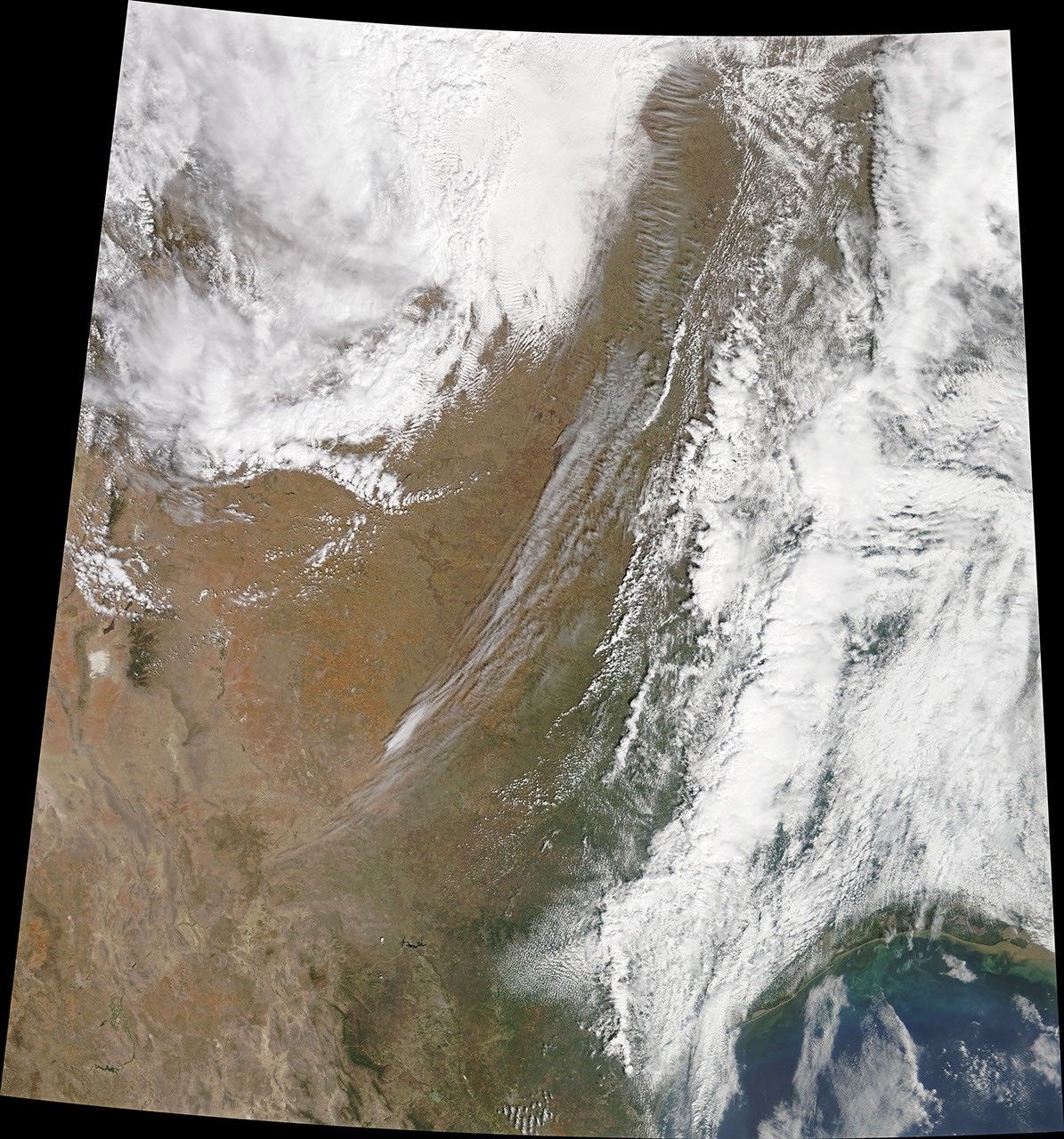
The Moderate Resolution Imaging Spectroradiometer (MODIS) on NASA’s Terra satellite captured this image of a large grass fire raging in Dewey County on April 13, 2018. The Rhea fire had burned more than 330 square kilometers (130 square miles) by the afternoon. To the north, the 34 Complex fire, which was possibly started by a downed power line, had charred roughly 240 square kilometers (92 square miles). Hundreds of people have been forced to evacuate from Vici, Taloga, Seiling, Putnam, and other communities.
The fires are burning through unusually withered prairie grass and pasturelands. Following a dry summer, most winter storms bypassed the region, leaving much of the Southwest in the grip of a serious drought. A recent hard freeze that killed off spring growth made the landscape even more of a tinderbox.
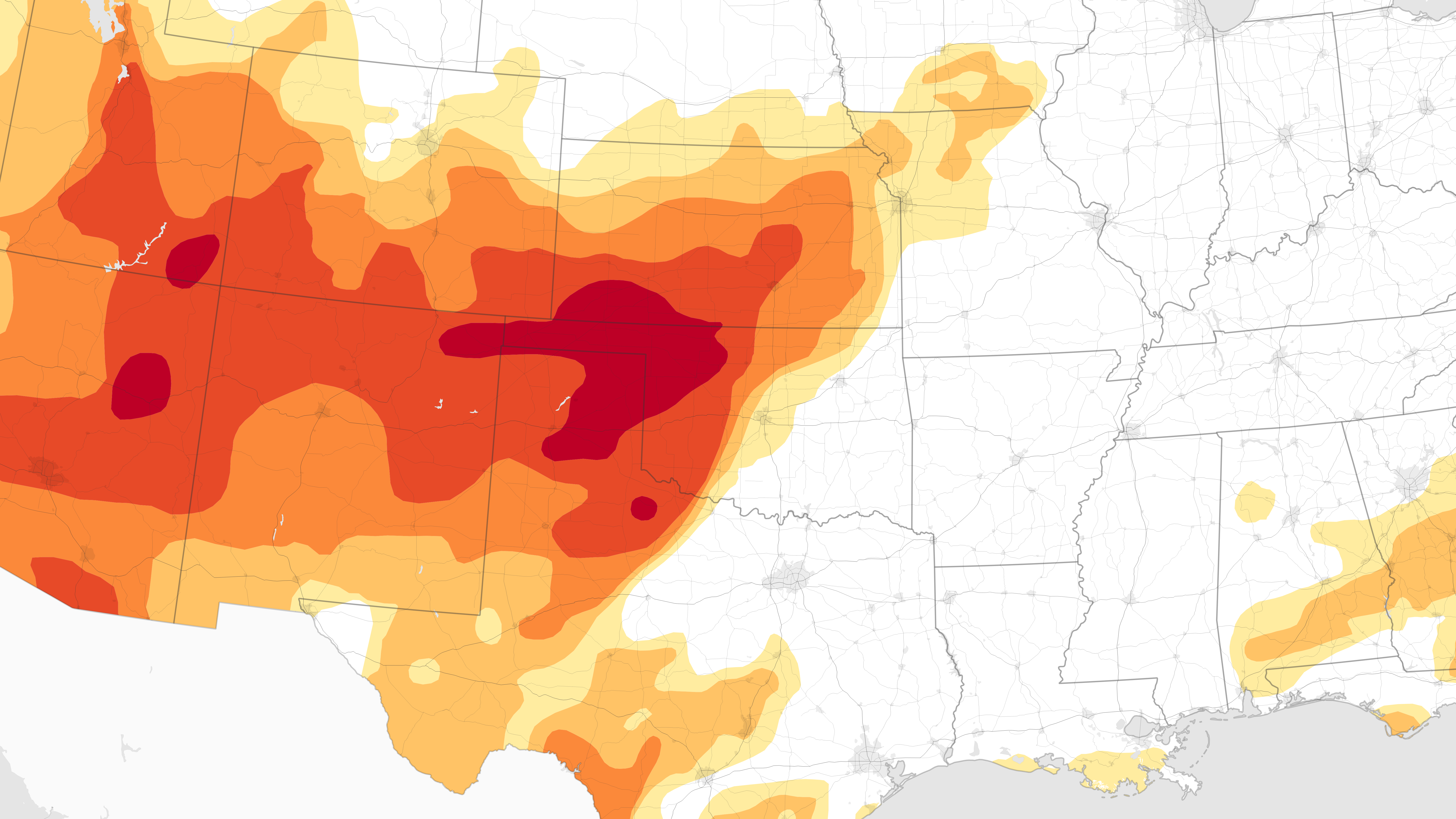
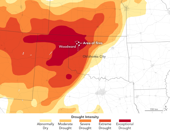
In its most recent analysis, the U.S. Drought Monitor listed conditions in western Oklahoma as “exceptional,” the highest rank on its drought intensity scale. The map above is based on measurements of climate, soil, and water conditions from more than 350 federal, state, and local observers around the country.
Some parts of western Oklahoma have gone more than 185 days without receiving more than one-quarter inch (0.6 centimeters) of rain, noted Todd Lindley, a meteorologist with the National Weather Service. Some areas are facing sustained winds of up to 55 kilometers (35 miles) per hour, relative humidity in the range of 10 to 15 percent, and temperatures above 32 degrees Celsius (90 degrees Fahrenheit). That potent combination, more extreme than any conditions seen in the area during the past decade, is what prompted forecasters to call the fire danger historic.
One of the fires was burning hot enough to produce a pyrocumulus cloud, noted Bill Line of the National Weather Service on the Satellite Liaison Blog. These towering clouds can loft smoke plumes several kilometers into the air, where they can encounter winds capable of transporting the smoke over long distances. Other observers have noted smoke from these fires had reached an estimated 9 kilometers (6 miles) above the surface.
References & Resources
- Oklahoma Department of Agriculture and Forestry (2018, April 13) Notes from Today’s Press Conference on Historic Fire Danger. Accessed April 13, 2018.
- Oklahoma Forestry Services (2018, April 13) Fire Situation Report – April 13, 2018. Accessed April 13, 2018.
- Satellite Liaison Blog (2018, April 12) Extreme Fire Weather 12 April 2018. Accessed April 13, 2018.
- The Weather Channel (2018, April 13) Oklahoma Wildfires Explode in Size, Force Towns to Evacuate. Accessed April 13, 2018.
- The Oklahoman (2018, April 12) Thousands of acres burned Thursday in wildfires across Oklahoma. Accessed April 13, 2018.
NASA Earth Observatory images by Joshua Stevens, using data from the United States Drought Monitor at the University of Nebraska-Lincoln, and MODIS data from LANCE/EOSDIS Rapid Response . Story by Adam Voiland.