


Along the West Coast, hot, dry, windy weather is hindering fire containment efforts from southern California to Washington. This Moderate Resolution Imaging Spectroradiometer (MODIS) image from Tuesday, July 29, 2002, shows active (red dots) up and down the Pacific coast.
In southern California, the McNalley Fire (large cluster of smoke and red dots) burning in the Sequoia National Forest has scorched 76,000 acres since it began on July 21, and is still only about 35% contained. The fire threatens 11 Giant Sequoia groves and 200 residences.
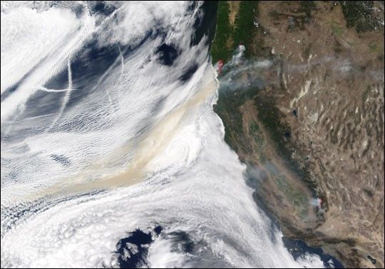
In Oregon, more than 300,000 acres are burning as firefighters work to contain 14 large fires in the state. Very near the coast, a line of red dots marks the locations of actively burning areas of the Florence Fire (north) and the Sour Biscuit Fire (south). A large smoke plume drifts out over a cloud bank sitting over the Pacific Ocean. In the central part of the state, three more large fires are adding their smoke to the larger plume: (north to south) North Umpqua Complex, Tiller Complex, and Timbered Rock.
References & Resources
Image by Jesse Allen, based on data from the MODIS Rapid Response Team at NASA-GSFC


