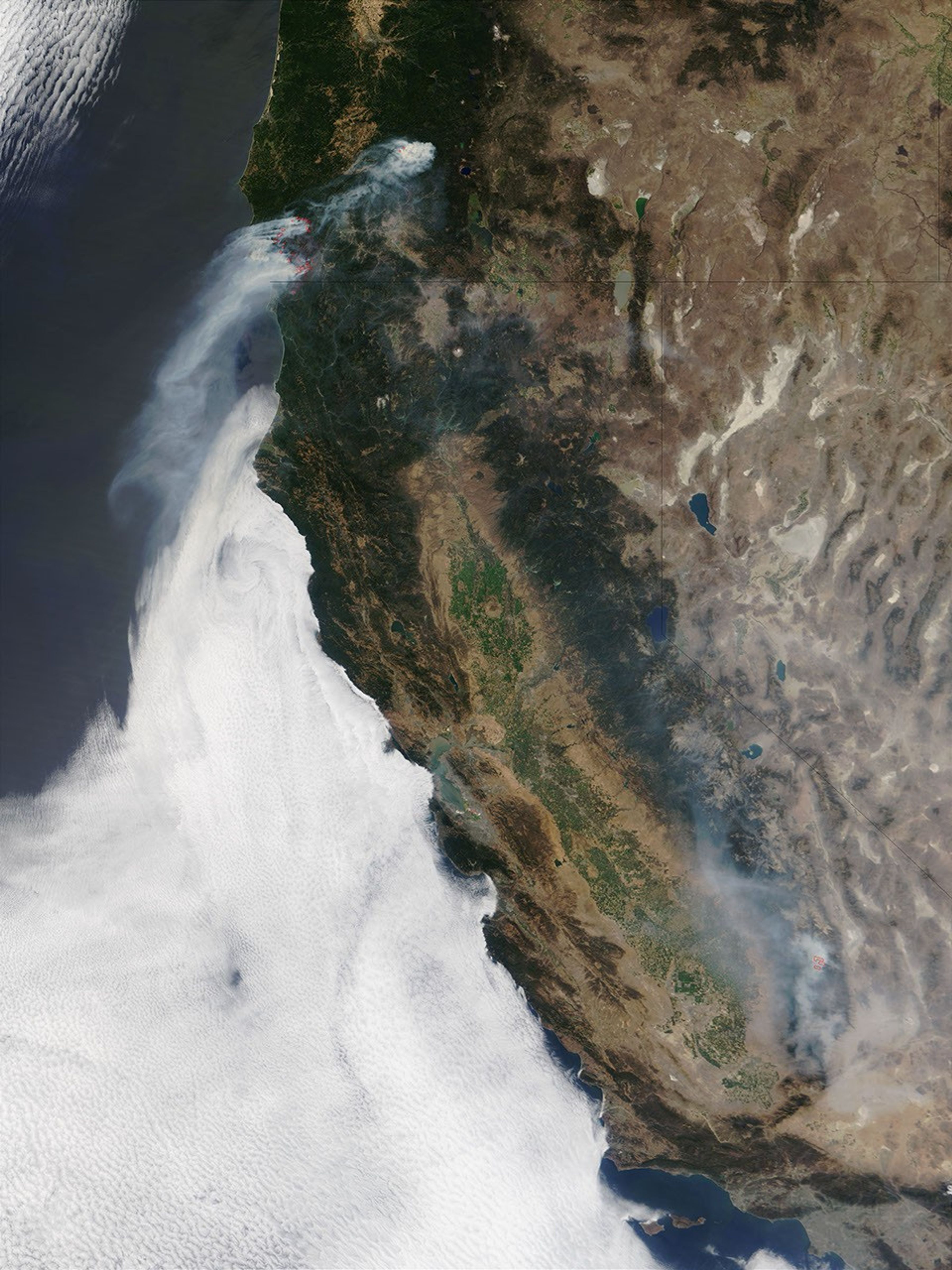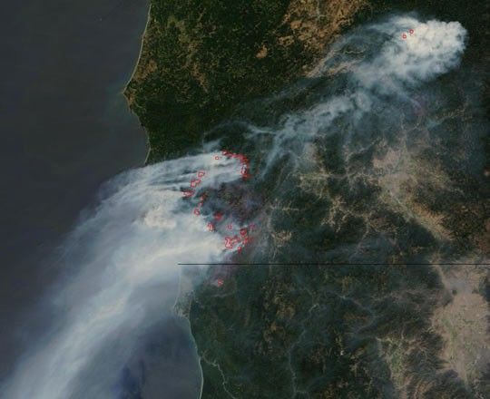
At the Oregon-California state line, an immense wildfire that resulted from the combination of two separate blazes has now burned over 375,000 acres and is still growing. The Biscuit Fire, formerly the Florence Fire and the Sour Biscuit Fire, was sparked by lightning in the Klamath Mountains in Oregon and has burned over the state line into California. On Monday, August 12, 2002, the Moderate Resolution Imaging Spectroradiometer (MODIS) on the Terra satellite captured this image, showing actively burning areas marked with red outlines. The columns of smoke billowing from the fire reach far south down the Pacific Coast (see high-resolution image).
Despite the fire’s enormous size, only four residences have been lost; however, over 4,000 remain threatened, as thousands of firefighters and fire management personnel struggle to curb the spread of the fire, which is only 26 percent contained. The cost of battling the blaze is staggering: $48.8 million to date.
References & Resources
Image courtesy Jacques Descloitres, MODIS Land Rapid Response Team at NASA GSFC