


On June 18, 2025, torrential rains hit the state of Rio Grande do Sul in southern Brazil. Reports indicate that the abundance of rain—more than 350 millimeters (14 inches) in places—caused flash flooding, landslides, and the evacuation of thousands of people.
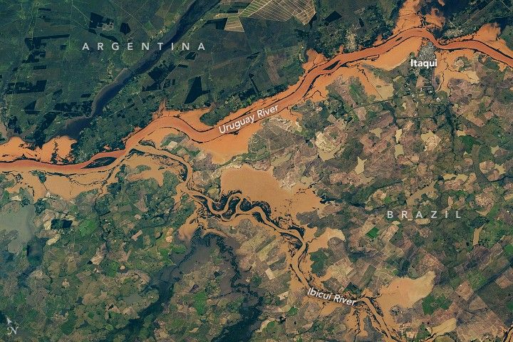
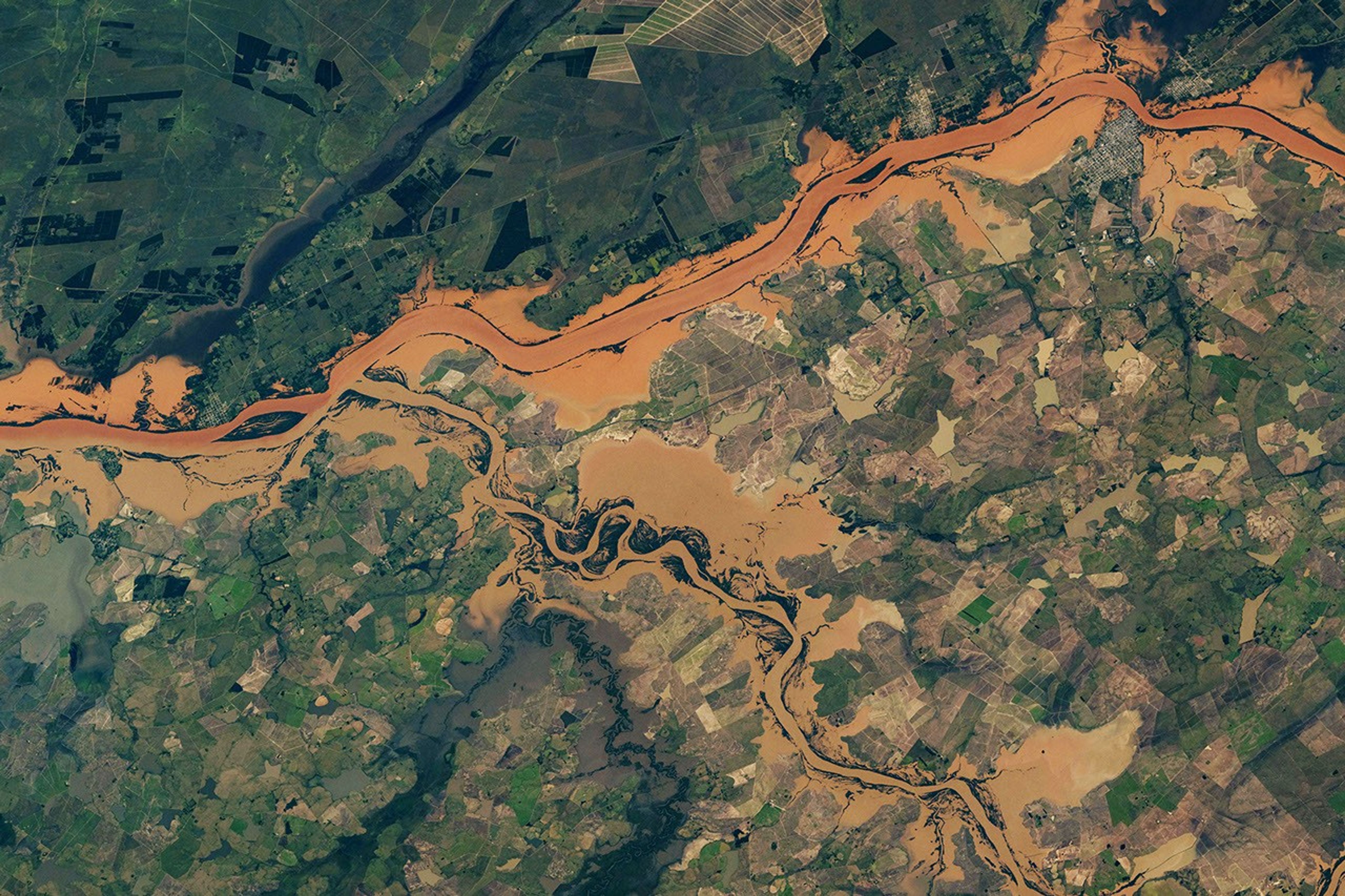
Almost a week later, an astronaut aboard the International Space Station photographed the still-swollen Uruguay and Ibicuí rivers. The image above is a mosaic of several of those photos, acquired on June 24, 2025. (Click on the image to see the full mosaic.)
The image shows flooding along the confluence of the two rivers, located in the western part of the Brazilian state. (Argentina can be seen to the north of the Uruguay River.) Part of Itaqui, a municipality along the bank of the Uruguay River, lies within the river’s floodplain. Using data from the Shuttle Radar Topography Mission, researchers previously showed that flood-related hazards are greatest along the outskirts of neighborhoods in the northern and western parts of Itaqui’s urban area.
The floods damaged more than 130 municipalities across the state, according to an International Organization for Migration report. Jaguari, a municipality about 190 kilometers (120 miles) east of Itaqui, was especially hard hit and declared a state of public calamity. More than 20 others issued a state of emergency.
Just over a year had passed since the region experienced another episode of widespread, destructive flooding. The 2024 floods inundated parts of Porto Alegre, the state’s capital city, and left parts of the state submerged for over a month.
References & Resources
- AP News (2025, June 18) Heavy rains in southern Brazil leave at least 2 dead and more than 2,600 displaced. Accessed July 2, 2025.
- Araújo, P. V. N., et al. (2019) Delimitation of flood areas based on a calibrated a DEM and geoprocessing: case study on the Uruguay River, Itaqui, southern Brazil. Nat. Hazards Earth Syst. Sci., 19, 237–250.
- International Charter Space and Major Disasters (2025, June 17) Flood in Brazil. Accessed July 2, 2025.
- IOM UN Migration (2025, June 24) IOM Assists Displaced Families as Floods Hit Brazil’s Rio Grande do Sul Again. Accessed July 2, 2025.
- NASA Earth Observatory (2024, June 3) Southern Brazil Submerged. Accessed July 2, 2025.
- NASA Earth Observatory (2024, May 9) Floods Engulf Porto Alegre. Accessed July 2, 2025.
- ReliefWeb (2025, June 23) Brazil - Floods, update (INMET, media) (ECHO Daily Flash of 23 June 2025). Accessed July 2, 2025.
Astronaut photographs ISS073-E-0248085 through ISS073-E-0248099 were acquired on June 24, 2025, with a Nikon Z9 digital camera using a focal length of 400 millimeters. It is provided by the ISS Crew Earth Observations Facility and the Earth Science and Remote Sensing Unit, Johnson Space Center. The image was taken by a member of the Expedition 73 crew . The image has been cropped and enhanced to improve contrast, and lens artifacts have been removed. The International Space Station Program supports the laboratory as part of the ISS National Lab to help astronauts take pictures of Earth that will be of the greatest value to scientists and the public, and to make those images freely available on the Internet. Additional images taken by astronauts and cosmonauts can be viewed at the NASA/JSC Gateway to Astronaut Photography of Earth . Mosaic by Chris Getteau, International Space Station Imagery Working Group. Text by Kathryn Hansen.


