


October 25, 2011
Flooding around Bangkok
Flood waters continued traveling southward through Thailand on October 25, 2011, prompting authorities to close one of Bangkok’s airports, news reports said. The closure affected not only air travelers, but also the country’s flood relief headquarters, which had been located there.
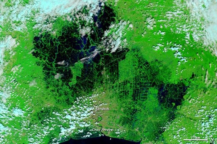
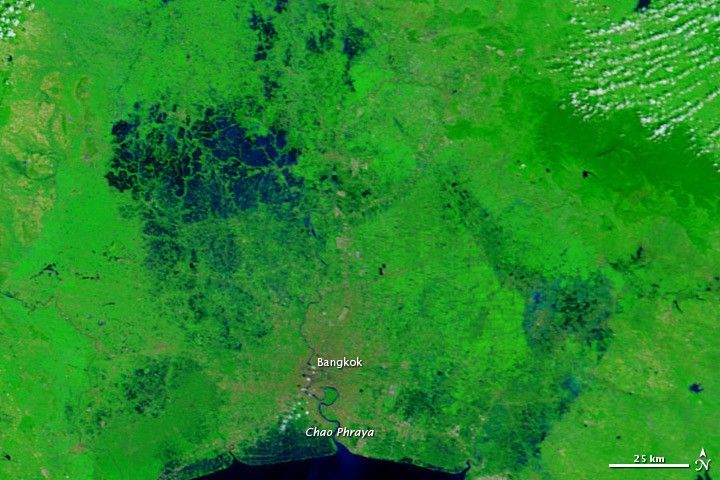
The Moderate Resolution Imaging Spectroradiometer (MODIS) on NASA’s Terra satellite captured the top image on October 25, 2011 and the bottom image, showing more normal conditions, on November 13, 2008. These images use a combination of visible and infrared light to better distinguish between water and land. Water is dark blue, vegetation is green, urban areas are tan, and clouds are pale blue-green.
Compared to conditions just days earlier, water appears higher northeast of Bangkok on October 25, 2011. Compared to conditions three years earlier (bottom image on this page) substantial flooding occurs all around Bangkok, submerging areas that were dry in 2008.
Days before MODIS acquired the top image, Thailand’s prime minister ordered the opening of key floodgates to allow water to flow through Bangkok canals en route to the ocean. The Associated Press described local concerns that rising tides in the Gulf of Thailand might slow that outflow, causing flooding in Bangkok. Meanwhile, one governor expressed concern about high water levels on the Chao Phraya River, which flows through the city. As of October 25, however, most of the city remained dry.
References & Resources
- Associated Press. (2011, October 25). Thai floods shut down Bangkok’s second airport, airlines suspend flights. The Washington Post. Accessed October 25, 2011.
- Bangkok Post. (2011, October 25). Don Mueang airport closed, more evacuations. Accessed October 25, 2011.
NASA images courtesy MODIS Rapid Response Team, Goddard Space Flight Center. Caption by Michon Scott.


