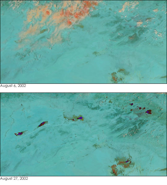
Heavy rains in Algeria over the past few weeks have led to flooding that has killed more than 30 people and left hundreds homeless. This false-color image of Algeria (bottom) was taken on August 27, 2002, by the Moderate Resolution Imaging Spectroradiometer (MODIS), flying aboard NASA’s Terra satellite.
Most of the deaths were due to flash floods in the towns along the Algerian-Tunisian border, which runs down the right side of the image. These floodwaters have made their way to the low-lying, desert wetlands of Algeria, clearly visible in the MODIS image (bottom). Normally, these oasis-like formations cannot be seen in MODIS imagery (top, acquired on August 6, 2002).
In this false-color image, land is green, clouds are pink and white, and water is blue and black.
References & Resources
Image by Jesse Allen, based on data from the MODIS Rapid Response Team at NASA-GSFC