December 14, 2011
Flooding in Australia
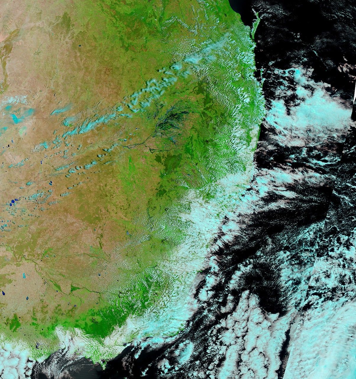
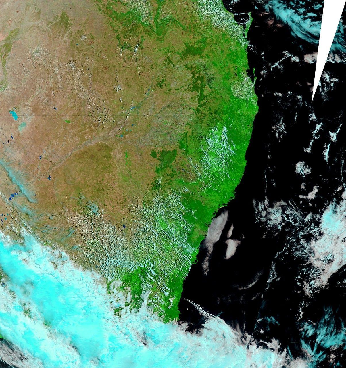
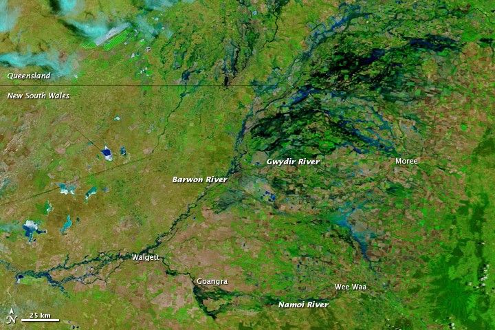
Floods struck northeastern New South Wales, Australia, starting in late November 2011. Over the next few weeks, floods traveled downstream, toward the west and southwest, along tributaries of the Darling River. The Bureau of Meteorology issued flood warnings for multiple rivers in the region, including the Gwydir River downstream of Moree, the Namoi River at Goangra, and along the Barwon River.
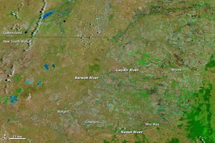
The Moderate Resolution Imaging Spectroradiometer (MODIS) on NASA’s Terra satellite captured the top image on December 14, 2011. For comparison, the bottom image shows the same region almost a month earlier, on November 19, 2011. These images use a combination of visible and infrared light to better distinguish between water and land. Water ranges from electric blue to navy. Vegetation is bright green. Bare ground is earth-toned. Clouds are pale blue-green.
The image from mid-November shows a landscape that is mostly dry. The image from mid-December shows a landscape that is largely drenched. Wee Waa, which was isolated by high waters in late November, is drying out, but high water appears around Goangra, Walgett, and west and north of Moree.
References & Resources
- Bureau of Meteorology. (2011, December 15). New South Wales and Australian Capital Territory Flood Warning Centre. Australian Government. Accessed December 15, 2011.
NASA image courtesy LANCE/EOSDIS MODIS Rapid Response Team at NASA GSFC. Caption by Michon Scott.