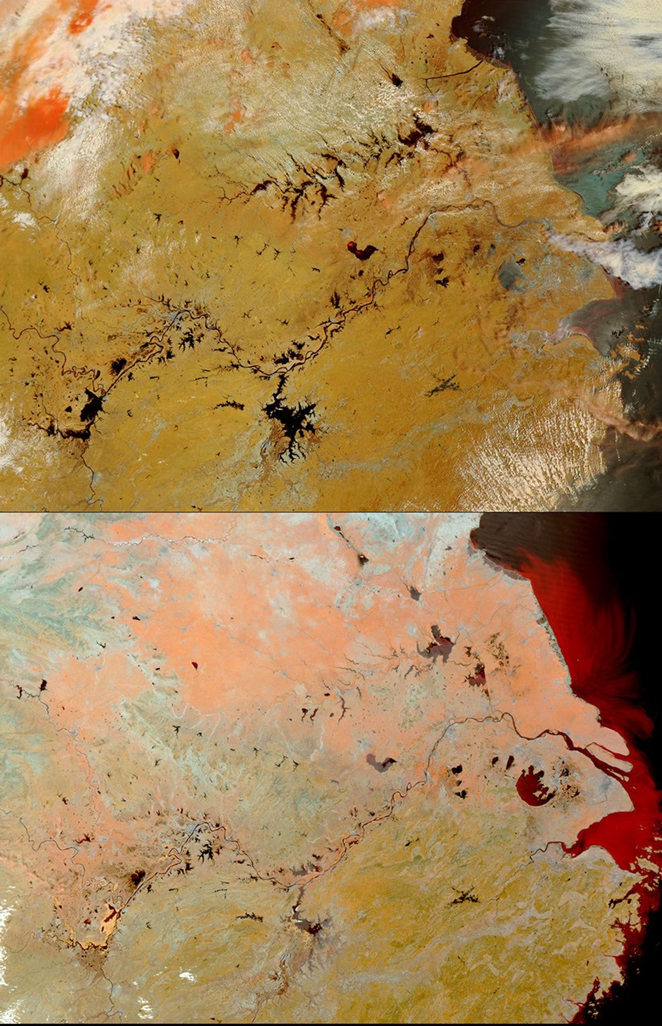
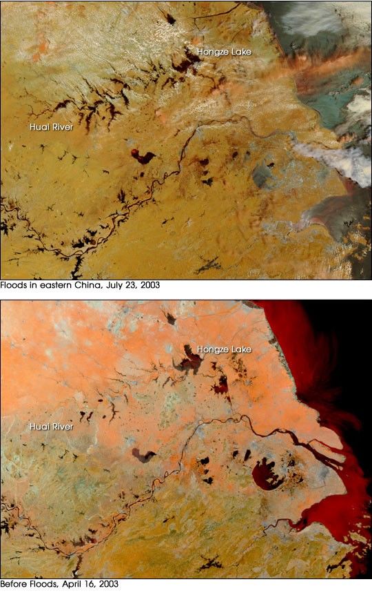
This pair of before and after images from the Moderate Resolution Imaging Spectroradiometer (MODIS) on the Terra satellite shows the severe flooding in eastern China in July 2003. The images have been enhanced to bring out the presence of standing water, which appears dark blue or black. At top is the area on July 23, after the rain clouds had cleared. Floodwaters stand out along the streams and rivers feeding the Huai River at top. The bottom image, captured April 16, 2003, shows the normal extent of the river. The gold color indicates vegetated land surfaces.
Over 560 people have died this year in flooding along the rivers of eastern China, though the flood season has only just begun. Lasting from June through September, flood-season storms bring more rain than the rivers and tributary systems in this part of China can handle, which often results in disaster for residents in the flood zones. The Chinese government estimates that over half a million homes have been destroyed, another 1.3 million damaged, and over 2.3 million people have been evacuated. The Huai River and Hongze Lake region were especially hard hit this year.
References & Resources
Images courtesy Jesse Allen and Jacques Descloitres, MODIS Rapid Response Team at NASA GSFC