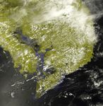
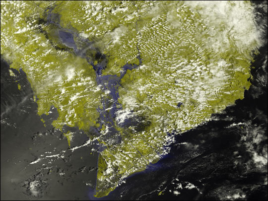
For the past month heavy rains in Indochina have led to seasonal flooding that has killed as many as 40 people and driven tens of thousands from their home. This false-color image of the Indochina Peninsula was acquired on September 14, 2002, by the Moderate Resolution Imaging Spectroradiometer (MODIS) aboard NASA’s Terra spacecraft.
Normally, the Tonle Sap, which is the oblong, inland body of water pointing toward the upper left-hand corner of the image, would appear as a well-defined lake separated from the Gulf of Thailand by green wetlands. During the rainy season, however, the flow of the Mekong River, running down the center of the image, increases. The excess water backs up at the Mekong Delta on the east side of the Indochina Peninsula and flows west into the Tonle Sap and the surrounding wetlands. The result is the large uninterrupted lake that appears as an extension of the Gulf of Thailand in Cambodia. When this image was taken, up to 40 people in Cambodia and Vietnam had been killed and over 50,000 had been evacuated from their homes.
In this image, clouds are white, water is black and blue, and solid land is pea green.
References & Resources
Image by Jesse Allen, based on data from the MODIS Rapid Response Team at NASA-GSFC