


- May 13, 2006 (4.7 MB)
- March 15, 2006 (4.4 MB)
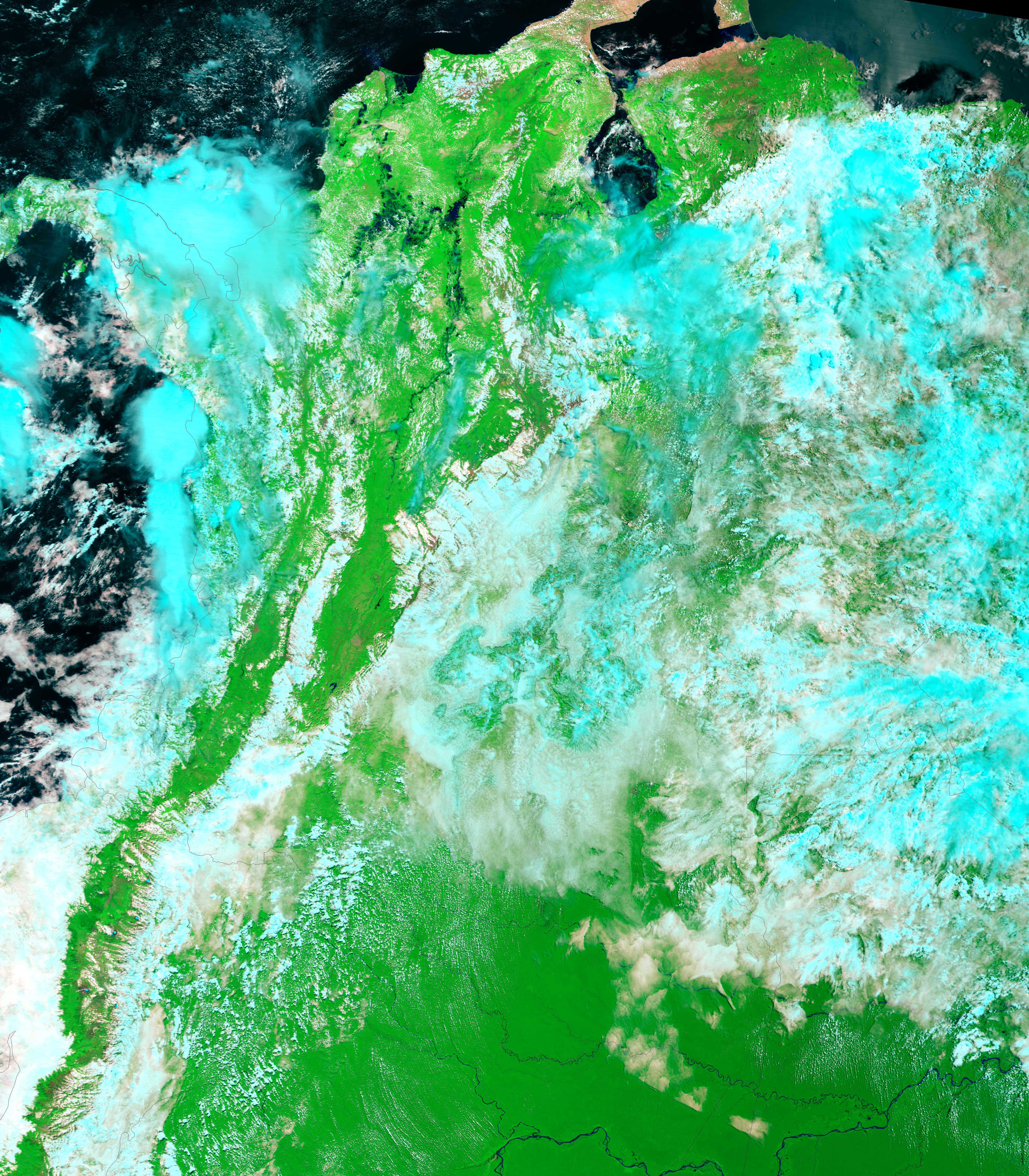
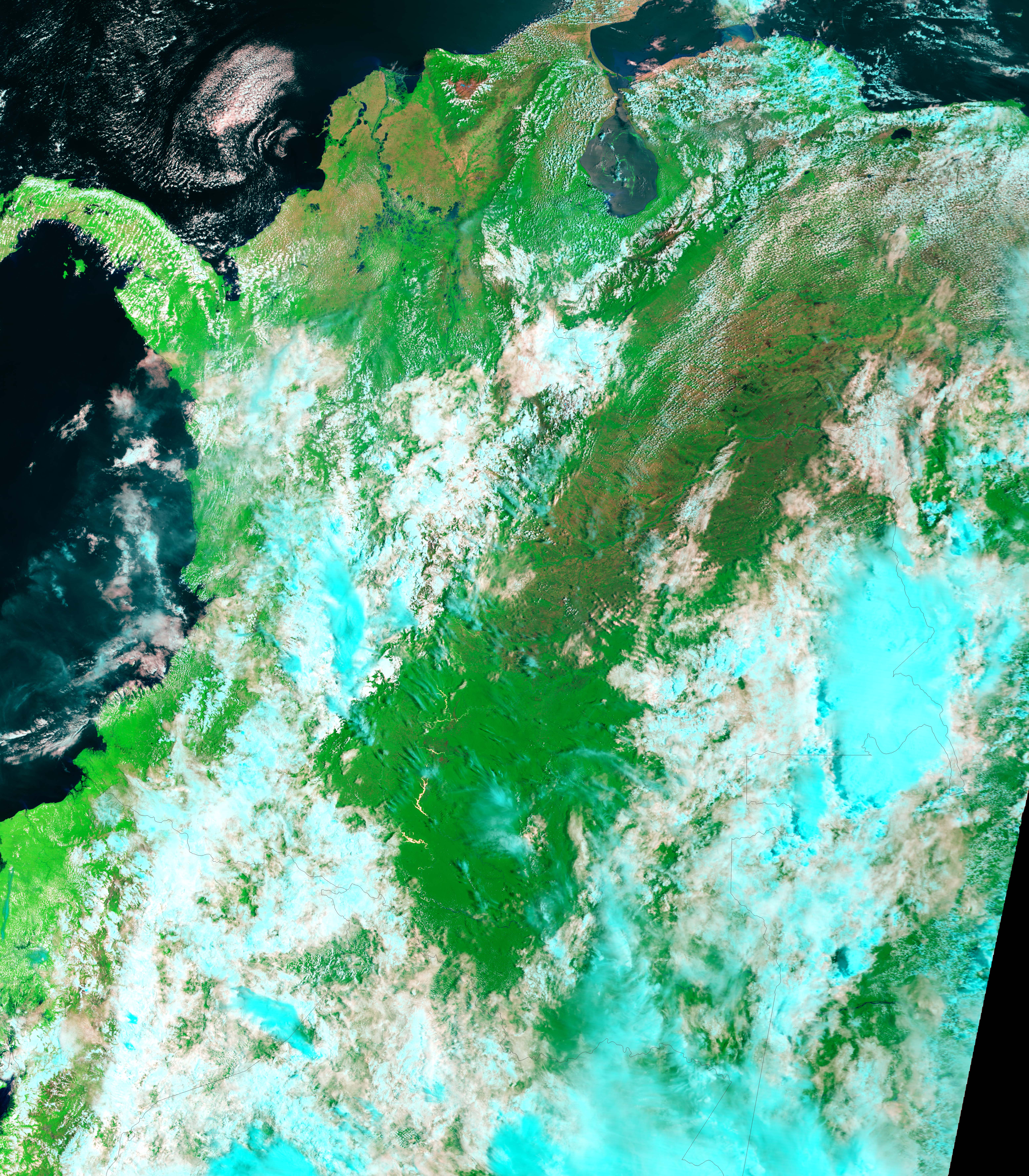
Heavy rains set in over Colombia in January 2006, and by May, severe flooding swept across much of the country, particularly in the northeast where some administrative regions were declared areas of national calamity, said the Government of Colombia. The Moderate Resolution Imaging Spectroradiometer (MODIS) on NASA’s Terra satellite captured the top image of flooding along the Magdalena River in northern Colombia on May 13, 2006. Wetland surrounds the river even during the dry season, but by May 13, the wetlands seemed to have expanded. Water, dark blue to black in these images, surrounds stretches of river, covering land that was relatively dry on March 15, 2006. The flooding is particularly obvious along the north-running section of the river that cuts across the center of the image. Elsewhere in the images, clouds are light blue and white, plant-covered land is green, and bare earth is tan and pink.
- Further Reading:
- Relief Web
- Dartmouth Flood Observatory
References & Resources
NASA images created by Jesse Allen, Earth Observatory, using data obtained from the MODIS Rapid Response team and the Goddard Earth Sciences DAAC.


