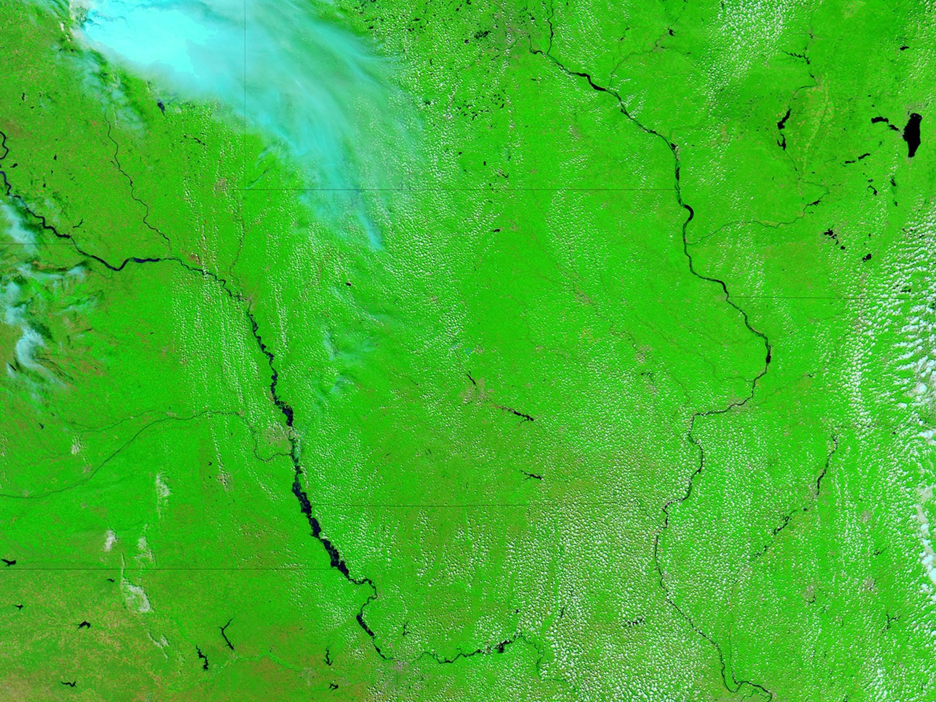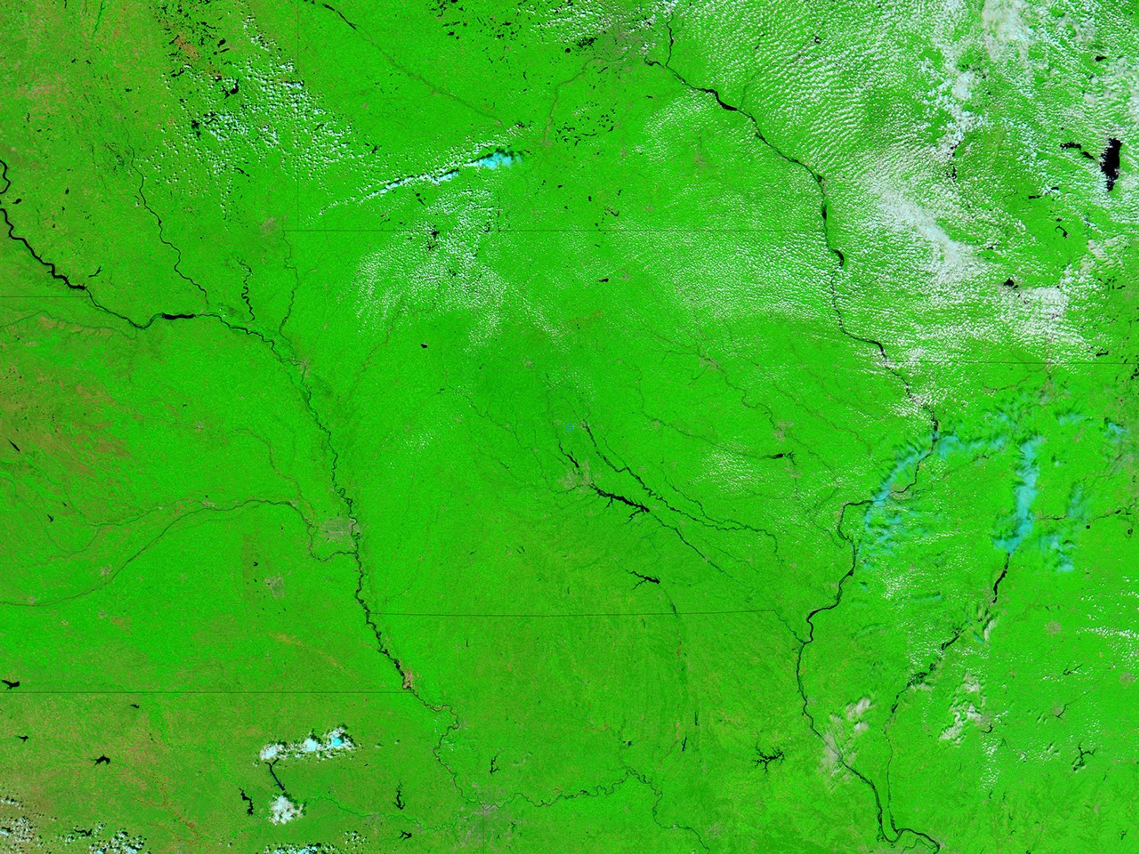
In mid-August 2011, long stretches of the Missouri River remained flooded, continuing a situation that began in early June. Water sat on floodplains as far north as Sioux City, Iowa, and as far south as Glasgow, Missouri. The Moderate Resolution Imaging Spectroradiometer (MODIS) on NASA’s Aqua satellite captured the top image on August 14, 2011. For comparison, the bottom image shows the same region a year earlier, on August 11, 2010.
Both images use a combination of visible and infrared light to increase contrast between water and land. Water is navy blue. Depending on land cover, land appears green or brown. Clouds are nearly white or pale blue-green and cast shadows.
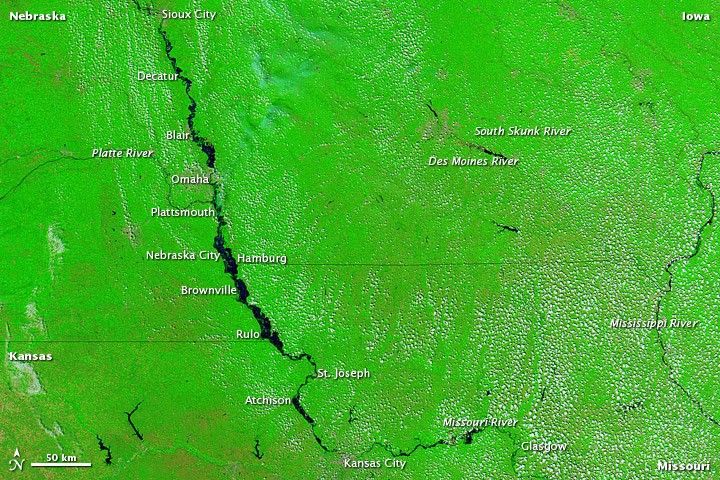
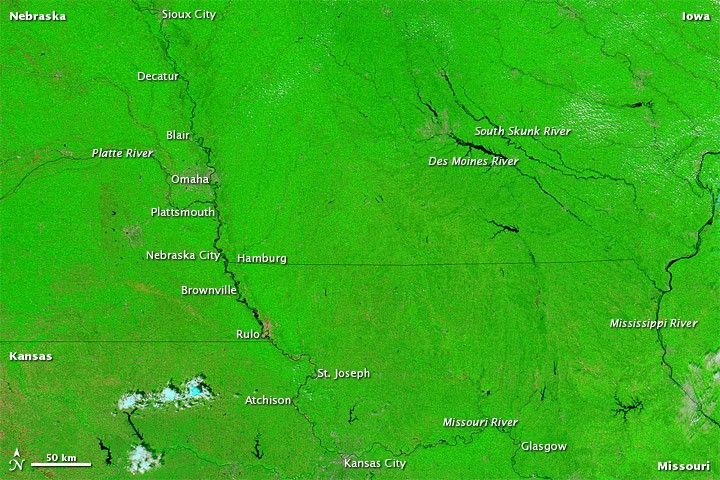
In 2011, the Missouri River is substantially swollen all along the Nebraska border, and in parts of Missouri and Kansas. Water spans the distance between Nebraska City and Hamburg, Iowa (shown in more detail in a high resolution image).
On August 15, 2011, the Advanced Hydrological Prediction Service (AHPS) of the U.S. National Weather Service reported minor flooding of the Missouri River at Sioux City, Iowa; Nebraska City; and multiple communities along the river in the state of Missouri. The AHPS reported moderate flooding in or near the Nebraska communities of Decatur, Blair, Omaha, Plattsmouth, Brownville, and Rulo. The AHPS also reported moderate flooding in St. Joseph and Glasgow, Missouri; and in Atchison, Kansas.
Although the Missouri experienced much higher water levels in 2011 than in 2010, water was not universally higher that summer. August 2011 actually saw lower water levels along the Des Moines and South Skunk Rivers in Iowa compared to the previous year.
References & Resources
- National Weather Service. Advanced Hydrologic Prediction Service. Accessed August 15, 2011.
NASA images courtesy MODIS Rapid Response Team, Goddard Space Flight Center. Caption by Michon Scott.