


- February 13, 2006 (3.3 MB)
- January 3, 2006 (3.2 MB)
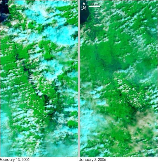
Heavy rains over several days pushed the Agusan River on the island of Mindanao over its banks in February 2006. On February 13, the Moderate Resolution Imaging Spectroradiometer (MODIS) on NASA’s Terra satellite captured the left image of the swollen river through a break in the clouds, which are shown in pale blue and white. Vegetation is bright green, while water is deep blue or nearly black. The right image, taken on January 3, shows the river basin under normal conditions. Though additional flooding is not visible through the nearly perpetual tropical clouds, the rains also triggered flash floods across northeastern Mindanao, the southernmost large island in the Philippines. According to news reports, the floods drove about 2,000 people from their homes and killed at least four.
References & Resources
NASA image created by Jesse Allen, Earth Observatory, using data provided courtesy of the MODIS Rapid Response team.


