


April 22-May 8, 2020
Flooding in Uzbekistan and Kazakhstan
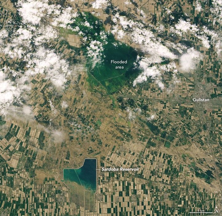
Flood waters continued to inundate villages and farmland one week after water breached the wall of a reservoir in Uzbekistan.
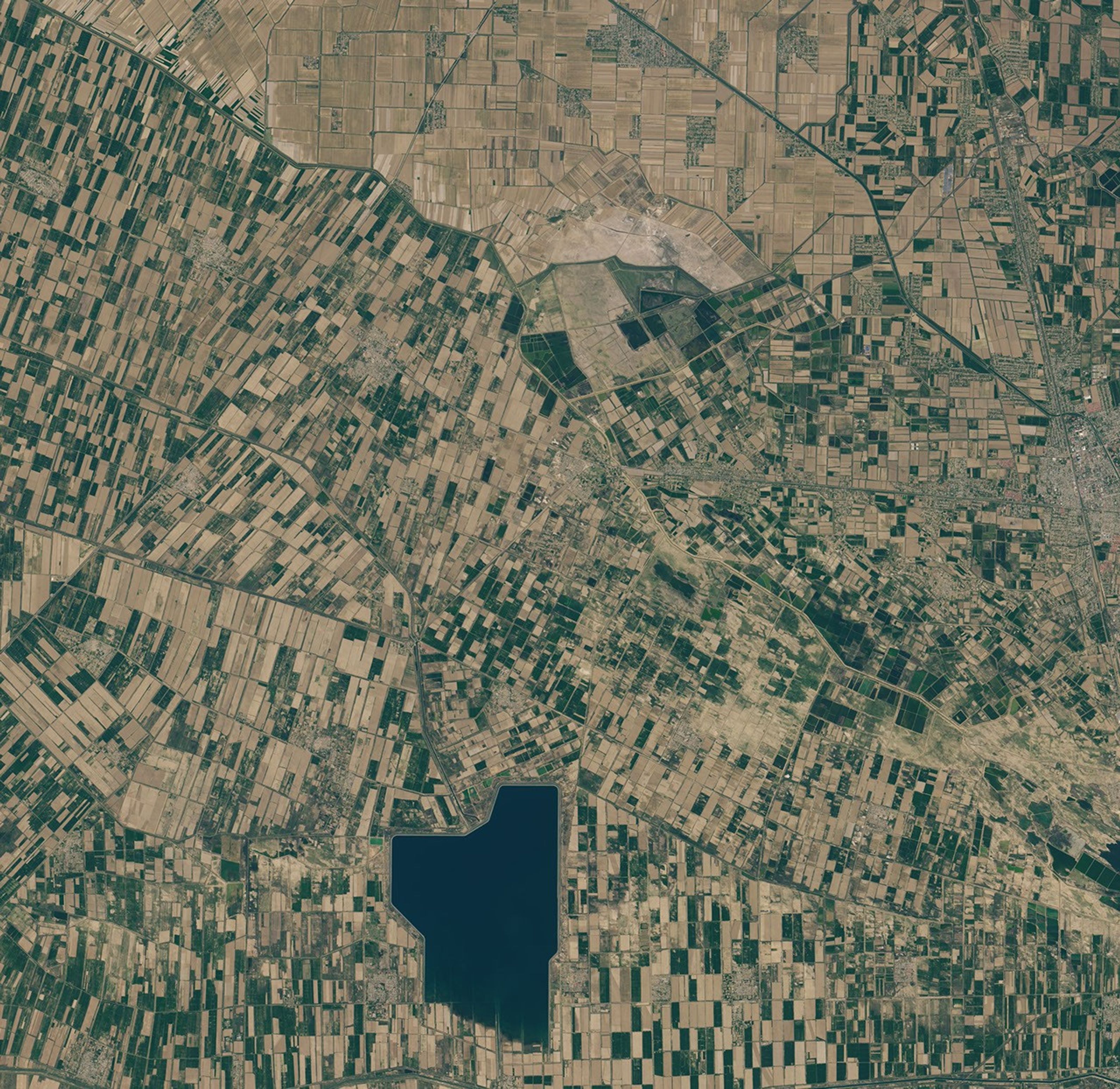
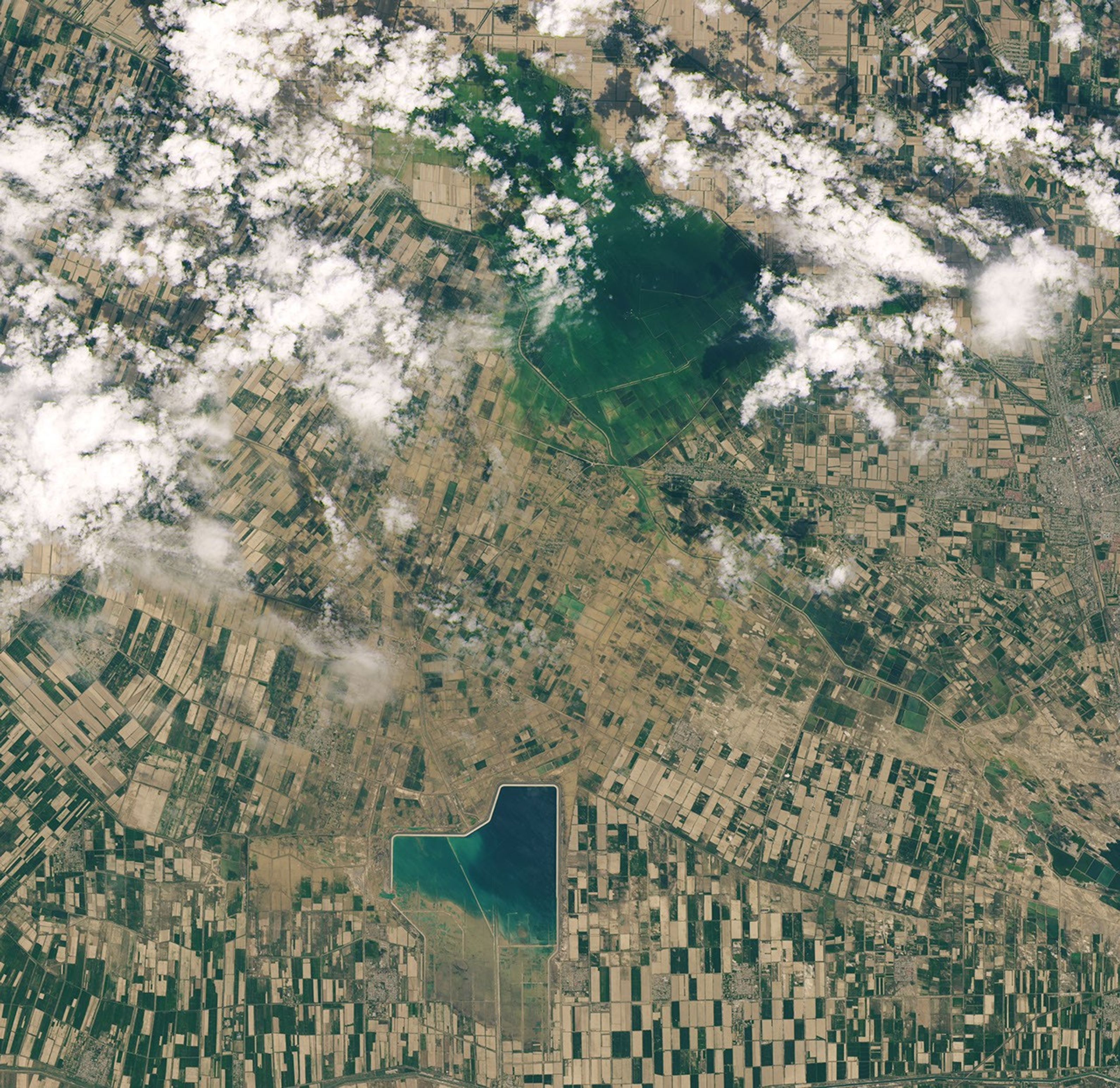
The western wall of a dam around the Sardoba Reservoir broke on May 1, 2020, following a week of heavy rain in the region. Images acquired on May 8, 2020, with the Operational Land Imager (OLI) on Landsat 8 show where that water ultimately collected in Uzbekistan and Kazakhstan. For comparison, the left image above shows the same area on April 22, before the dam failure.
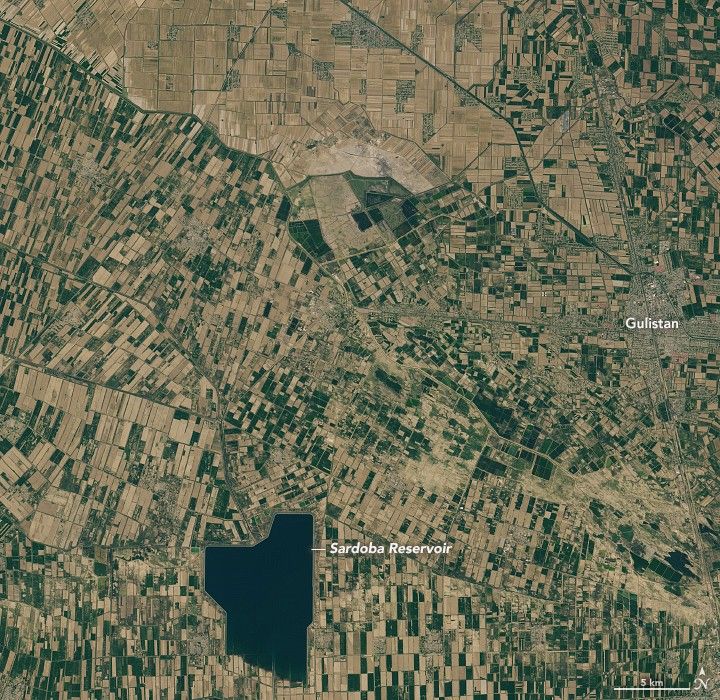
Construction of the reservoir, located in Uzbekistan’s Sirdaryo region, was completed in 2017. It was designed to hold more than 920 million cubic meters of water for irrigation of the region’s agriculture.
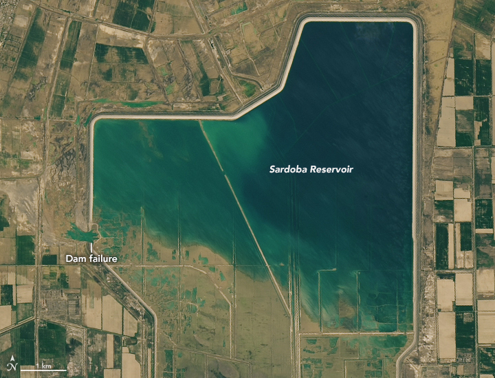
The first detailed view above shows the spot of the dam failure, as well as the partially empty reservoir, on May 8. Water was no longer pouring across the breached wall at the time of the satellite image, but you can see where the once fast-moving flood water had scoured the land. Some of the water followed channels northward alongside the dam and then flowed east.
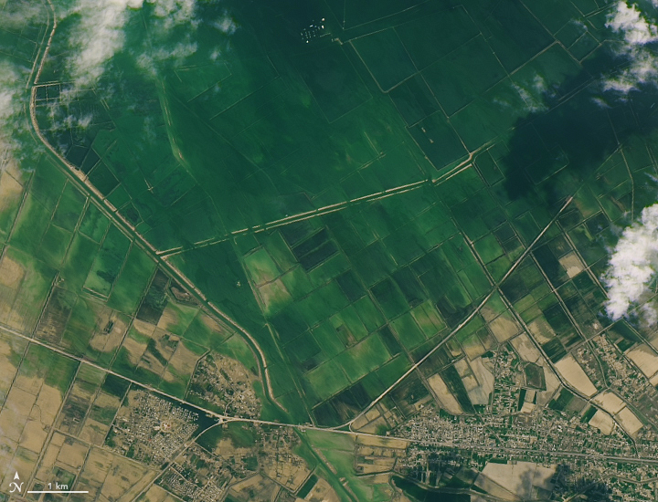
Not all of the water, however, flowed neatly within channels. David Petley, of the University of Sheffield, wrote in a blog post that the water covered a broad area as it flowed away from the reservoir, damaging fields and villages along the way. (The contrast between vegetated and flooded areas is especially apparent in false-color images.)
Water flowing north of the reservoir ultimately pooled across a large area spanning the border of Uzbekistan and Kazakhstan. The second detailed view above shows the southern patch of the pooled water in Uzbekistan.
According to news reports, tens of thousands of people were evacuated from villages in both countries. The flooding submerged homes and destroyed farms and infrastructure across important agricultural areas.
References & Resources
- AGU Blogosphere (2020, May 5) The Sardoba dam failure: flood routing. Accessed May 8, 2020.
- AGU Blogosphere (2020, May 4) Sardoba Reservoir: a major dam collapse in Uzbekistan on 1 May 2020. Accessed May 8, 2020.
- The Diplomat (2020, May 4) 70,000 Evacuated After Breach in Uzbek Dam, Investigation Into Failure Launched. Accessed May 11, 2020.
- Reuters (2020, May 2) Uzbekistan, Kazakhstan evacuate thousands over flood. Accessed May 8, 2020.
- USAID via Reliefweb (2020, May 8) The United States is providing immediate humanitarian assistance in response to the partial dam collapse in the Republic of Uzbekistan. Accessed May 11, 2020.
NASA Earth Observatory images by Lauren Dauphin, using Landsat data from the U.S. Geological Survey. Story by Kathryn Hansen.