

April 18, 2012
Flooding on the Arabian Peninsula
Torrential rains caused flooding in parts of Saudi Arabia and Oman in mid- to late April 2012. News reports blamed the floods for damaged buildings, washed out roads, 18 deaths, and about 12 people missing. As of April 21, police and air force personnel were engaged in search-and-rescue operations.
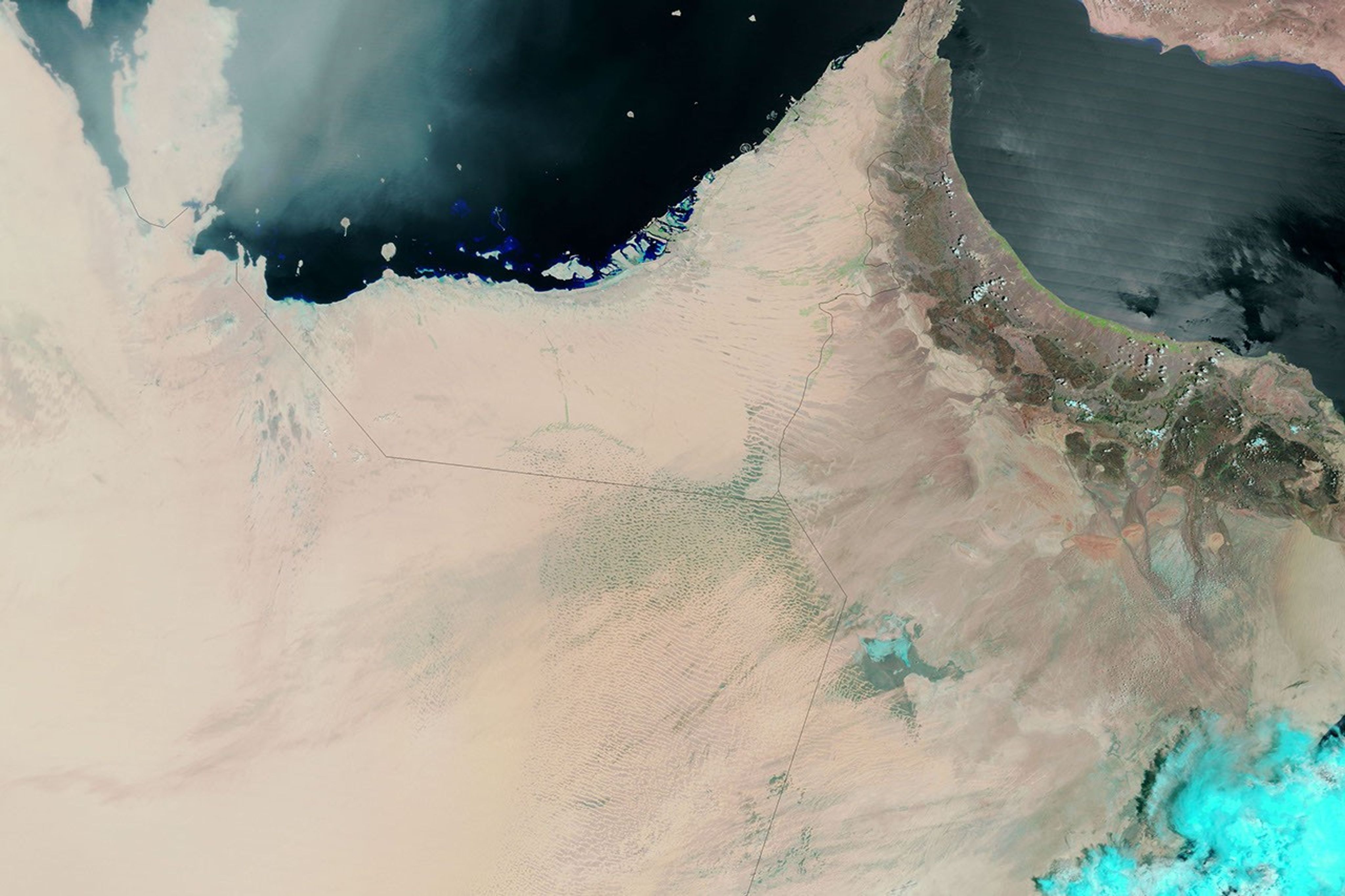
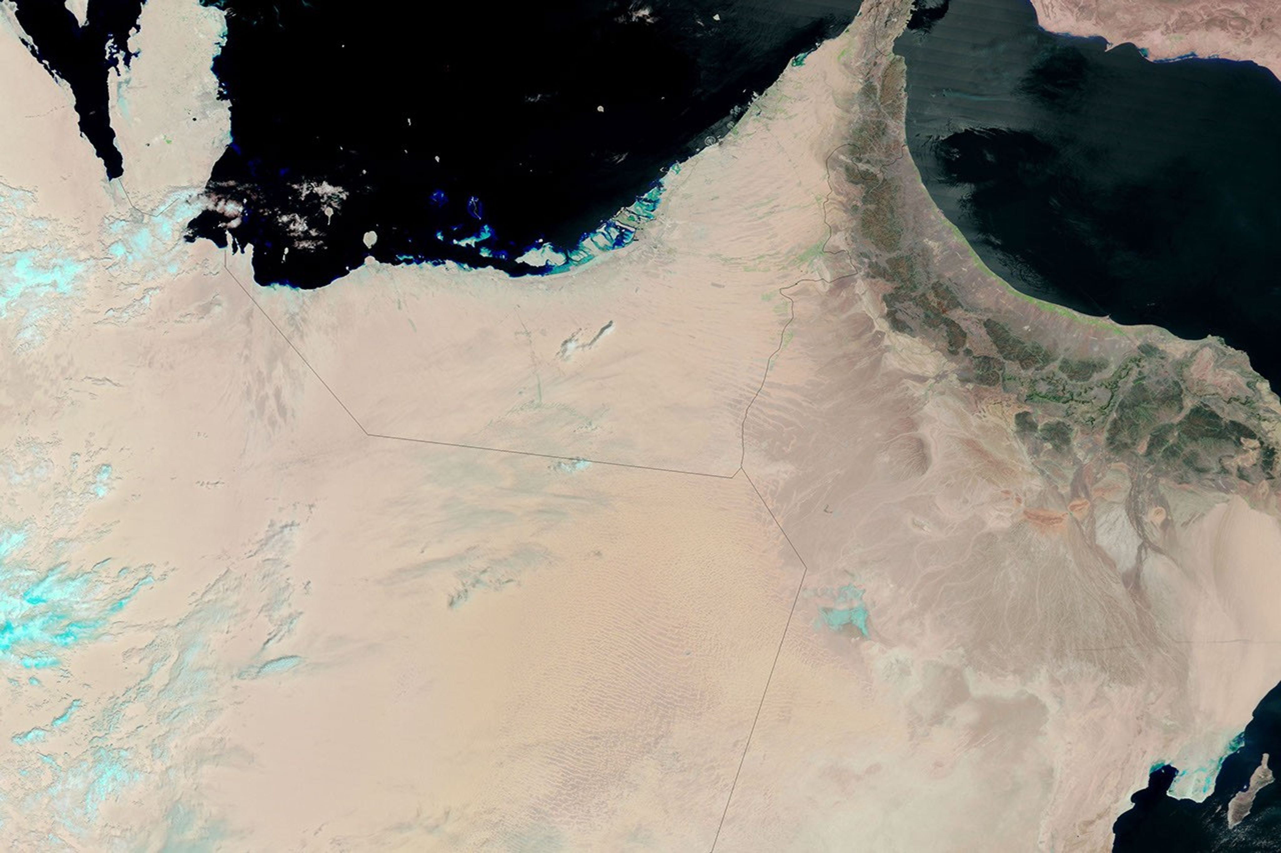
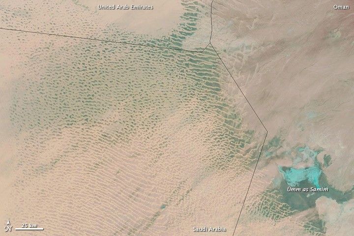
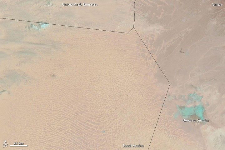
The Moderate Resolution Imaging Spectroradiometer (MODIS) on NASA’s Terra satellite observed evidence of flooding along the borders between Saudi Arabia, United Arab Emirates, and Oman in April 2012. MODIS captured the top image on April 18 and the bottom image on April 9. These images use a combination of visible and infrared light to better distinguish between water and land. Water appears in shades of blue-green, and bare ground appears in shades of pink-beige. Isolated clouds appear in pale blue-green and cast shadows.
The image from April 18 shows large areas of water and wet sand extending from southeastern Saudi Arabia into western Oman. In addition, Umm as Samim (or Umm al Samim), a salt pan in Oman, apparently holds more water on April 18.
This region includes part of the Empty Quarter or Rub’ al Khali. In this vast sand sea, salt flats often separate towering dunes, and much of the water visible on April 18 probably rests on those flat areas. Some of the salt flats are paved with roads, and standing water left at least one of those roads impassable.
The flood water might have flowed into the region from the southwestern Empty Quarter, and from the mountains of Oman. Ground water often feeds perennial lakes in this region, and in April 2012, Umm as Samim might have been both a destination for flood water flowing over the surface and a source of upwelling ground water.
Few people associate the Empty Quarter with heavy rain, but G. Robert Brakenridge of the Flood Observatory at the University of Colorado explains: “Flooding is actually surprisingly common, despite how arid the region is, and is often deadly.” Brakenridge produced a flood map of this region, covering April 16–25, 2012.
References & Resources
- Bahrain News Agency. (2012, April 18) 18 killed in Saudi Arabia floods over past week. Accessed April 24, 2012.
- Rejimon, K. (2012, April 21) Rain wreaks havoc. Times of Oman. Accessed April 24, 2012.
NASA image courtesy MODIS Rapid Response Team, Goddard Space Flight Center. Caption by Michon Scott with information from G. Robert Brakenridge, Flood Observatory, University of Colorado; and Neil Munro, Darfur Land Commission, Sudan.