


![Request for Information – Potential [Placeholder for Prize]](https://assets.science.nasa.gov/dynamicimage/assets/science/psd/solar/2023/09/s/solarsystem_0.jpg?w=1024)


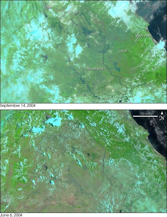
- September 14, 2004 (3 Mb)
- June 6, 2004 (4.2 Mb)
Heavy wet-season rains drenched Northern Thailand and Laos in early September, bringing water levels on the Mekong River to dangerous levels. When the Moderate Resolution Imaging Spectroradiometer (MODIS) on NASA’s Terra satellite flew over on September 14, 2004, the floods were visible through the clouds. Dark blue flood waters surround the Mekong River, the dark blue line that forms the border between Thailand and Laos. The Songkhram River to the left of the Mekong is also much larger than it appeared in June. According to news reports, three districts in Northern Thailand have been affected by the floods.
This false-color pair makes the floods easier to spot by showing water as dark blue against the bright green vegetation. Clouds are light blue. The large image provided above is at MODIS’ maximum resolution of 250 meters per pixel.
References & Resources
NASA image created by Jesse Allen, Earth Observatory, from data obtained from the MODIS Rapid Response team.


