


![Request for Information – Potential [Placeholder for Prize]](https://assets.science.nasa.gov/dynamicimage/assets/science/psd/solar/2023/09/s/solarsystem_0.jpg?w=1024)


- August 14, 2006 (3.78 MB)
- August 7, 2006 (3.66 MB)
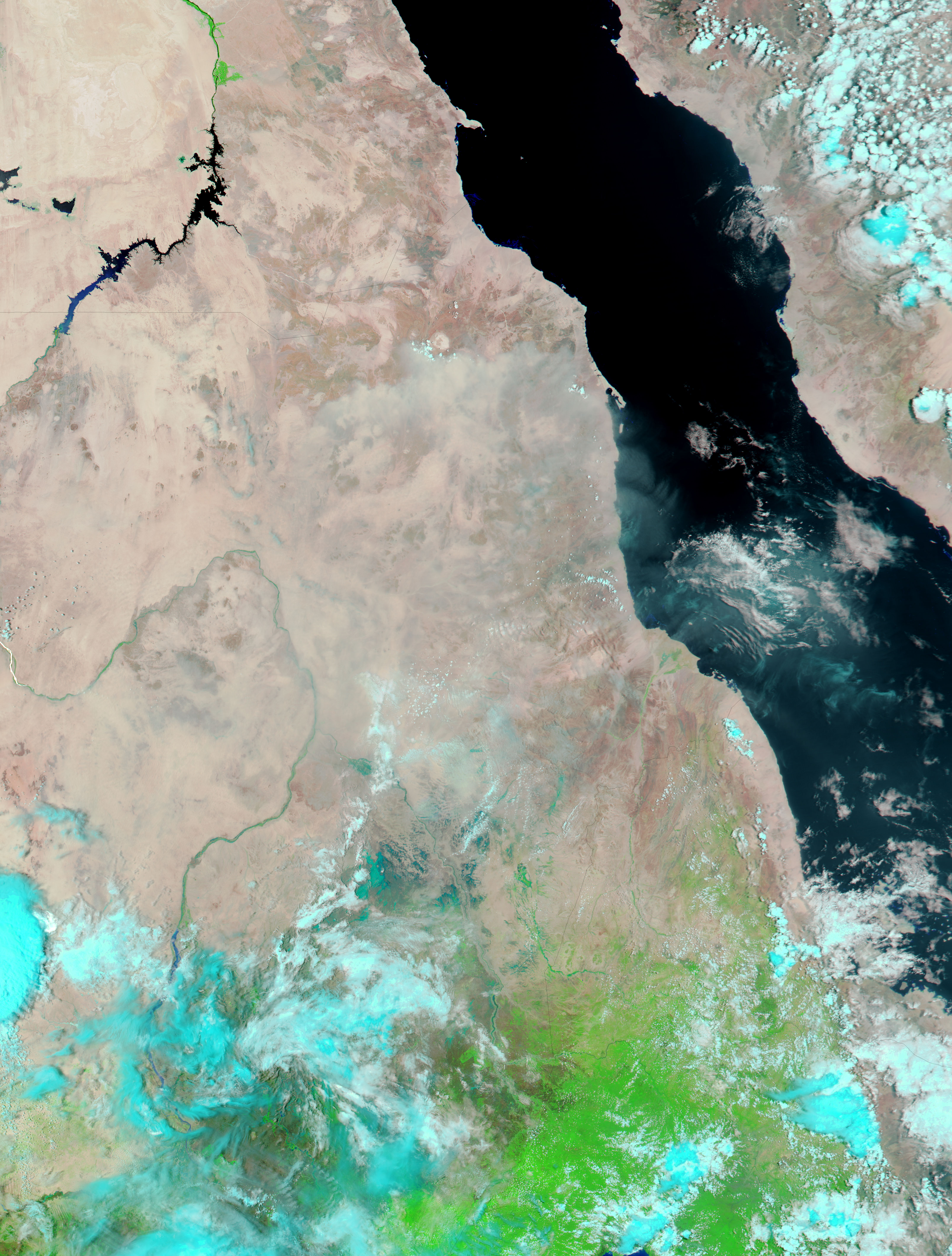
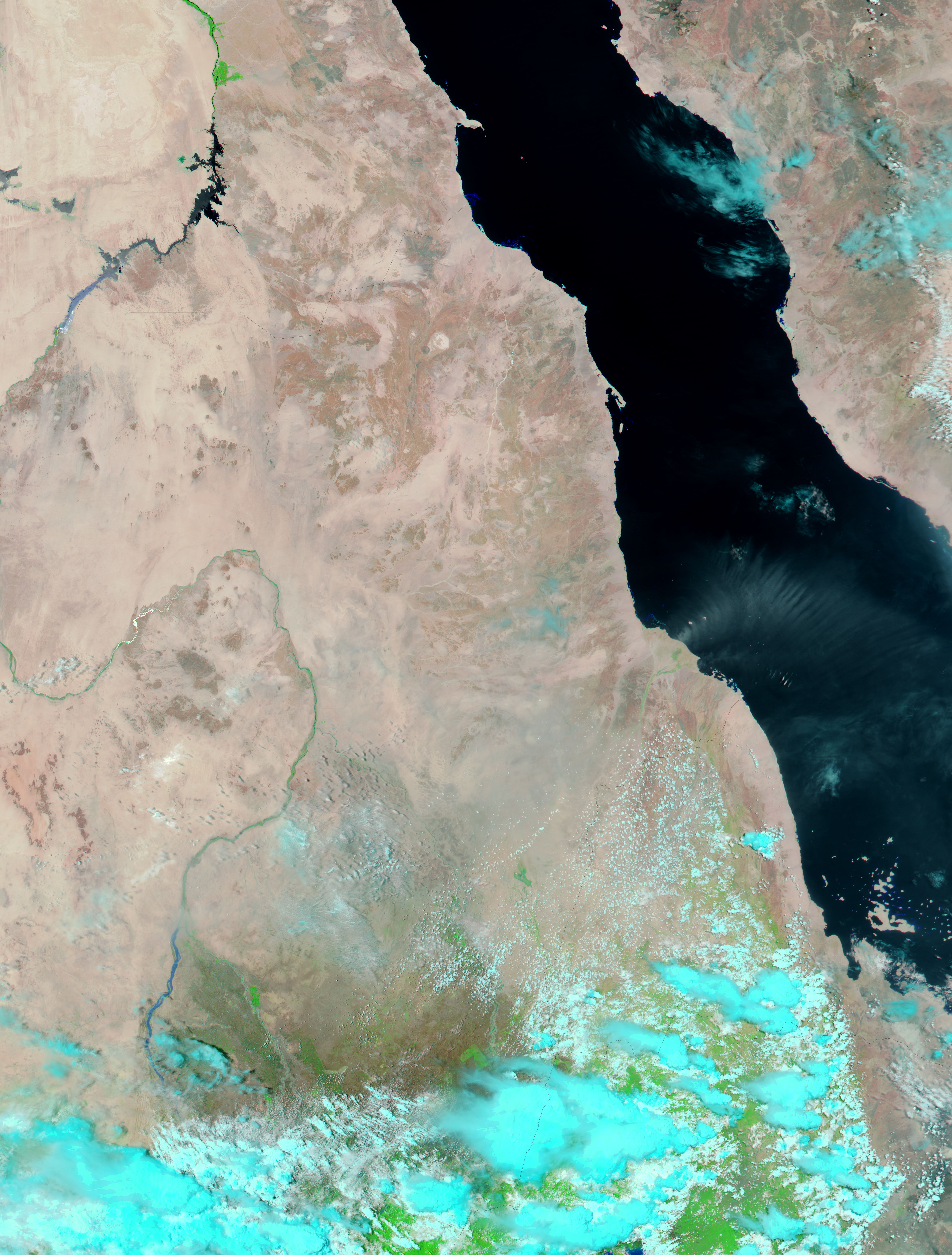
By the first of August 2006, the eastern Sahel was in the middle of its three- to four-month-long rainy season, which typically runs from about mid-June to mid-September. Heavy rains pounded many countries across the Sahel during the first or second week of August, leaving flooding in their wake. Worst affected was Ethiopia, which by August 16 was appealing for international assistance after floods left an estimated 870 dead, reported Reuters. Though the floods in Ethiopia were not clearly visible from space, the Moderate Resolution Imaging Spectroradiometer (MODIS) on NASA’s Aqua satellite detected extensive flooding just across the border in Sudan when the sensor flew over on August 14. Large pools of standing water and swollen rivers, turquoise blue in this false-color image, dominate the scene. A week earlier, when the lower image was taken, none of the water was evident except the thin blue line of the Atbara River. Both the Atbara and Gash Rivers were flooded on August 14, as was the Nile River, immediately east of the region shown here and visible in the large image.
The large images provided above have a resolution of 250 meters per pixel. Daily images of the region are available from the MODIS Rapid Response Team.
References & Resources
NASA images courtesy the MODIS Rapid Response Team at NASA GSFC.


