


![Request for Information – Potential [Placeholder for Prize]](https://assets.science.nasa.gov/dynamicimage/assets/science/psd/solar/2023/09/s/solarsystem_0.jpg?w=1024)


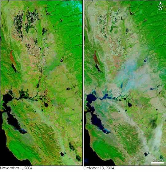
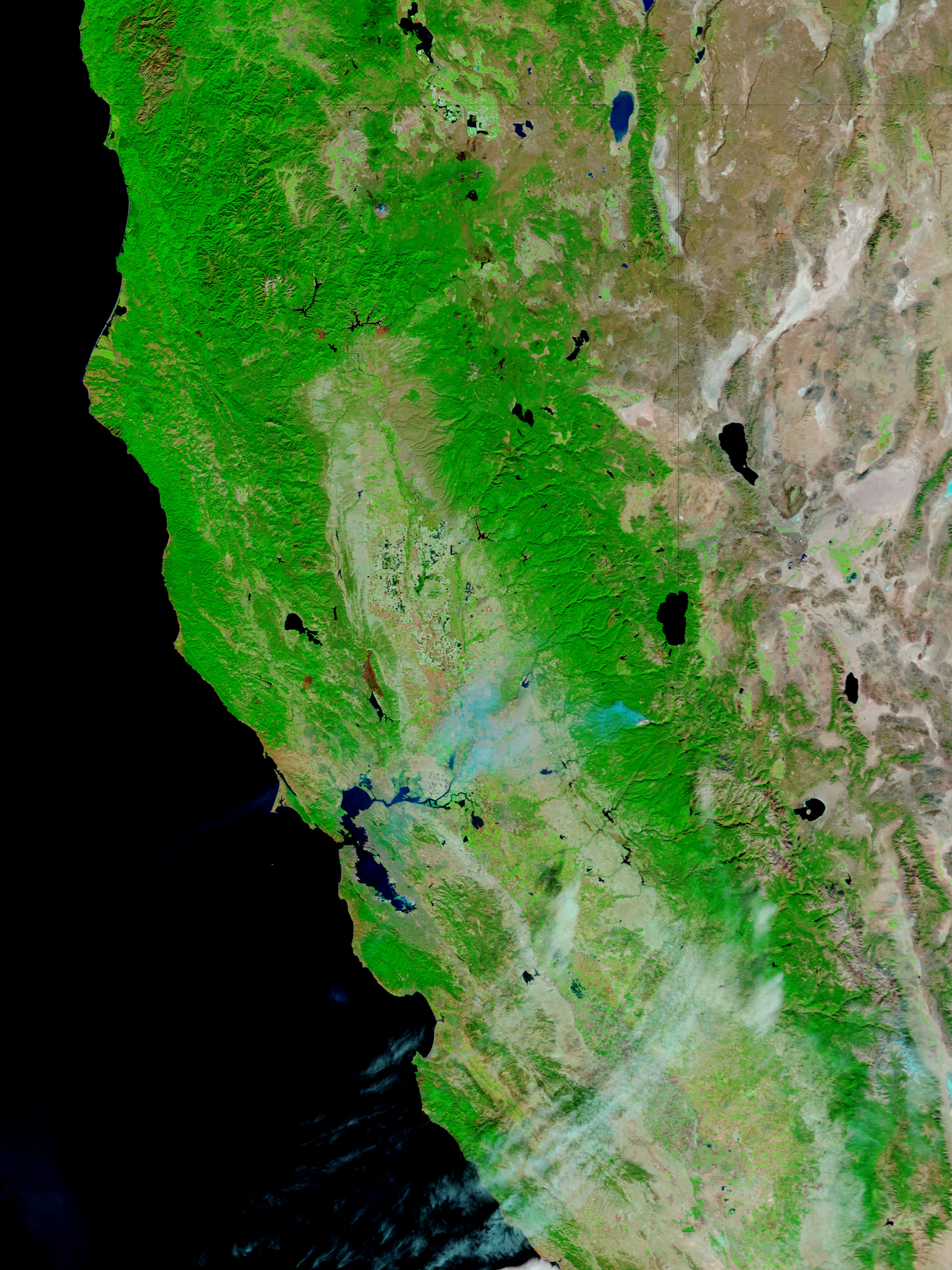
- November 1, 2004 (2.15 Mb)
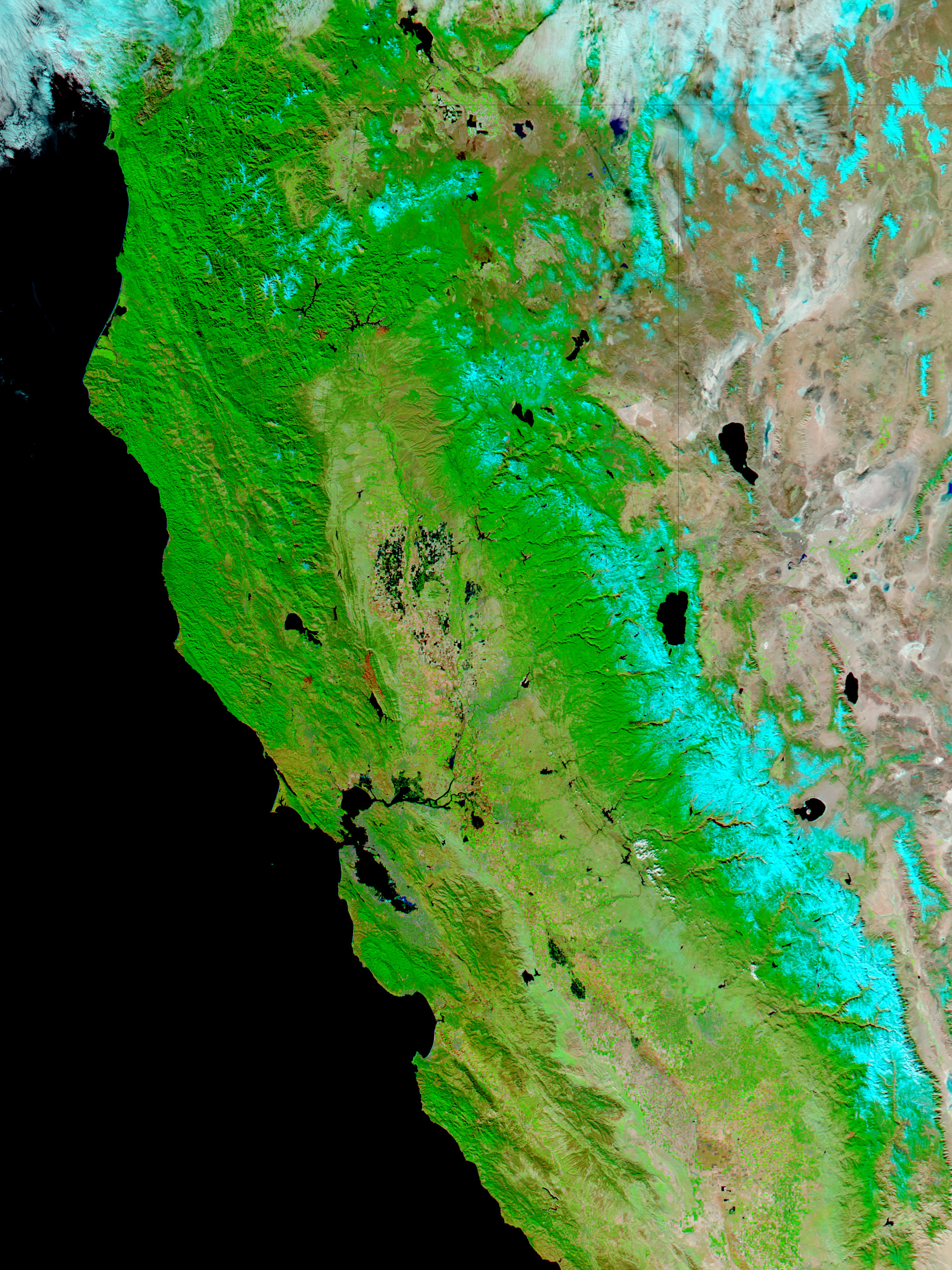
- October 13, 2004 (1.75 Mb)
Two large storms pounded California with rain and snow during the last two weeks of October 2004, bringing rain and snowfall totals to record levels for many areas. The resulting high water levels are apparent in the above pair of false color images, both acquired by the Moderate Resolution Imaging Spectroradiometer (MODIS) on NASAâs Aqua and Terra satellites. In the left image, acquired on November 1, inky black water has pooled in lowlands around the Sacramento River (top left) in areas that were mostly dry on October 13. The River flows south through Sacramento Valley, then turns west to empty into San Pablo Bay, the body of water north of San Francisco Bay on the left edge of the image. Additional flooding is apparent along the Sacramento River near San Pablo Bay and around the Bay itself. In the lower right corner of the image, the San Joaquin River also appears to be flooded in two places where black pools of water surround the river.
The high resolution images provided above are at MODISâ maximum resolution of 250 meters per pixel. Both the
and the
images are available in additional resolutions from the MODIS Rapid Response Team.
References & Resources
NASA images courtesy Jacques Descloitres, MODIS Rapid Response Team at NASA GSFC


