


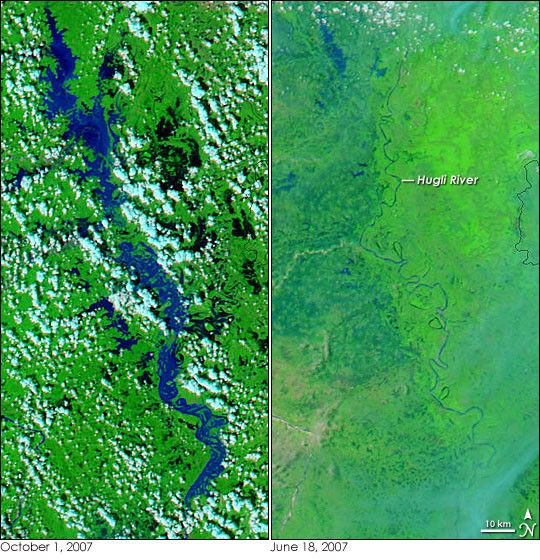
- October 1, 2007 (4.73 MB JPG)
- June 18, 2007 (2.53 MB JPG)
Though September typically marks the end of the summer monsoon in East India, fresh flooding filled the region’s rivers at the end of September 2007. On October 1, the Moderate Resolution Imaging Spectroradiometer (MODIS) flying on NASA’s Aqua satellite captured the left image of floods on the Hugli River in West Bengal. Not only is the river significantly wider than it had been at the start of the monsoon season in June (right), but the surrounding landscape is also pocked with dark pools of water. The water is black or dark blue in these false-color images, which are made from a combination of infrared and visible light. The surrounding plant-covered landscape is bright green, while clouds are pale blue and white.
The late-September floods claimed 48 lives in West Bengal, reported the AFP news service on September 29. The monsoon rain and floods displaced about three million people in East India during September, said the AFP.
Daily images of East India are available from the MODIS Rapid Response System.
References & Resources
NASA images courtesy the MODIS Rapid Response Team at NASA GSFC.


