


![Request for Information – Potential [Placeholder for Prize]](https://assets.science.nasa.gov/dynamicimage/assets/science/psd/solar/2023/09/s/solarsystem_0.jpg?w=1024)


- April 23, 2008 (1.77 MB jpg)
- April 18, 2008 (1.46 MB jpg)
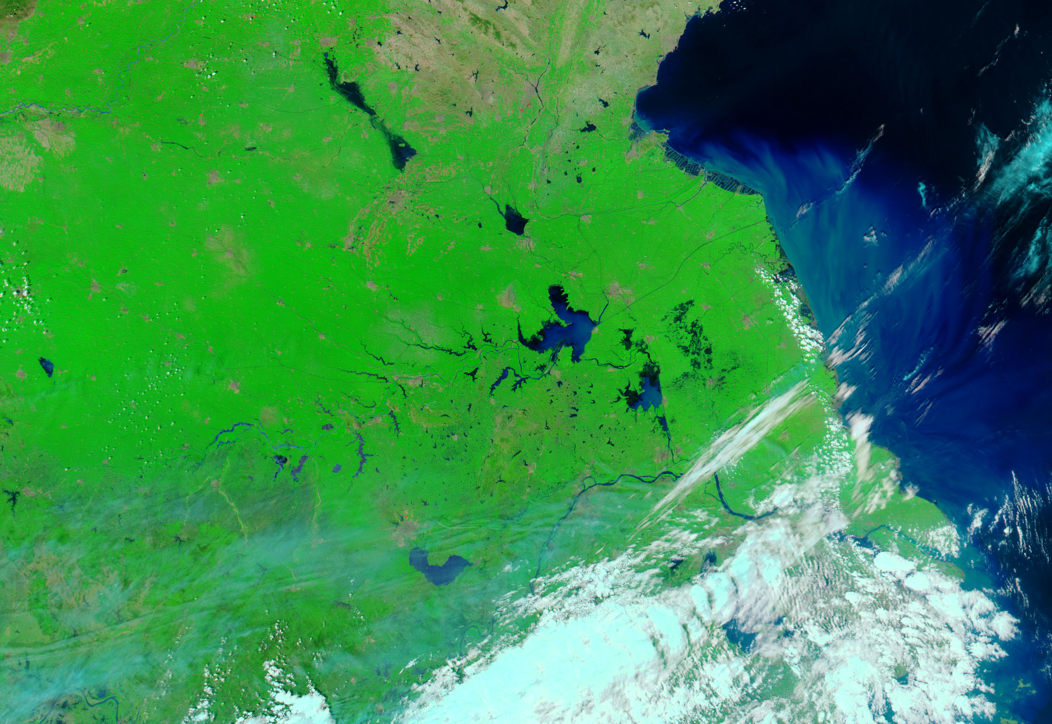
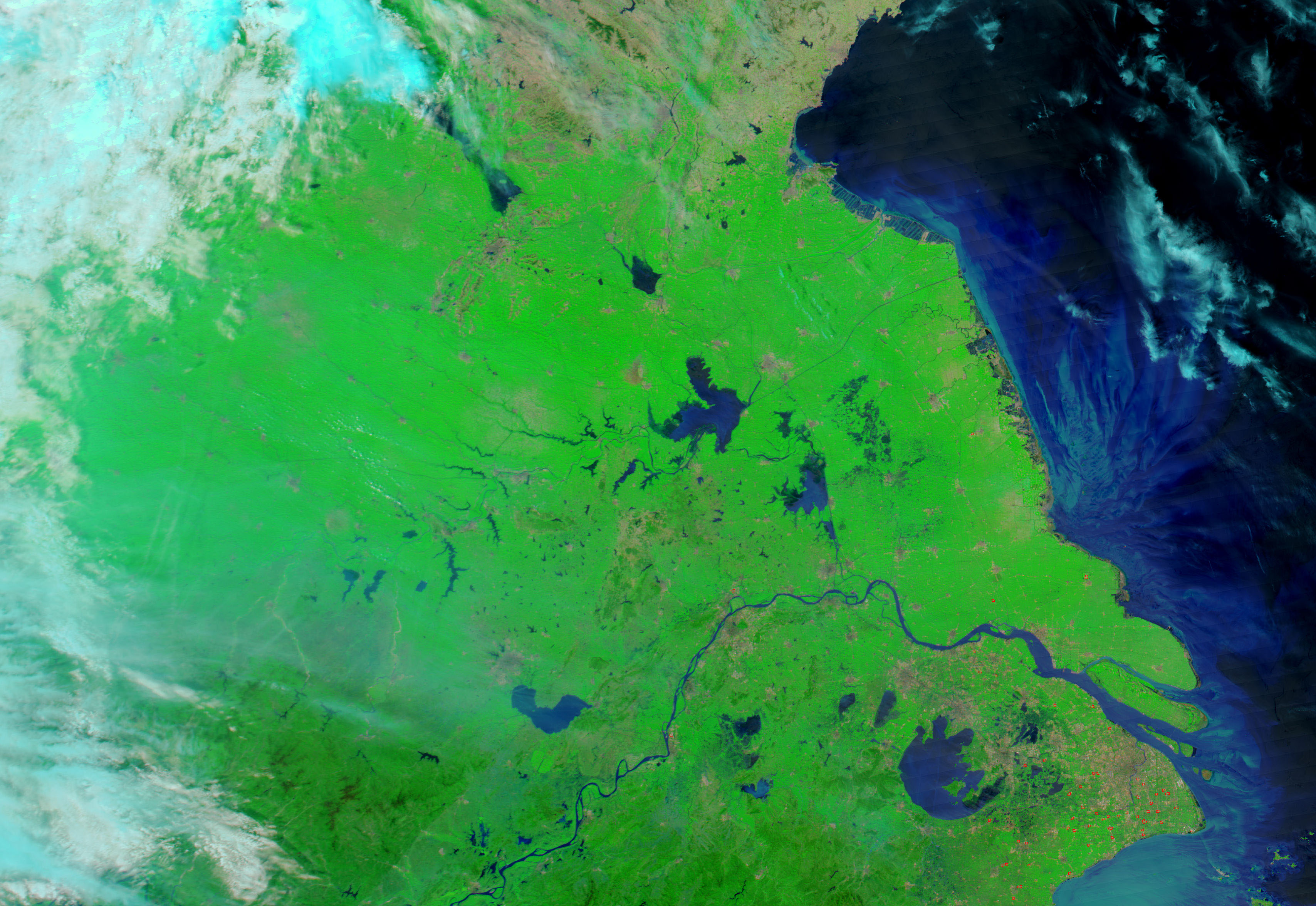
Four days of intense rain brought floods to parts of eastern China’s Anhui province from April 19 through April 22, 2008, causing damage to crops, reported Xinhua, China’s official news agency. By April 23, the clouds had cleared to provide the Moderate Resolution Imaging Spectroradiometer (MODIS) on NASA’s Terra satellite this unusually clear view of the region. The flood-prone Huai River is swollen in the April 23 image (top) compared to an image taken on April 18, the day before the rain started to fall (bottom).
In these images, made with a combination of visible and infrared light reflected from Earth’s surface, water is dark blue or black. Reflected sunlight off the water’s surface creates the lighter blue color seen in the April 23 image. Low cloud or haze casts a faint blue pall over the lower image, slightly blurring the land features underneath. On the ground, plant-covered land is bright green, while cities are gray. The largest city shown in the image is Fuyang, north of the Huai River.
Daily images of China are available from the MODIS Rapid Response System.
References & Resources
- References
- Xinhua. (2008, April 22). Heavy rain floods parts of China north of Huaihe River. Accessed April 23, 2008.
NASA images courtesy the MODIS Rapid Response Team at NASA GSFC. Caption by Holli Riebeek.


