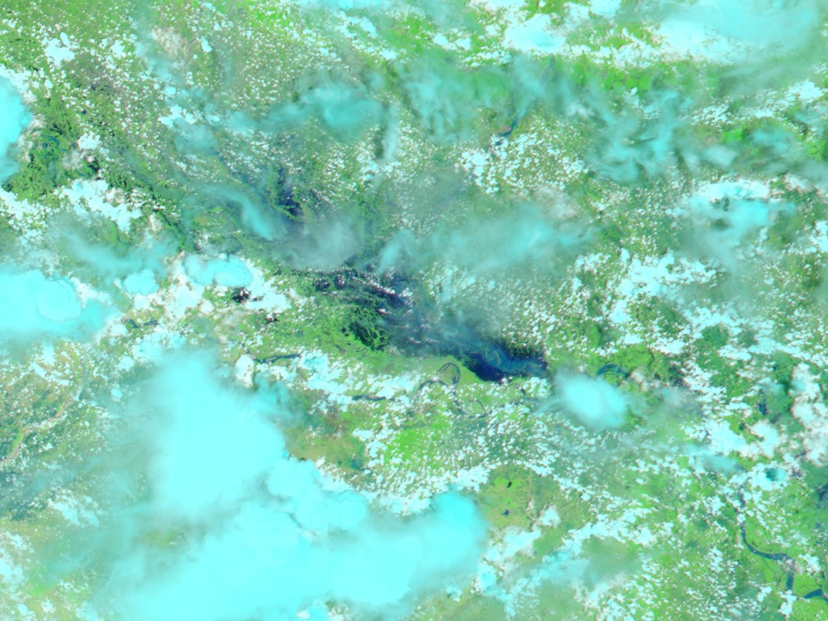
Overwhelmed by monsoon rains and melting snow running down from the Himalaya, the Ganges River has spread over the Indo-Gangetic plains of Northern India’s Bihar state. On August 1, 2004, the clouds cleared just enough to afford a peak at the dark blue flood waters. The Moderate Resolution Imaging Spectroradiometer (MODIS) on NASA’s Aqua satellite captured this scene, which is shown in false color to highlight the presence of water. Clouds are light blue, vegetation is bright green, and water is dark blue and black. According to news reports, the floods stranded over 400,000 people in the final two weeks of July. Now, as the flood waters begin to recede, the concern is water-borne disease in the absence of fresh drinking water.
References & Resources
NASA image created from data courtesy the MODIS Rapid Response Team at NASA GSFC.