


- August 30, 2004 (628 KB)
- July 31, 2004 (648 KB)
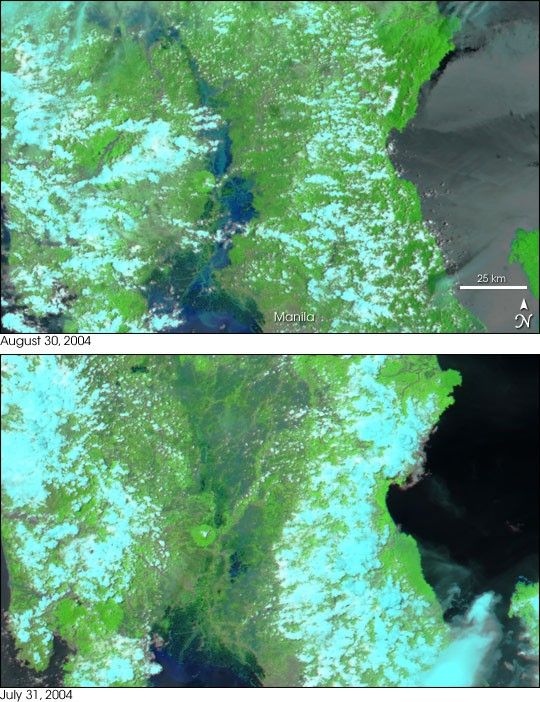
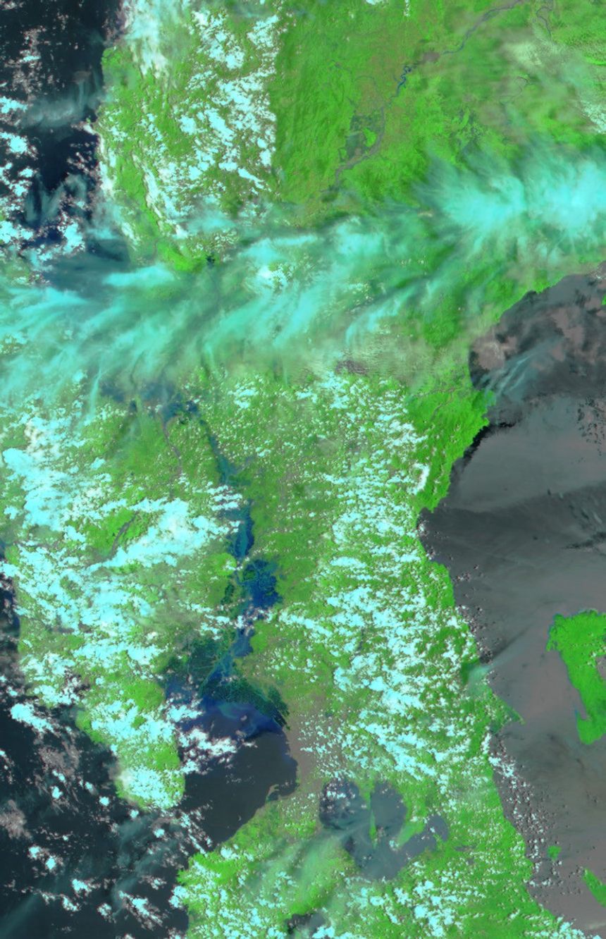
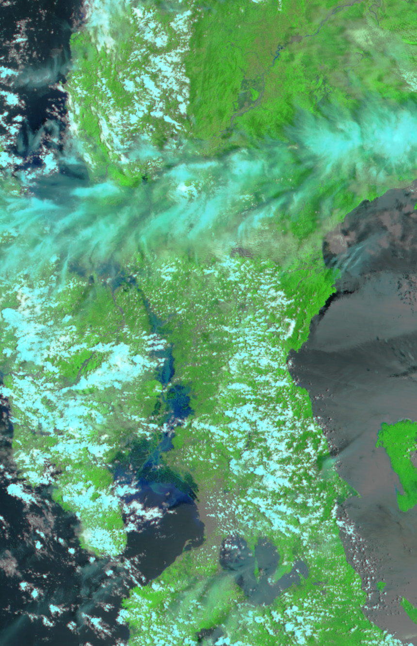
Starting on August 25, 2004, heavy monsoon rains, enhanced by Typhoons Aere and Chaba, inundated Manila and regions to its north in the northern Philippine island of Luzon. The ensuing floods have killed 43 and displayed over a million others, according to news reports issued on August 31.
When the Moderate Resolution Imaging Spectroradiometer (MODIS) on NASAâs Terra satellite flew over Luzon on August 30, the Tarlac and Pampangna Rivers were still visibly flooded. Dark blue flood waters appear along the rivers emptying into Manila Bay on August 30 in contrast to the drier scene acquired one month earlier on July 31. In both false-color images, clouds are light blue, water is dark blue, and vegetation is bright green. The large images provided above show a slightly larger area at MODISâ maximum resolution of 250 meters per pixel.
References & Resources
NASA image courtesy Jesse Allen, based on data from the MODIS Rapid Response Team at NASA GSFC


