


![Request for Information – Potential [Placeholder for Prize]](https://assets.science.nasa.gov/dynamicimage/assets/science/psd/solar/2023/09/s/solarsystem_0.jpg?w=1024)


- October 3, 2005 (1.5 MB)
- September 24, 2005 (1.6 MB)
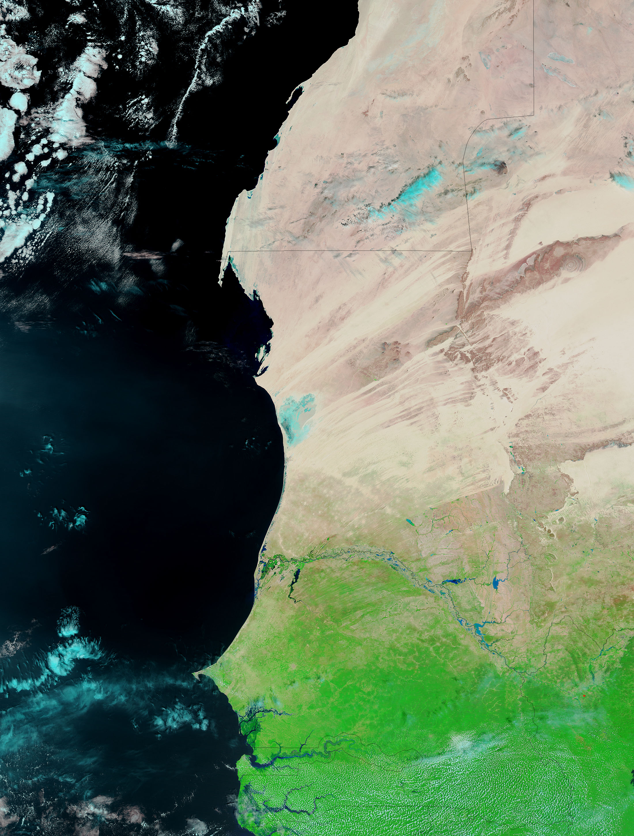
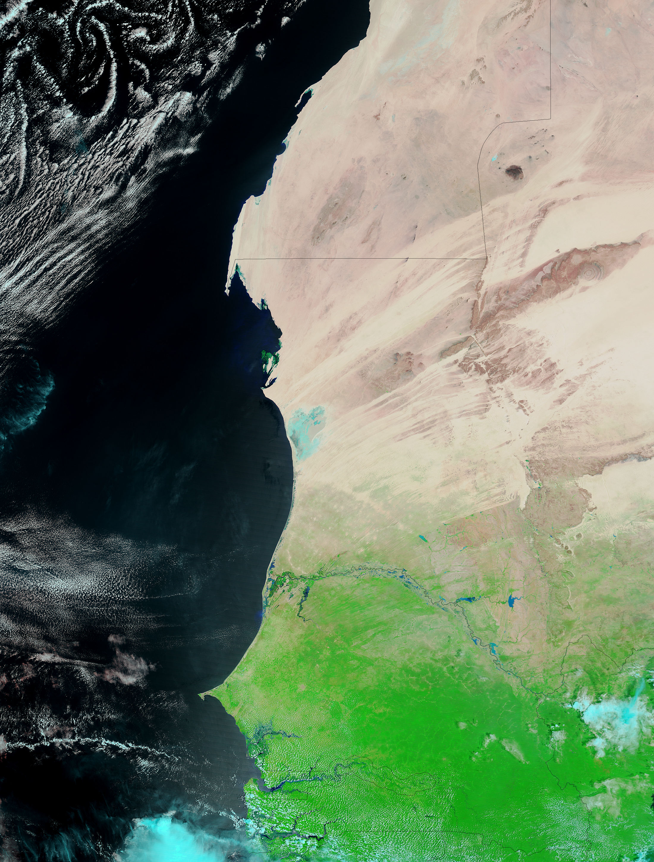
The Senegal River and its tributaries were running high after heavy rains fell over western Africa in late September 2005. According to the Dartmouth Flood Observatory, the floods washed away several villages and left thousands stranded. The Moderate Resolution Imaging Spectroradiometer (MODIS) on NASA’s Terra satellite captured the top image of the floods on October 3, 2005. The lower image, provided for comparison, was taken on September 24, 2005. In these false-color images, water is blue, bare land is pinkish-tan, and vegetation is bright green. On October 3, all of the rivers in the scene appear in bolder strokes of blue, widened by the flooding.
The large images provided above have a resolution of 500 meters per pixel. Daily images are available for this region in a variety of resolutions, including MODIS’ maximum resolution of 250 meters per pixel.
References & Resources
NASA images courtesy the MODIS Rapid Response Team at NASA GSFC.


