


- September 25, 2006 (2.27 MB)
- September 5, 2006 (2.26 MB)
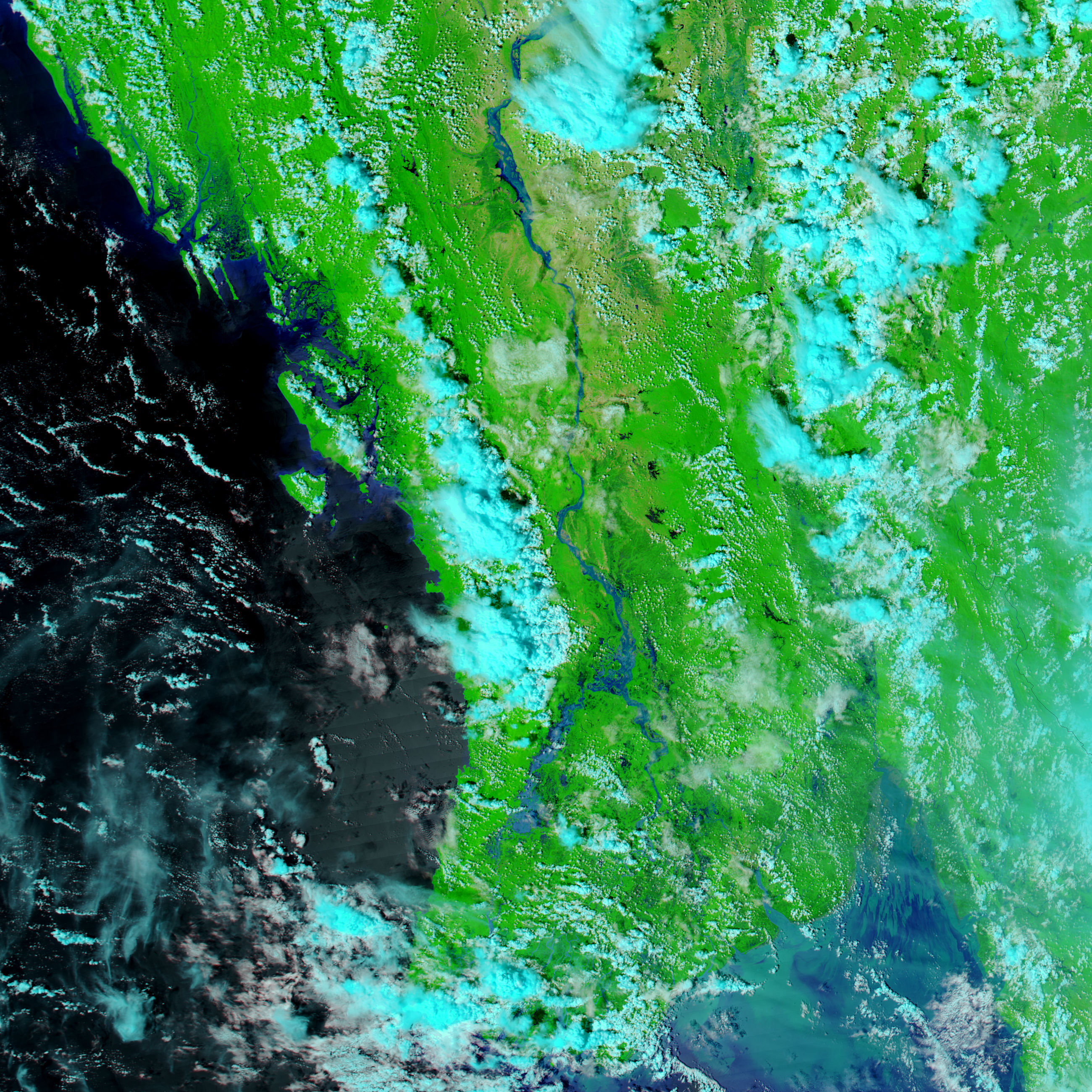
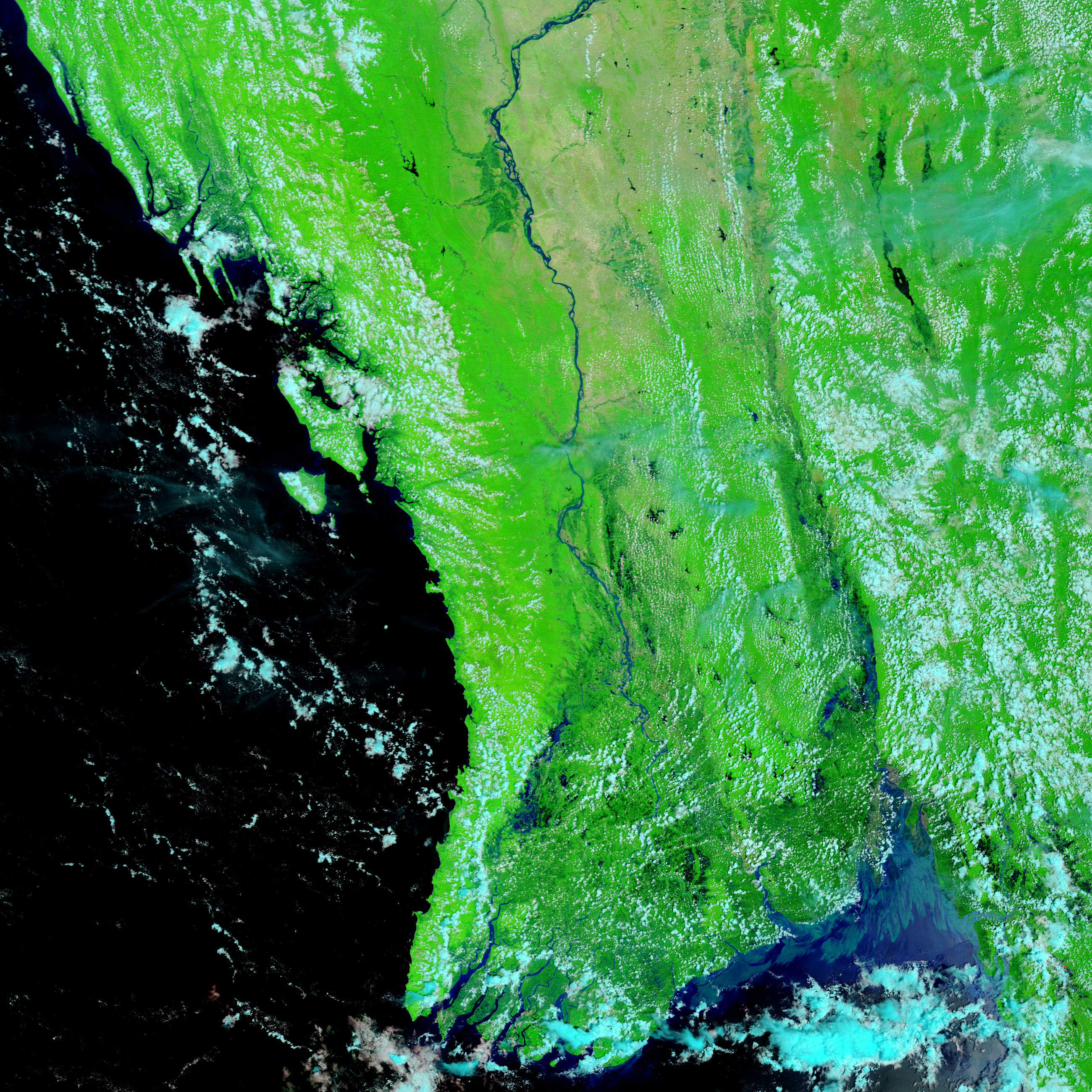
The Asian monsoon annually triggers floods along the major river systems of South Asia from the Indus River in Pakistan to the Ganges and its tributaries in India and the Mekong and Tonle Sap in Cambodia and Vietnam. Draining Myanmar (Burma) from north to south, the Ayeyarwady (Irrawaddy) River also rose when late-season monsoon rains inundated the country in mid-September. The Moderate Resolution Imaging Spectroradiometer (MODIS) on NASA’s Aqua satellite captured the top image of floods along the Ayeyarwady on September 25, 2006. Compared to its extent three weeks earlier (lower image), the river had spread several kilometers over its flood plain on September 25. Like many rivers, the Ayeyarwady splits into several branches across its wide, triangular delta, and it is this branching portion of the river that is shown in these images. Additional flooding is visible along the full extent of the river in the large image provided above.
The images were made with both visible light (light that is visible to the human eye) and infrared light. This light combination makes it easier to distinguish water from land. Water is dark blue or black, while plant-covered land is bright green, bare land is tan, and clouds are pale blue and white. Photo-like versions of both the September 25 and September 5 images are available from the MODIS Rapid Response Team.
References & Resources
NASA images courtesy the MODIS Rapid Response Team at NASA GSFC.


