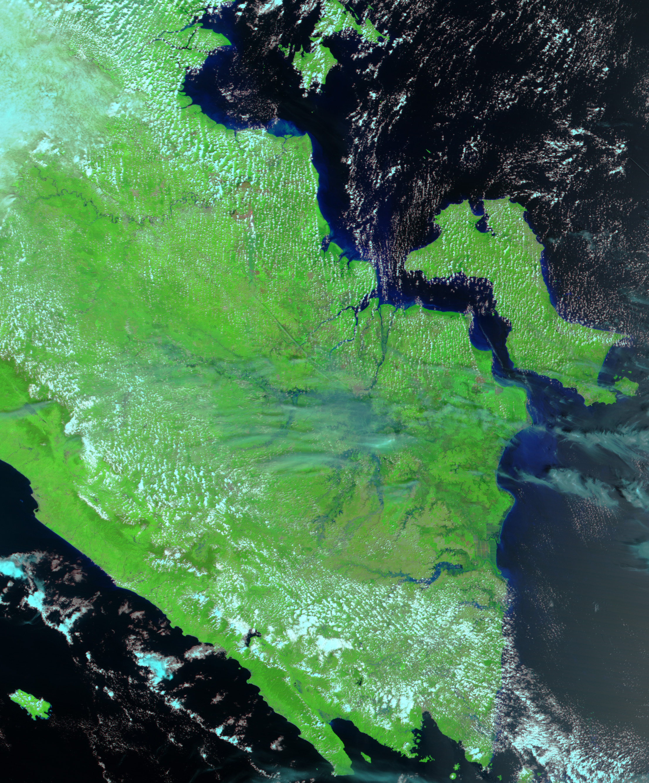
- January 22, 2005 (2.7 MB)
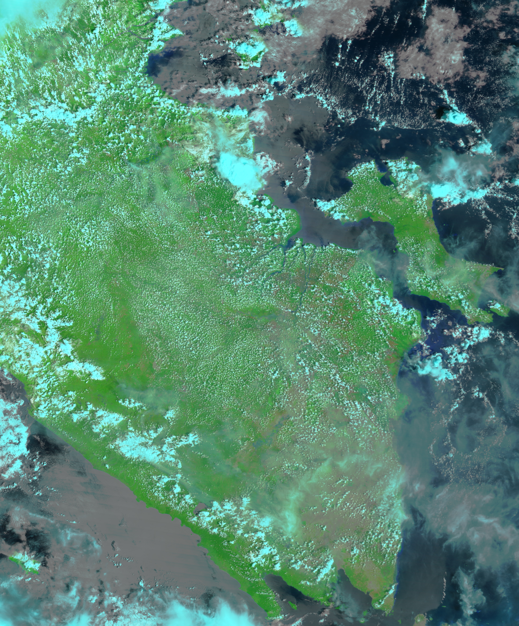
- November 8, 2004 (3.5 MB)
Even as cleanup from the December 26 tsunami continues in northern Sumatra, southern Sumatra has been inundated with floods. A rare break in the clouds provided the Moderate Resolution Imaging Spectroradiometer (MODIS) the top view of the flooded region on January 22, 2005. Compared to November 8, 2004, wide dark-blue rivers of water cut across the tropical landscape. The Musi River in the north and the Tulangbawang River in the south are significantly larger than they were in November. Dark shadows in the wetlands to the east of the swollen Musi River reveal water where bare brown land existed in November. The floods were caused by heavy rains, which started on January 11, 2005. About 17,000 hectares of rice and corn have been destroyed in the region.
The above images show the flooded region in false color to highlight the presence of water, which appears dark blue. Vegetation is bright green, and clouds are light blue.
References & Resources
NASA image created by Jesse Allen, Earth Observatory, using data obtained courtesy of the MODIS Rapid Response team and the NASA/GSFC Land Processes DAAC.