


- January 23, 2005 (1.80 Mb)
- December 1, 2004 (1.73 Mb)
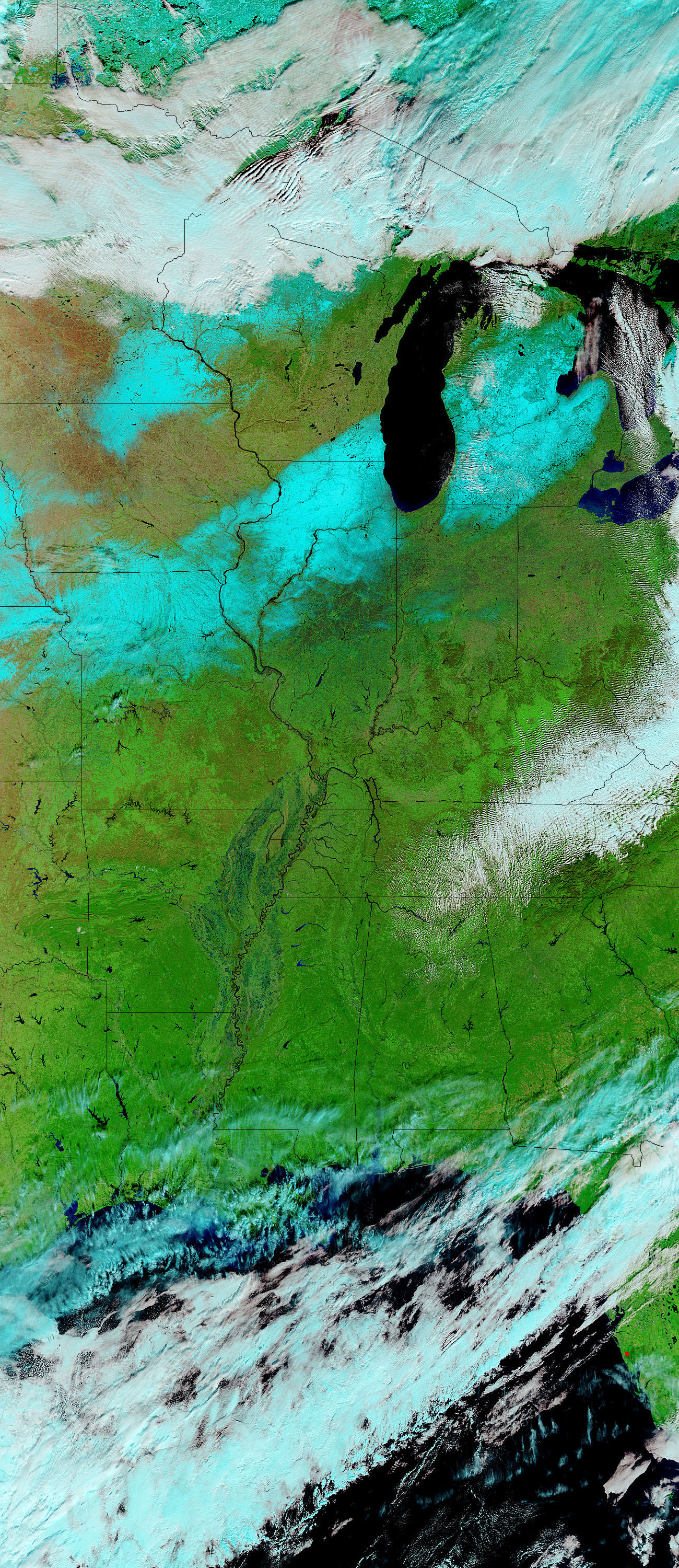
Though water levels on the Ohio and Wabash Rivers appear to be falling, the rivers are still much fuller than they were on December 1, 2004. The floods were triggered by days of heavy rain over the Ohio River Valley in late December and early January. The rains ended by January 17, 2005, and the flood waters began to push downstream. In the left image, acquired on January 23, by the Moderate Resolution Imaging Spectroradiometer (MODIS) on NASAâs Aqua satellite, the Mississippi River and its tributaries bulge with water draining from the north. In both images, water is black and dark blue, clouds are light blue, and vegetation is bright green. Blue snow dusts the ground along the top of both images. MODIS also detected a few fires burning in Mississippi on January 23. These have been marked with red dots.
References & Resources
NASA image courtesy the MODIS Rapid Response Team at NASA GSFC. The images are available in additional resolutions.


