


- Large images
- May 28, 2008 (12.1MB JPEG)
- June 8, 2008 (11.1 MB JPEG)
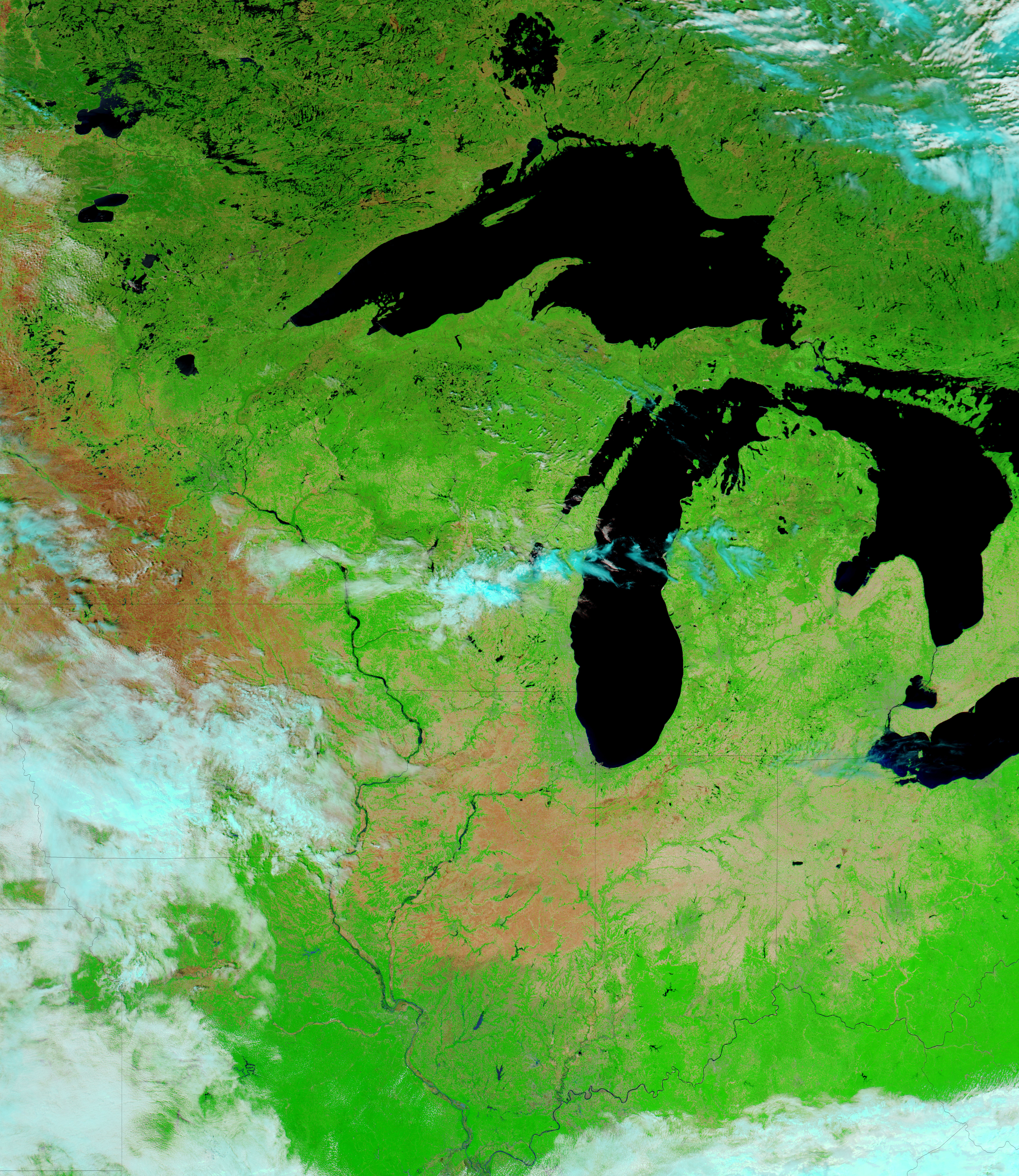
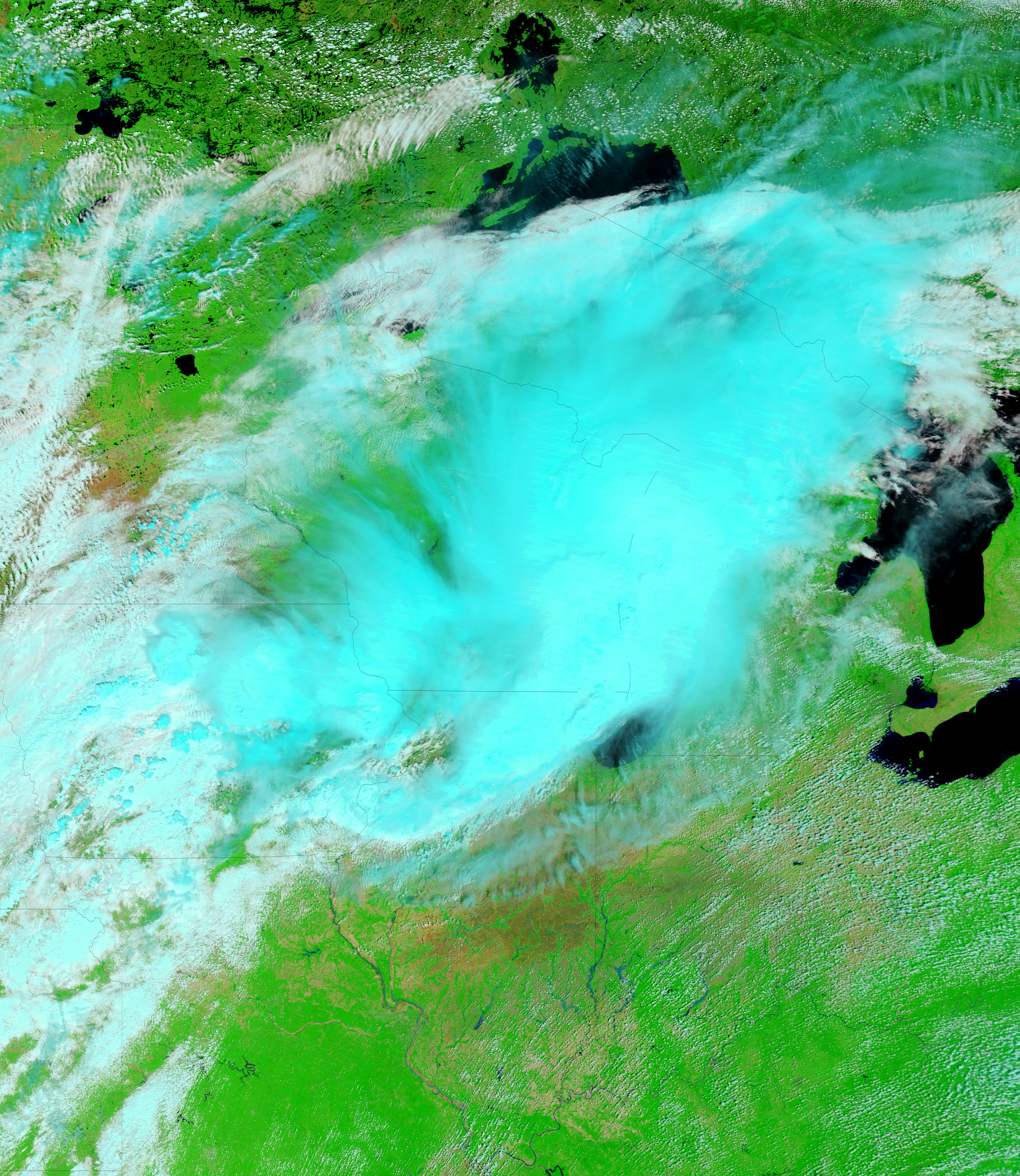
Heavy rains in early June 2008 soaked the U.S. Midwest, leaving swollen rivers in their wake. By June 8, 2008, the National Weather Service had issued flood warnings for numerous counties throughout Indiana and Illinois. The lower Wabash, White, and East Fork White watersheds had all been affected by the deluge, according to National Weather Service bulletins. On June 10, 2008, CBS News reported that authorities blamed the floods for 15 deaths.
The Moderate Resolution Imaging Spectroradiometer (MODIS) on NASA’s Aqua satellite captured the top image on May 28, 2008. MODIS on NASA’s Terra satellite captured the bottom image, showing the flooded areas, on June 8, 2008. These images use infrared and visible light to enhance the contrast between land and water. In these images, vegetation appears bright green, bare ground looks pinkish-tan, clouds look blue-white, and water appears bright blue. The Embarras, Wabash, White, and East Fork White Rivers are all swollen from the heavy rains.
References & Resources
NASA image courtesy the MODIS Rapid Response Team at NASA GSFC. The Rapid Response Team provides daily images of this region.


