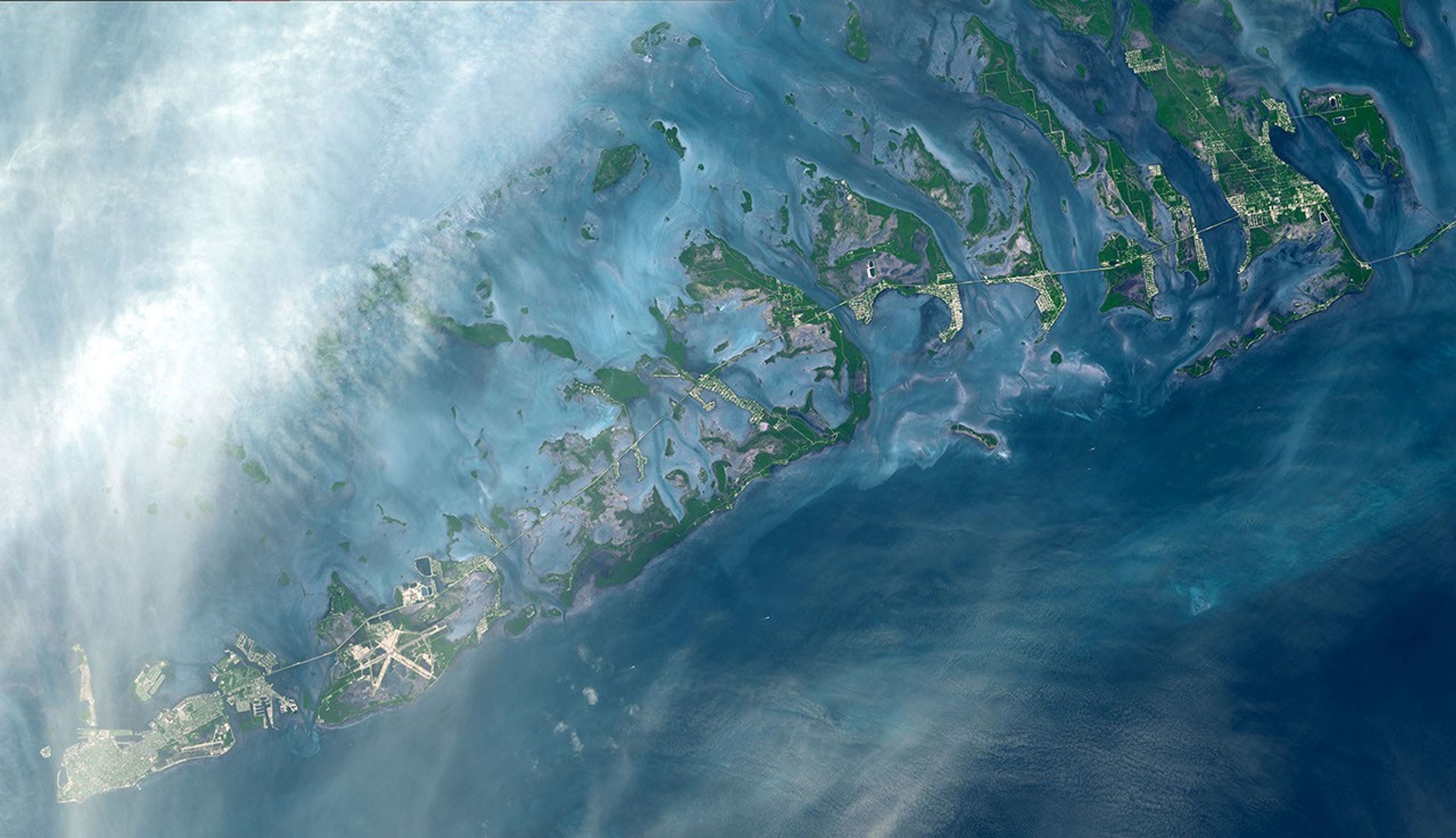
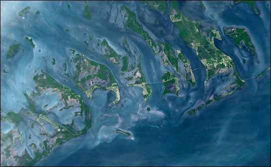
The Florida Keys are a chain of islands, islets, and reefs extending from Virginia Key to the Dry Tortugas for about 309 kilometers. Stretched out into the waters of the Strait of Florida between the Gulf of Mexico to the west and the Atlantic Ocean to the east, the keys are chiefly limestone and coral formations. In this image from the Advanced Spaceborne Thermal Emission and Reflection Radiometer (ASTER) on the Terra satellite, the keys form a mosaic of green and white against the blues of the sea. The white areas clearly show where the islands have been developed with both communities and roads. Among the roads is the causeway that connects the Keys to the mainland and to one another. The high resolution image shows the larger islands of the group at lower left: Key West (with its airport), Key Largo, Sugarloaf Key, and Boca Chica Key. This ASTER image covers an area of 51.6 x 29.7 km and was acquired on October 28, 2001.
References & Resources
Image courtesy the U.S./Japan ASTER Science Team.