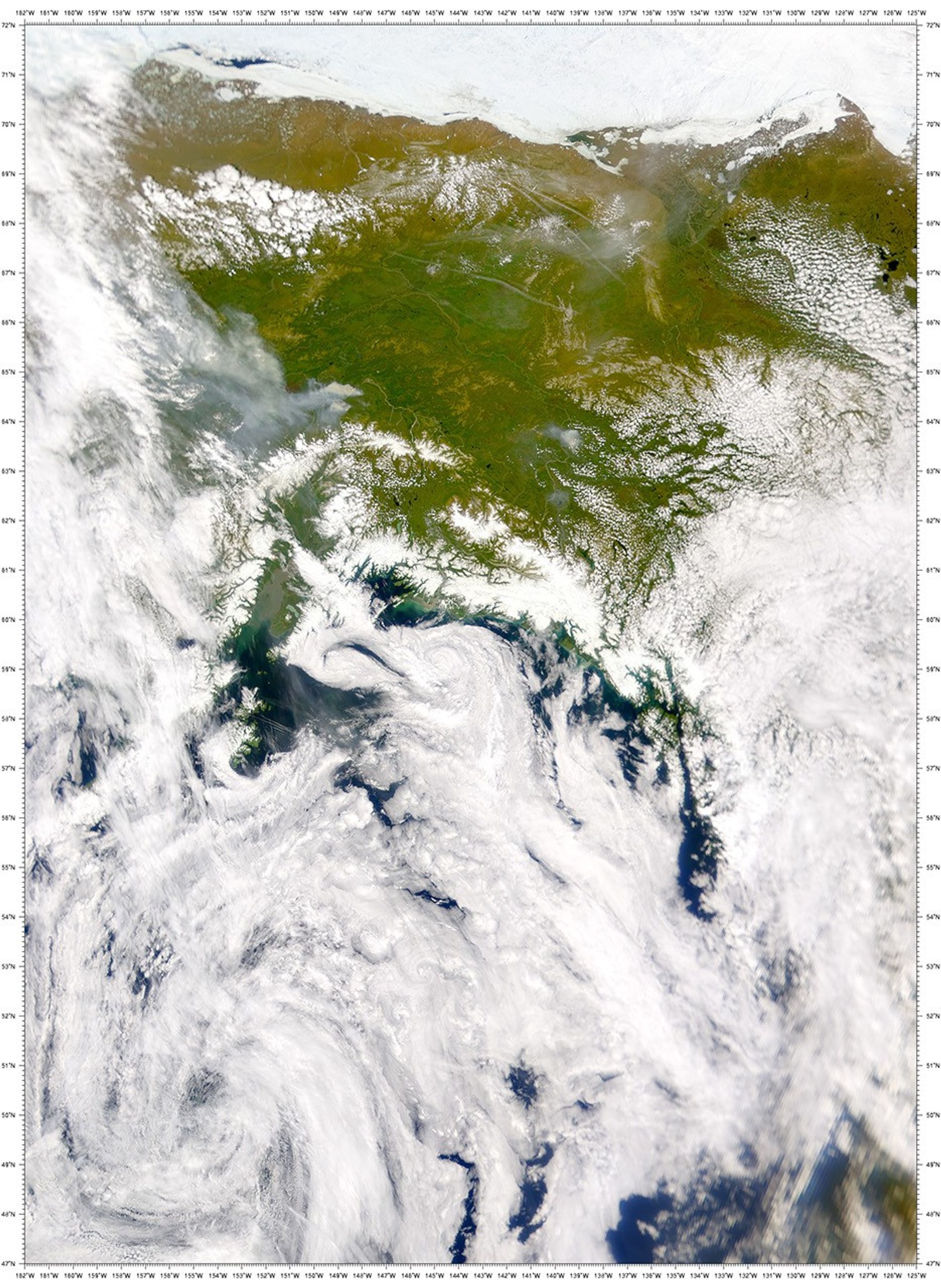
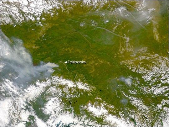
Two large wildfires were burning south of Fairbanks, Alaska, on June24, when this true-color image of the region was acquired by theSea-viewing Wide Field-of-view Sensor (SeaWiFS). A combination of hightemperatures and light winds were fanning the flames southwestward, awayfrom Fairbanks. Together, both fires consumed more than 80,000acres.
The largest of the fires burned about 50,000 acres on Fort Wainwrightmilitary land, sending a thick plume of smoke over the nearby town ofNenana. South of Nenana, more than 250 firefighters and 5 helicopterswere dispatched to fight the other large fire, which had consumed about30,000 acres. In addition to these blazes, there were thirteen other,smaller wildfires burning across the state on June 24.
The smoke plumes of several of these fires are visible in this scene,including the large fire burning near Fairbanks. The snow-capped peaksof part of the Alaska Mountain Range is visible along the southern(bottom) portion of this image. To the north we see a number of long,thin airplane contrails casting shadows on the surface.
References & Resources
Image courtesy the SeaWiFS Project, NASA/Goddard Space Flight Center, and ORBIMAGE