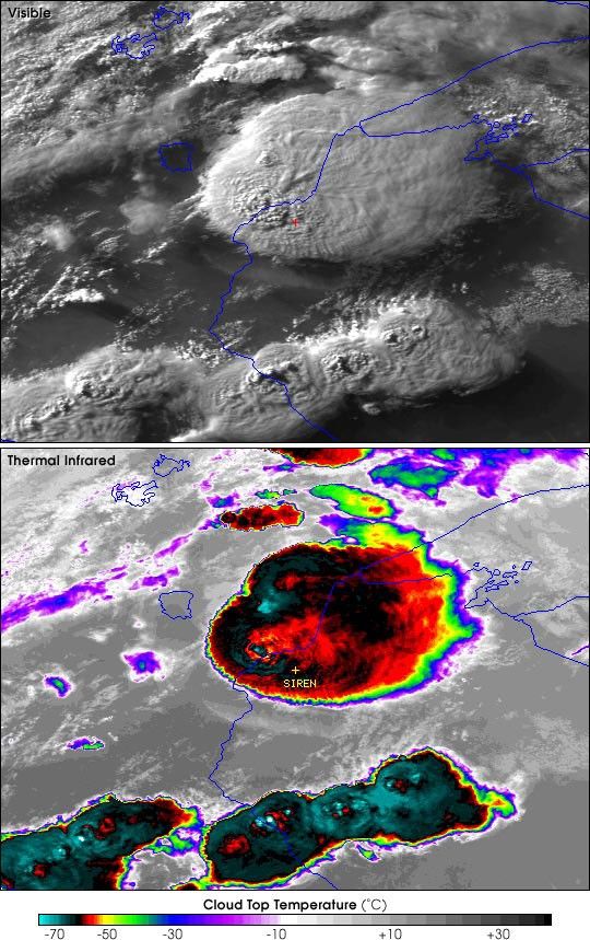
The above images were acquired by the National Oceanographic and Atmospheric Administration's (NOAA's) Advanced Very High Resolution Radiometer (AVHRR) aboard the NOAA-15 Polar Orbiting Environmental Satellite at 6:59 PM CDT on June 18, 2001.
The track left by the tornado was visible from the Landsat 7 satellite the next morning.
For more information on the Siren, Wisconsin, tornado follow this link to the Cooperative Institute for Meteorological Satellite Studies (CIMSS), University of Wisconsin Space Science and Engineering Center.
Tornadoes: Nature's most violent wind from USA Today provides a more detailed explanation of tornado formation.
References & Resources
Image courtesy CIMSS, University of Wisconsin
None