


October 4, 2015
Grizzly Bear Complex Fire
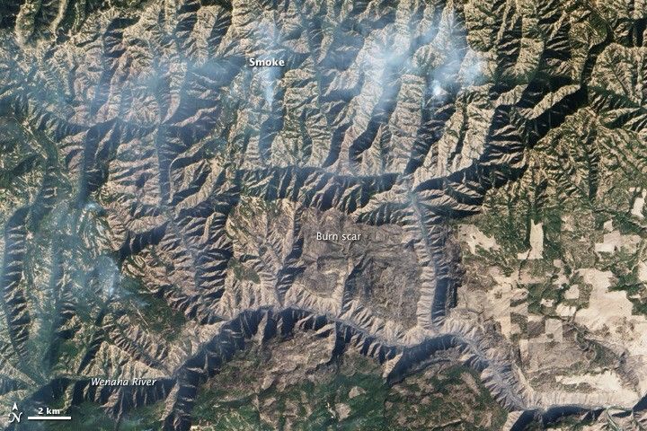
Several fires burningin northeastern Oregon and southeastern Washington—known as the Grizzly Bear Complex—have charred tens of thousands of acres. The Advanced Land Imager (ALI) on the Earth Observing-1 (EO-1) satellite acquired these images of the affected area on October 4, 2015.
The fires have burned through rugged terrain comprised of basaltic ridges and sharp canyons. In the natural color image (top), smoke is visible emanating from a few active fires in stream valleys north of the Wenaha River. In the false-color image (bottom), burned areas appear brown; unburned vegetation is green. Firefighting authorities note that the fire has moved through several types of fuel: timber, grass, brush, and logging slash.
Lightning triggered the fires on August 13, 2015. By October 8, they had charred 82,659 acres (33,450 hectares).
Further Reading
- The Columbian (2015, October 2) Grizzly Bear Complex still a threat to some cabins. Accessed October 8, 2015.
References & Resources
- Inciweb (2015, October 8) Grizzly Bear Complex. Accessed October 8, 2015.
NASA Earth Observatory image by Jesse Allen, using EO-1 ALI data provided courtesy of the NASA EO-1 team. Caption by Adam Voiland.


