


![Request for Information – Potential [Placeholder for Prize]](https://assets.science.nasa.gov/dynamicimage/assets/science/psd/solar/2023/09/s/solarsystem_0.jpg?w=1024)


Haikui made landfall in eastern China overnight on August 7–8, 2012. When the storm came ashore, it brought trouble with it. China’s news agency Xinhua reported torrential rains, severed bridges, downed power lines, hundreds of stranded tourists, and about 1.5 million people evacuated.
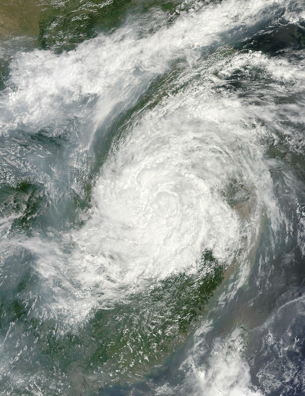
The Moderate Resolution Imaging Spectroradiometer (MODIS) on NASA’s Terra satellite captured this natural-color image of Haikui’s remnants on August 9, 2012. By then, the center of the storm was west of Shanghai. Although Haikui lacked a clear eye, it retained the spiral shape typical of a strong tropical storm.
Unisys Weather reported that Haikui transitioned from a typhoon to a tropical storm on August 7, and from a tropical storm to a tropical depression on August 9. It nevertheless brought widespread damage to China’s east coast. It was the third storm to make landfall in that region in a week.
References & Resources
- Unisys Weather. (2012, August 9) Haikui Tracking Information. Accessed August 9, 2012.
- Xinhua. (2012, August 8) Typhoon Haikui wreaks havoc after landing in E. China. Accessed August 9, 2012.
NASA image courtesy Jeff Schmaltz, LANCE MODIS Rapid Response Team at NASA GSFC. Caption by Michon Scott.


