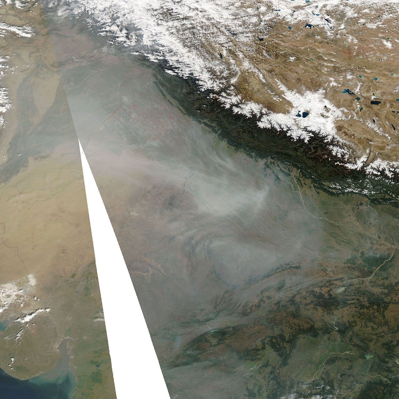
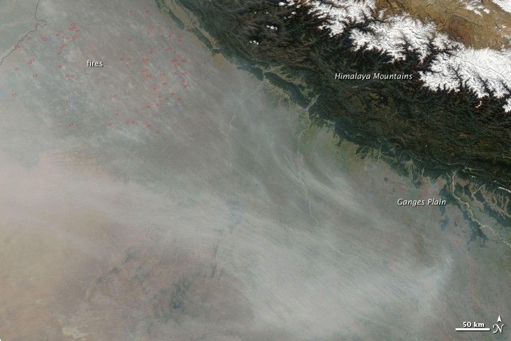
It’s difficult to tell just what darkened the skies over India’s Ganges Plain in this satellite image. The Moderate Resolution Imaging Spectroradiometer (MODIS) on NASA’s Aqua satellite captured the image on October 29, 2009. Thick brownish-gray haze covered much of the Ganges Plain, hiding it from view. The haze likely had many sources and may be made up of smoke, dust, and urban pollution.
A cluster of agricultural fires, outlined in red, burned in northwestern India. White-gray smoke rises from the fires and flows east over the Ganges Plain. While fires had been burning in the region for more than a week (see Fires in Northwestern India), they may not be responsible for all of the pollution seen in the image.
South of the fires, a pale plume appears to be blowing east from the desert that straddles the border between India and Pakistan. The plume may contain desert dust. Finally, urban haze frequently builds over the Ganges Plain during the winter. It is likely that some of the murky air seen in this image contains urban pollutants.
References & Resources
NASA image courtesy the MODIS Rapid Response Team at NASA GSFC. Caption by Holli Riebeek, NASA Earth Observatory.