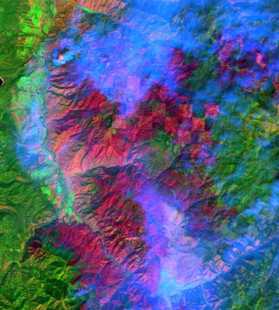

This false-color image over the Bitterroot National Forest, Montana, wasmade using data acquired on Aug. 14 by Landsat 7's Enhanced ThematicMapper plus (ETM+). As of Aug. 21, more than 200,000 acres (300 squaremiles) of the Bitterroot have burned and hundreds of people in the areahave been evacuated from their homes. In all, about 30 large blazesacross Montana have burned more than 600,000 acres (937 square miles).In this image, dull red pixels show recent burn scars, while bright redpixels depict the flaming portions of the burn. (Look underneath the bluesmoke at the top of the image.) The green pixels showvegetated regions not burned. The image was made using a combination ofETM+ Bands 7, 4, 1 (shortwave infrared, near-infrared, and bluewavelengths, respectively.)
Nationally, there were about 90 wildfires burning that have consumed anestimated 1,393,426 acres (2,177 square miles) across 10 states,according to the National Interagency Fire Center in Boise, Idaho. Therewere significant wildfires in Arizona (3), California (1), Florida (2),Idaho (28), Nevada (6), Oregon (1), Texas (3), Utah (3), and Wyoming(10). It appears that most of the blazes were ignited by lightningstrikes, although some have been attributed to human error.
The news service CNN reports that nationally, 68,791 wildfires this yearhave burned 5,669,328 acres (8,858 square miles). By comparison, theland area of New Jersey is 7,418 square miles; Massachusetts is 7,838square miles in size; and New Hampshire is 8,969 square miles. Fireofficials are calling the summer of 2000 the worst fire season in morethan 50 years.
References & Resources
Image courtesy Rich Irish, Landsat 7 Team, NASA GSFC; Data provided by EROS Data Center.