- Quicktime (.mov) format (1.9 MB)
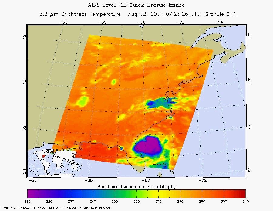
This image and movie of Tropical Storm Alex was made with the infrared sensor in the AIRS instrument suite on August 2, 2004. Located in the Atlantic Ocean located about 80 miles south-southeast of Charleston, South Carolina, the storm is moving in a north/northeast path at 5 knots (6 mph). At the time of this observation, the storm had a maximum sustained wind speed of 35 knots (40 mph) with gusts to 45 knots (52 mph).
The major contribution to radiation (infrared light) that AIRS infrared channels sense comes from different levels in the atmosphere, depending upon the channel wavelength. To create the movies, a set of AIRS infrared channels were selected which probe the atmosphere at progressively deeper levels. If there were no clouds, the color in each frame would be nearly uniform until the Earth's surface is encountered. The tropospheric air temperature warms at a rate of 6 K (about 11 F) for each kilometer of descent toward the surface. Thus the colors would gradually change from cold to warm as the movie progresses.
Clouds block the infrared radiation. Thus wherever there are clouds we can penetrate no deeper in infrared. The color remains fixed as the movie progresses, for that area of the image is "stuck" to the cloud top temperature. The coldest temperatures around 220 K (about -65 F) come from altitudes of about 10 miles.
We therefore see in a 'surface channel' at the end of the movie, signals from clouds as cold as 220 K and from Earth's surface at 310 K (about 100 F). The very coldest clouds are seen in deep convection thunderstorms over land.
References & Resources
Image and movie courtesy of the AIRS Science Team at the Jet Propulsion Laboratory.