Suggested Searches

1 min read

Hurricane Charley

Instruments:
2004-08-12 00:00:00
August 12, 2004

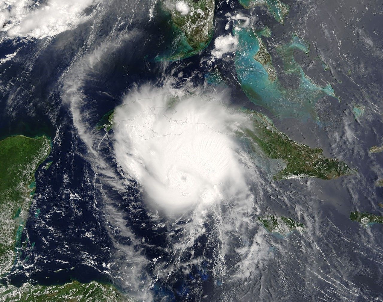
The MODIS instrument aboard NASA's Terra satellite captured this true-color image of Hurricane Charley on August 12 at 11:55 a.m. EDT. At the time this image was taken, Charley had maximum sustained winds near 90 mph with higher gusts and was moving toward the northwest at 17 mph.

The MODIS Rapid Response System provides this image at additional resolutions and formats.

References & Resources

Image courtesy Jacques Descloitres, MODIS Land Rapid Response Team at NASA GSFC.

You may also be interested in:

Stay up-to-date with the latest content from NASA as we explore the universe and discover more about our home planet.

Snow in the Shadow of the Andes
2 min read

An early autumn storm left higher elevations in southern Argentina with a fresh and fleeting coat of white.

Article
Wave of Dust Rolls Through Texas
3 min read

An advancing cold front kicked up a sharp line of sand and other small particles that swept over the high…

Article
Winds Whip Up Fires and Dust on the Southern Plains
3 min read

Dry, gusty conditions spurred fast-growing fires in Oklahoma and Kansas, along with dangerous dust storms across the region.

Article