Suggested Searches

1 min read

Hurricane Charley

Instruments:
2004-08-13 00:00:00
August 13, 2004

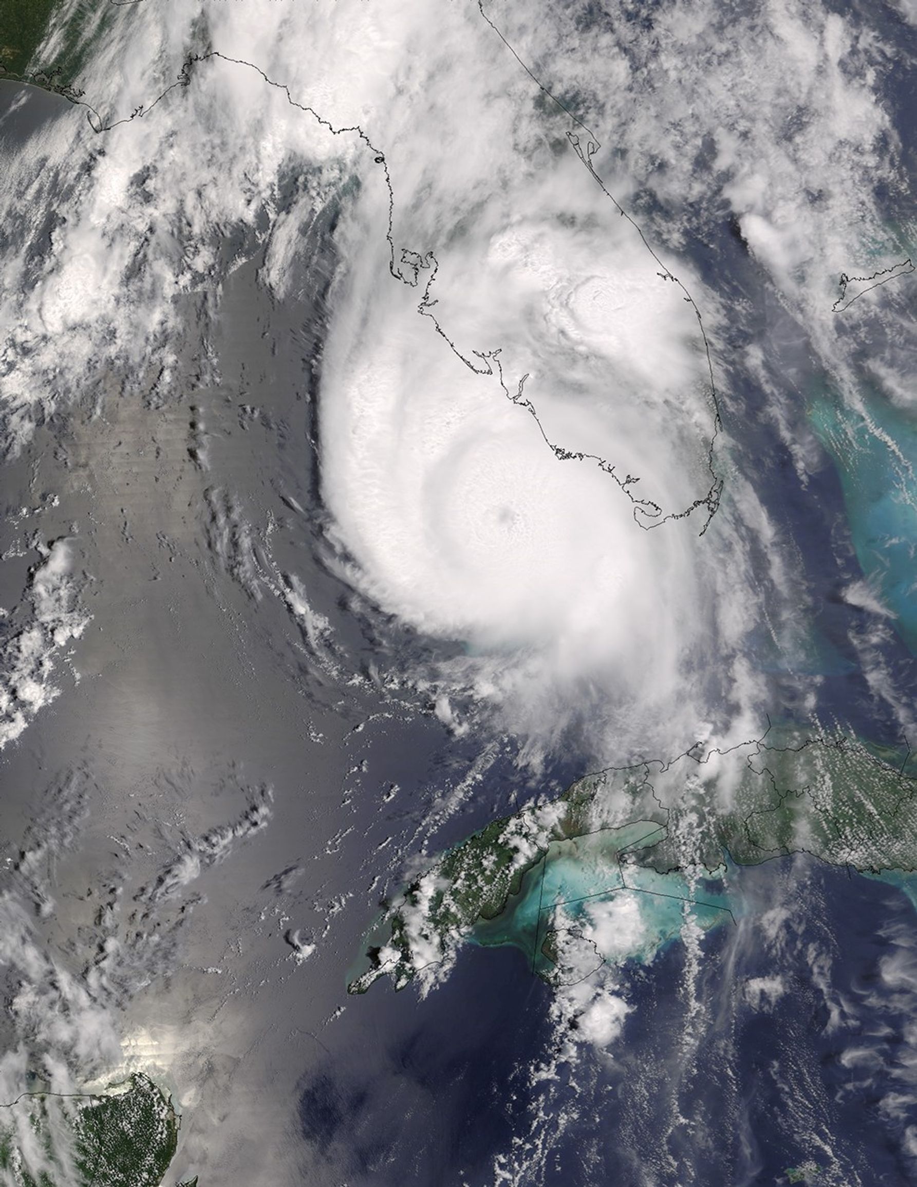
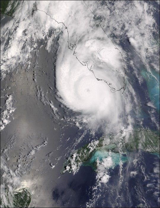
The MODIS sensor aboard NASA's Terra satellite captured this true-color image of Hurricane Charley on August 13 at 12:35 p.m. EDT. At the time this image was taken Charley was rapidly gaining strength and would reach category 4 status just 90 minutes later. Maximum sustained winds at 2:00 p.m. were at 145 mph and Charley was moving towards the north-northeast at 20 mph.

References & Resources

Image courtesy of the Space Science and Engineering Center, University of Wisconsin-Madison.

You may also be interested in:

Stay up-to-date with the latest content from NASA as we explore the universe and discover more about our home planet.

Hurricane Erin Roils in the Atlantic
3 min read

The major hurricane steered clear of land but delivered tropical storm conditions to coastal areas along its path.

Article
Hurricane Kiko Nears Hawaii
2 min read

The storm became a major hurricane while traversing the eastern Pacific but weakened as it approached the islands.

Article
Imelda and Humberto Crowd the Atlantic
3 min read

The tropical cyclones are close enough in proximity that they may influence one another.

Article