![Request for Information – Potential [Placeholder for Prize]](https://assets.science.nasa.gov/dynamicimage/assets/science/psd/solar/2023/09/s/solarsystem_0.jpg?w=1024)


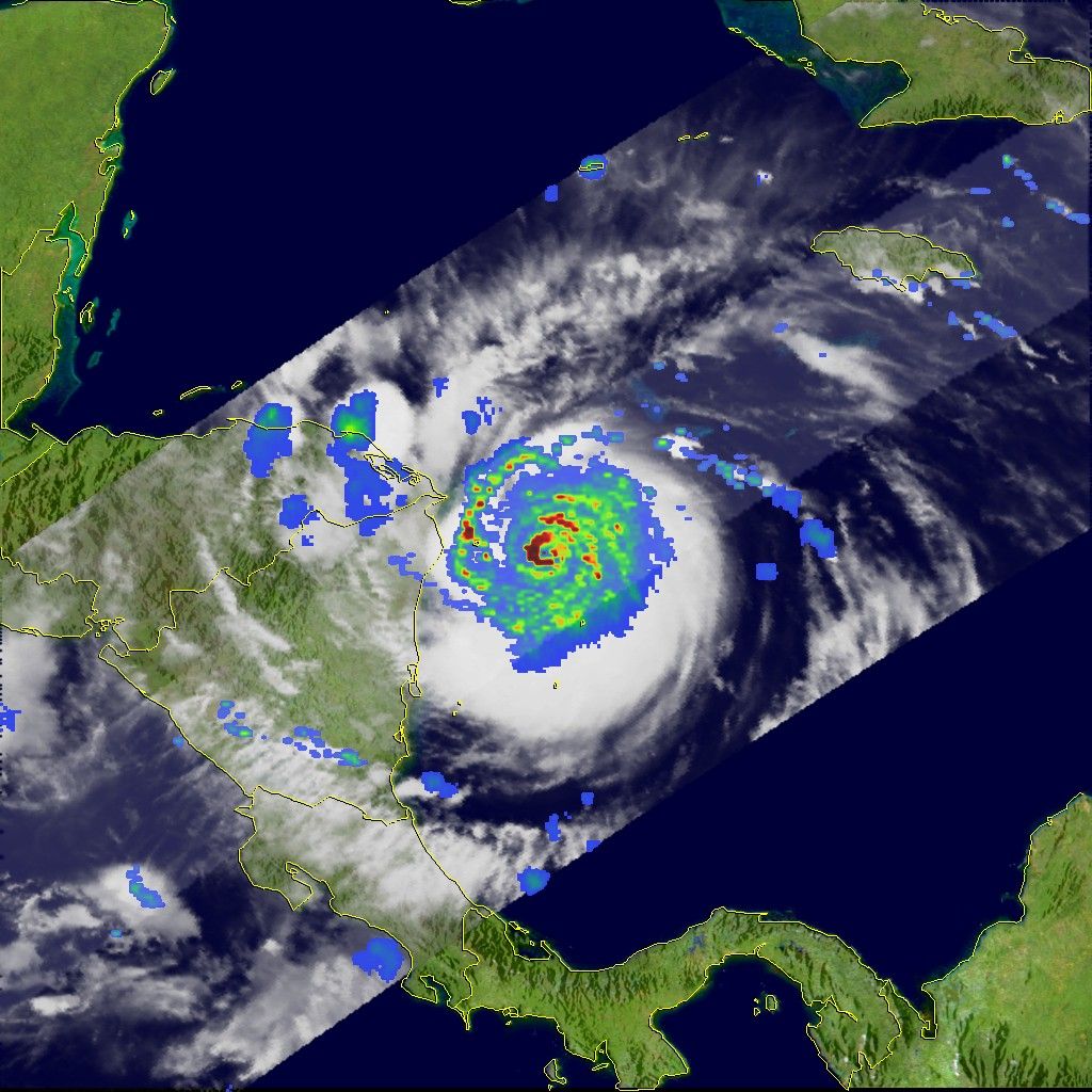
Hurricane Felix was approaching the Central American coastline on September 4, 2007, shortly after midnight local time (06:04 UTC), when the Tropical Rainfall Measuring Mission satellite (TRMM) captured the data used to make this image. The image shows rainfall rates within the powerful storm overlaid on a visible image of the storm. Areas in which rainfall is heaviest are red, while regions of lighter rainfall are blue.
Rainfall can reveal features of a storm’s structure that might not otherwise be visible. In this case, a band of heavy rain circles the eye of the storm. Additional distinct rain bands spiral out from the center of the storm. The image also reveals that the heavy rain that Felix brought to Central America was concentrated in a relatively small area.
At the time that TRMM observed Felix, the storm was strengthening from Category 4 to Category 5 status, with sustained winds near 215 kilometers per hour (135 miles per hour), according to the National Hurricane Center. Felix developed very rapidly. The storm formed on the evening of August 31 and had grown into a hurricane by the next day. By September 2, Felix had become a rare Category 5 storm. It was the second Category 5 storm to make landfall in as many weeks.
References & Resources
Image produced by Hal Pierce (SSAI/NASA GSFC).