August 31, 2004
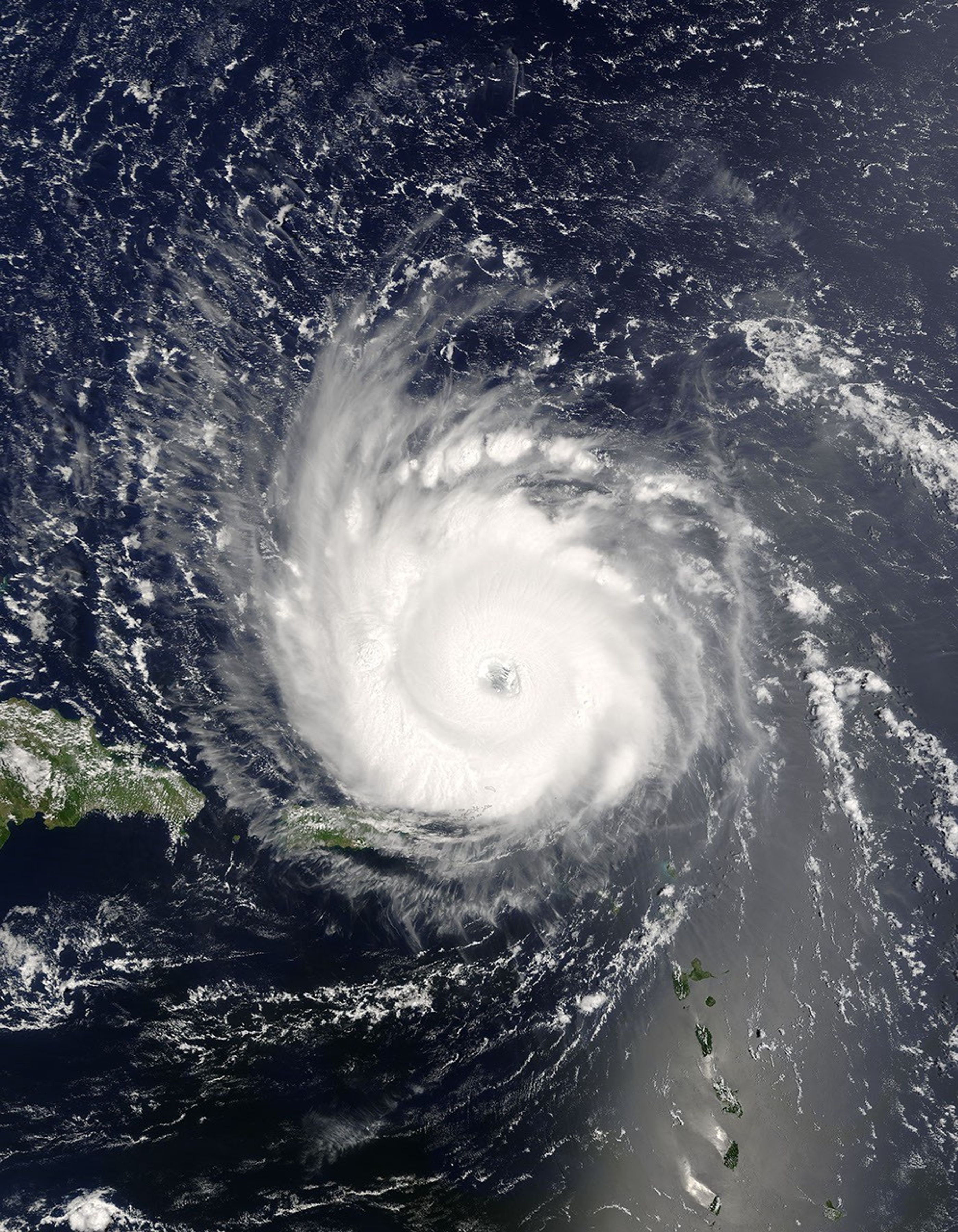
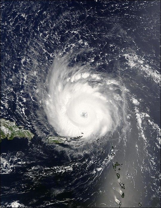
The MODIS instrument aboard NASA's Terra satellite captured this true-color image of Hurricane Frances swirling above the waters of the tropical Atlantic Ocean on August 31 at 14:45 UTC (10:45 AM EDT). At the time this image was taken Frances was located approximately 285 km (175 miles) northeast of San Juan, Puerto Rico and was moving towards the west at 24 km/hr (15 mph). Maximum sustained winds were near 215 km/hr (135 mph) with a minimum central pressure of 950 mb. This makes Frances a Category 4 storm on the Saffir/Simpson Scale.
The MODIS Rapid Response System provides this image at additional resolutions and formats.
References & Resources
NASA image courtesy Jacques Descloitres, MODIS Land Rapid Response Team at NASA GSFC.