Suggested Searches

1 min read

Hurricane Frances

Instruments:
2004-08-31 00:00:00
August 31, 2004

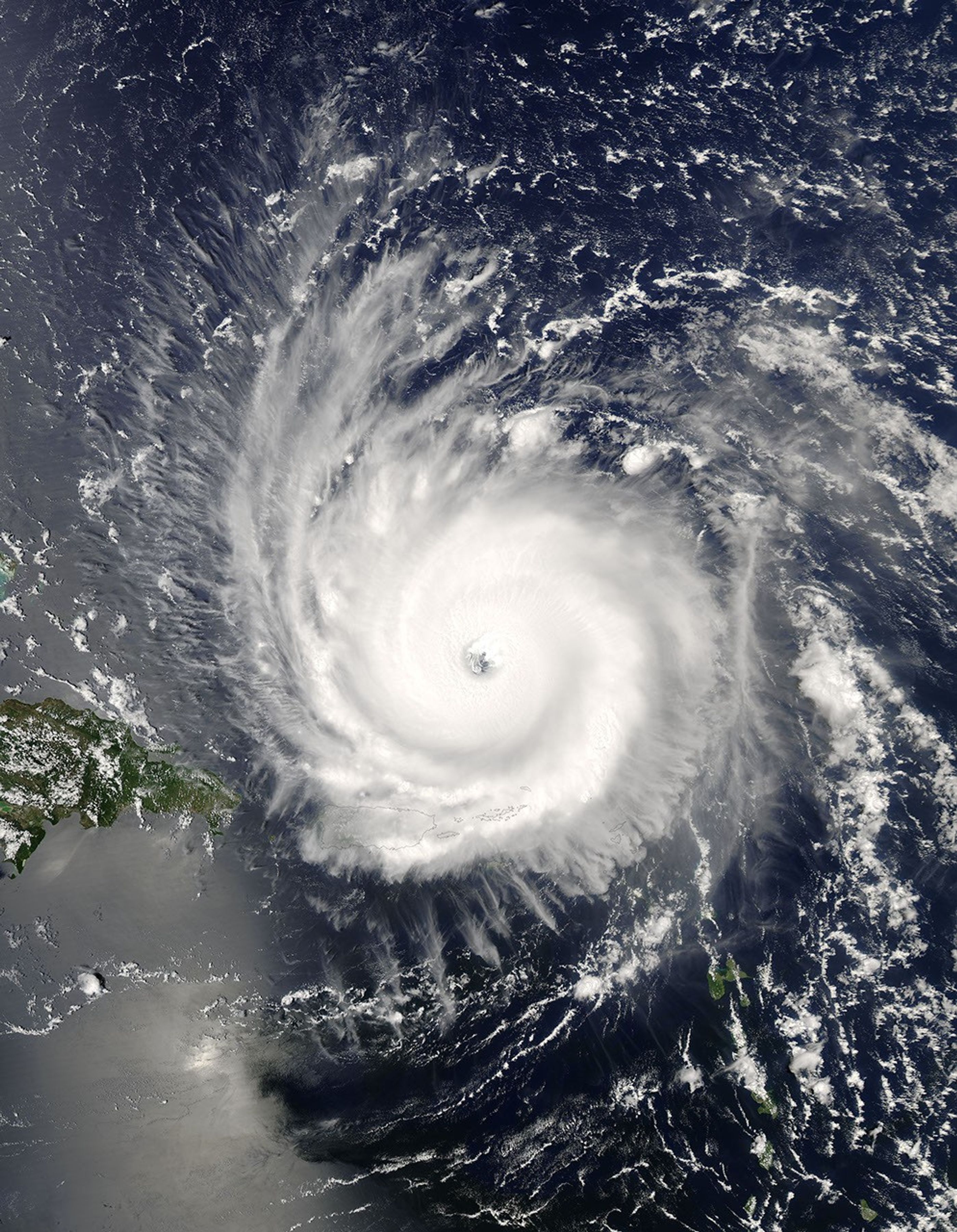
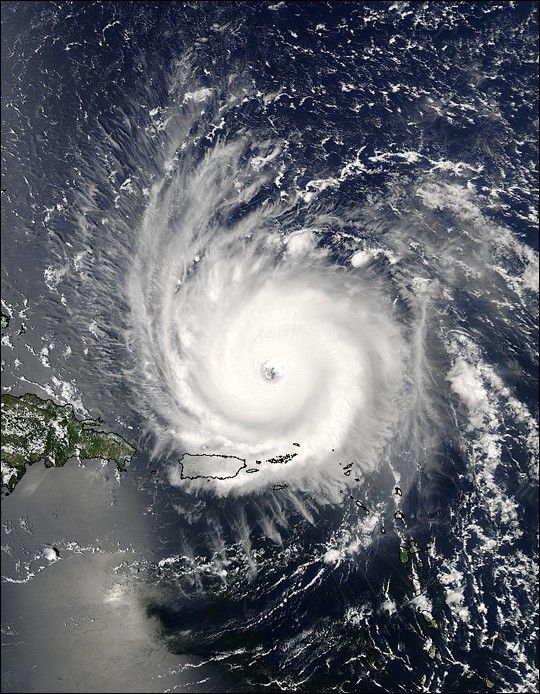
The MODIS instrument aboard NASA's Aqua satellite captured this true-color image of Hurricane Frances on August 31, 2004 at 17:55 UTC (1:55 PM EDT). At the time this image was taken Frances was located approximately 230 km (140 miles) north-northeast of San Juan, Puerto Rico and was moving towards the west near 26 km/hr (16 mph). Maximum sustained winds were near 225 km/hr (140 mph) and the storm's minimum central pressure was down to 942 millibars.

The MODIS Rapid Response System provides this image at additional resolutions and formats.

References & Resources

NASA image courtesy Jacques Descloitres, MODIS Land Rapid Response Team at NASA GSFC.

You may also be interested in:

Stay up-to-date with the latest content from NASA as we explore the universe and discover more about our home planet.

A Plume of Bright Blue in Melissa’s Wake
5 min read

The category 5 hurricane stirred up carbonate sediment near Jamaica in what scientists believe is the largest such event in…

Article
A Winter Blanket Covers North Carolina
3 min read

In late January 2026, a strong, moisture-laden storm dropped snow across nearly the entire state, spanning from the Appalachians to…

Article
Fires Erupt in South-Central Chile 
2 min read

Tens of thousands of people fled to safety as blazes spread throughout the country’s Biobío and Ñuble regions.

Article