


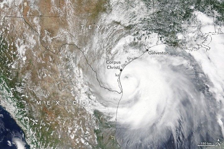
At around 5:00 p.m. Central Daylight Time on July 25, 2020, Hurricane Hanna made landfall just on Padre Island, south of Corpus Christi, Texas. The category 1 hurricane caused flash flooding and knocked out power for tens of thousands of Texas residents.
The Moderate Resolution Imaging Spectroradiometer (MODIS) on NASA’s Terra satellite acquired this image of Hurricane Hanna on the morning of July 25. Hanna had sustained winds of 90 miles (145 kilometers) per hour at landfall. Preliminary rainfall totals registered 4 to 6 inches (10 to 15 centimeters) of rain around Corpus Christi, although some news media reported up to a foot in some places.
References & Resources
- CNN (2020, July 26) Hurricane Hanna weakens to tropical depression after making landfall in southern Texas. Accessed July 27, 2020.
- The Dallas Morning News (2020, July 26) As Hanna is downgraded to tropical storm, South Texas braces for possibly âcatastrophicâ flooding. Accessed July 27, 2020.
- National Hurricane Center (2020, July 25) Hurricane Hanna. Accessed July 27, 2020.
NASA Earth Observatory image by Lauren Dauphin, using MODIS data from NASA EOSDIS/LANCE and GIBS/Worldview . Text by Kasha Patel.


