


October 24, 2002
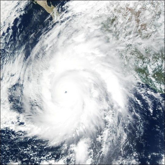
Packing winds of 160 miles per hour (257 km per hour), Hurricane Kenna intensified into a Category 5 storm on Oct. 25, 2002. Kenna is shown in this true-color image bearing down on Mexico’s west coast.
This scene was acquired by the Moderate Resolution Imaging Spectroradiometer (MODIS), flying aboard NASA’s Terra satellite, on October 24. Category 5 hurricanes, the strongest category, are capable of causing catastrophic damage. The storm is predicted to make landfall by late morning on Oct. 25.
References & Resources
Image by Jesse Allen, NASA Earth Observatory; data provided by the MODIS Land Rapid Response Team, NASA GSFC


