Suggested Searches

1 min read

Hurricane Nate

Instruments:
2005-09-06 00:00:00
September 6, 2005

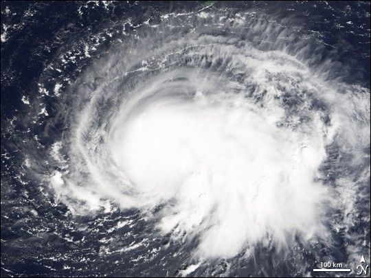
Tropical Storm Nate was becoming better organized on September 6, 2005, when the Moderate Resolution Imaging Spectroradiometer (MODIS) on NASA’s Terra satellite captured this image. The storm had winds of about 95 kilometers per hour (65 mph) with stronger gusts, according to the National Hurricane Center. Nate may strengthen into a weak hurricane and strike Bermuda as it moves northeast over the Atlantic Ocean.

References & Resources

NASA image created by Jesse Allen, Earth Observatory, using data obtained courtesy of the MODIS Rapid Response team.

You may also be interested in:

Stay up-to-date with the latest content from NASA as we explore the universe and discover more about our home planet.

Imelda and Humberto Crowd the Atlantic
3 min read

The tropical cyclones are close enough in proximity that they may influence one another.

Article
A Direct Hit on Jamaican Forests 
6 min read

Hurricane Melissa left the island nation’s forests brown and battered, but they won’t stay that way for long.

Article
A Plume of Bright Blue in Melissa’s Wake
5 min read

The category 5 hurricane stirred up carbonate sediment near Jamaica in what scientists believe is the largest such event in…

Article