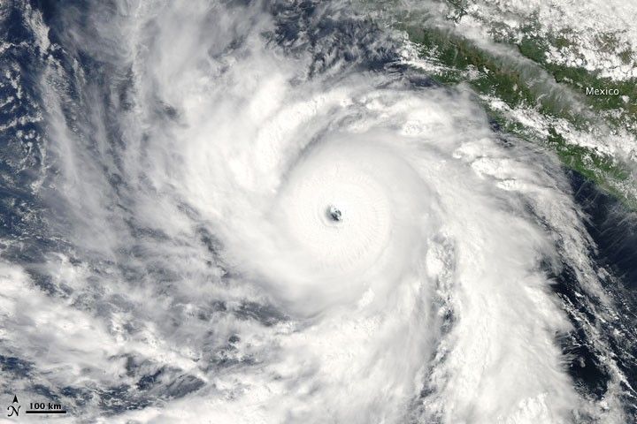
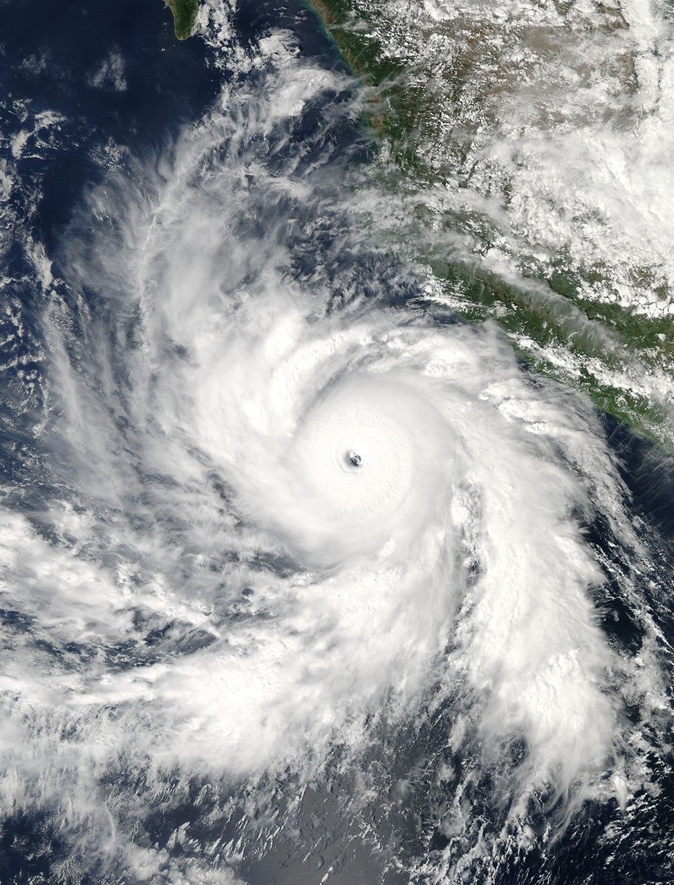
On October 17, 2009, Hurricane Rick hovered over the eastern Pacific Ocean, just off the west coast of southern Mexico. The Moderate Resolution Imaging Spectroradiometer (MODIS) on NASA’s Aqua satellite captured this true-color image at 3:20 p.m. Mexico City time (20:20 UTC) on October 17. According to a bulletin from Unisys Weather, Hurricane Rick was a Category 4 hurricane about the time this image was acquired. The following day, Rick strengthened to a Category 5 storm.
Rick spans several hundred kilometers in this image, with long arms stretching to the south and northwest. The eye of this storm appears to span roughly 50 kilometers. Cloud cover is thick over Mexico, although the clouds do not appear to be part of this hurricane.
References & Resources
- Unisys Weather. (2009, October 19). Hurricane Rick. Accessed October 19, 2009.
NASA image by Jeff Schmaltz, MODIS Rapid Response Team. Caption by Michon Scott, NASA Earth Observatory.


