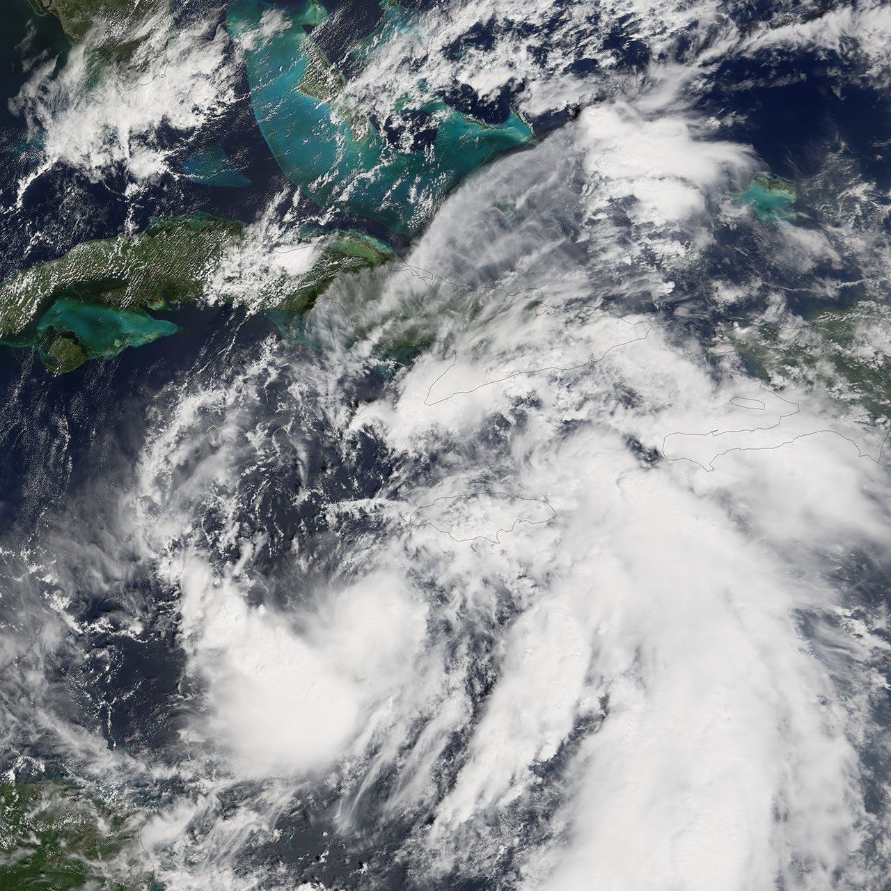
Tropical Depression Wilma does not appear impressive or well organized in this image, acquired by the Moderate Resolution Imaging Spectroradiometer (MODIS) on NASA’s Terra satellite at 12:05 p.m. local time, on October 16, 2005. At the time of this MODIS observation, Wilma was still an unnamed tropical depression without the coherent spiral structure and cloud bands of a hurricane. However, the first stirrings of cyclonic development are visible in this image, even though winds were only around 55 kilometers per hour (35 miles per hour).
Within 24 hours of this MODIS image being acquired, the tropical depression gathered enough wind speed and organization to be classified as a tropical storm and take the name Wilma. Wilma was the 21st storm of the 2005 Atlantic Hurricane season to be named. This made 2005 the most active hurricane season on record, tied with 1933, which also had 21 named storms. Wilma’s projected course when it became a tropical storm was to continue northeast into the Gulf of Mexico where warm waters were predicted to fuel its continuing growth into a full-fledged hurricane.
References & Resources
NASA image created by Jesse Allen, Earth Observatory, using data courtesy of the MODIS Rapid Response team.