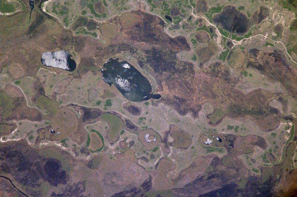

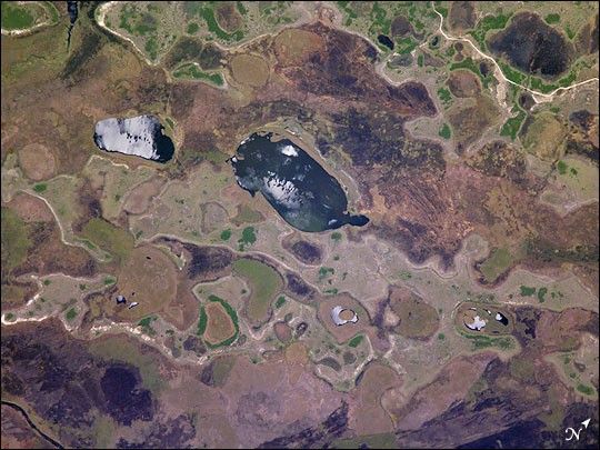
The central lake in this astronaut photograph is one of hundreds in the Iberá swamplands that were formed by South America’s second largest river, the Paraná. Although this great river now lies 120 kilometers to the north of this area today, its channel has swung over a great “inland delta” in the recent geological past.
This and other lakes were captured by the astronaut in the camera’s sunglint region (the area where the Sun reflects directly back toward the camera ) as the International Space Station passed over this remote but vast swampland in northeast Argentina. The glint pattern gives the lakes a slivery appearance, and shows winds ruffling the water surfaces. The lakes in this image lie within side channels of the Paraná that formed when the river flowed through the region from the northeast. The center coordinates of this enhanced image are 28.7°S 58.4°W. The central lake in the image is about 2 km long.
Forest, swamp, and prairie vegetation outline the low topography which consists of lakes, low swells, and depressions. The rounded shape of the topography probably relates to the effects of wind. Evidence from areas both north and south of the swamps suggests that these parts of South America were climatically drier during several periods in the last couple of million years (while North America and Europe were experiencing glaciations). Aridity allows the effects of wind to become pronounced. Wind builds elliptical sand dunes and scours out rounded depressions. Wind also generates waves on lakes that smooth sandy and muddy lake shores.
References & Resources
Astronaut photograph ISS010-E-5072 was acquired October 25, 2004 with a Kodak 760C digital camera with an 800 mm lens, and is provided by the ISS Crew Earth Observations experiment and the Image Science & Analysis Group, Johnson Space Center. The International Space Station Program supports the laboratory to help astronauts take pictures of Earth that will be of the greatest value to scientists and the public, and to make those images freely available on the Internet. Additional images taken by astronauts and cosmonauts can be viewed at the NASA/JSC Gateway to Astronaut Photography of Earth.