


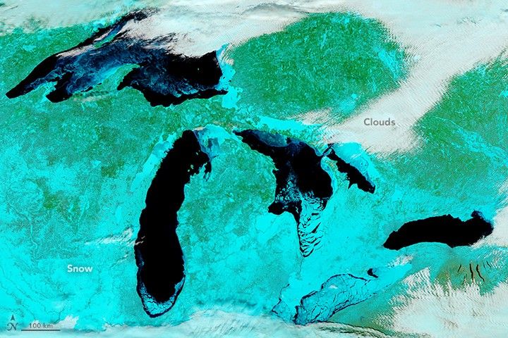

The unusually cold winter in the Upper Midwest has led to a notable buildup of ice on the Great Lakes.
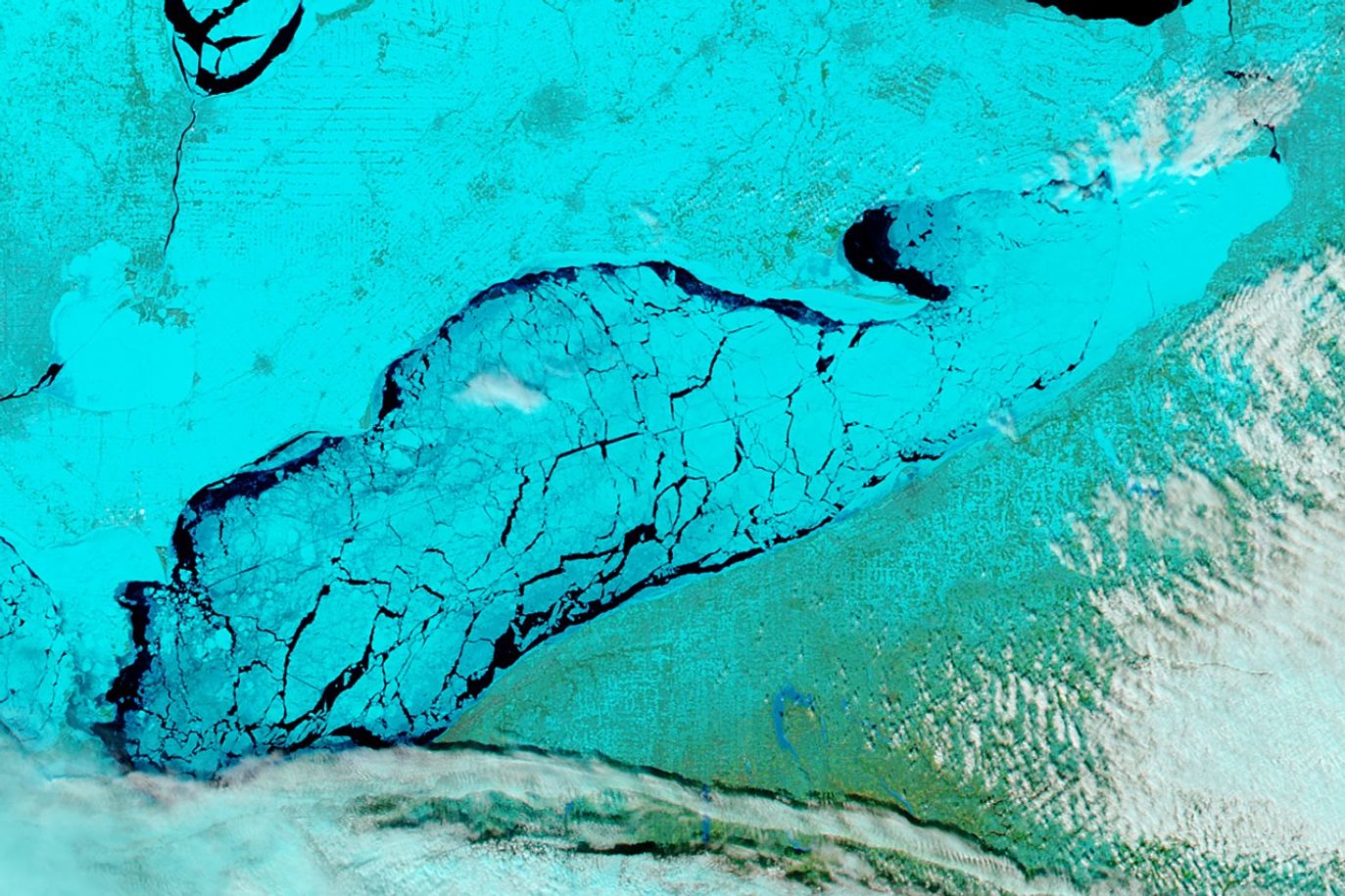
On February 14, 2018, the Moderate Resolution Imaging Spectroradiometer (MODIS) on NASA’s Aqua satellite acquired data for these false-color images of North America’s Great Lakes. The images were made from a combination of infrared and visible light (MODIS bands 7-2-1) in order to better differentiate between snow and ice (teal) and clouds (white). Open water appears black, though some of the dark areas likely have a layer of clear ice (without snow cover on it). For a detailed map of ice extent and thickness on the Great Lakes, visit the Great Lakes Ice Analysis page.
When these data were acquired, 57.9 percent of the surfaces of the Great Lakes were covered with ice, according to NOAA’s Great Lakes Environmental Research Laboratory. On the same date last year, total ice cover was 9.7 percent. Lake Erie was the iciest of the five lakes, with 93.3 percent iced over.
Lake Erie is slightly larger in surface area than Lake Ontario (the smallest of the five Great Lakes), but Erie is relatively shallow and contains less than one-third of the volume of water found in Lake Ontario. Lake Erie is generally the first to freeze in winter and the first to thaw in spring.
All of the ice poses challenges for shipping. In January 2018, the U.S. Coast Guard sent an icebreaker to free five ships trapped in ice in the Straits of Mackinac. However, it is a boon for fisherman. Outdoor shops that cater to ice fisherman on Lake Erie have seen a spike in equipment supplies, according to AccuWeather.
References & Resources
- AccuWeather (2018, February 14) Fishing economy flourishes as most extensive Great Lakes ice coverage accrues in 3 years. Accessed February 15, 2018.
- GoErie (2018, February 14) Lake Erie is 89 percent frozen over. Accessed February 15, 2018.
- Michigan Live (2018, January 19) 5 ships stuck in ice in Straits of Mackinac. Accessed February 15, 2018.
- NOAA Great Lakes Environmental Laboratory (2018, February 14) Great Lakes Ice Cover. Accessed February 15, 2018.
- University of Wisconsin–Madison CIMSS Satellite Blog (2018, February 14) Ice Motion on the Great Lakes. Accessed February 15, 2018.
- WoodTV (2018, February 14) Lake Michigan Satellite Picture Shows the Ice. Accessed February 15, 2018.
NASA Earth Observatory image by Jeff Schmaltz, using MODIS data from LANCE/EOSDIS Rapid Response . Caption by Adam Voiland.


