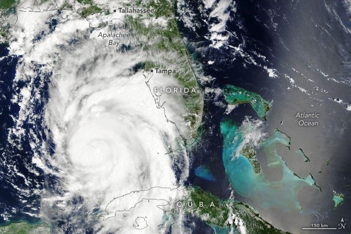

After roaring into the Gulf of Mexico, Hurricane Idalia made landfall over the Big Bend region of Florida on the morning of August 30, 2023, as a category 3 storm. Winds measured 205 kilometers (125 miles) per hour as the storm reached land, according to the National Hurricane Center. Before landfall, however, Idalia spent some time over the gulf as an “extremely dangerous” category 4 storm.
This animation highlights the storm’s wind field over a 24-hour period between the mornings of August 29 and August 30, 2023. The strongest winds appear red and yellow; weaker winds are blue and white. Data for the map come from the Goddard Earth Observing System Model (GEOS), which scientists use to analyze global weather phenomena. The GEOS model ingests wind data from more than 30 sources, including ships, buoys, radiosondes, dropsondes, aircraft, and satellites.
At the start of the animation, winds measured 120 kilometers (75 miles) per hour; by the end, winds were 215 kilometers (130 miles) per hour. The animation includes the period when Hurricane Idalia rapidly intensified. Some key ingredients for rapid intensification are high sea surface temperatures, excess ocean heat content (a measure of the water temperature below the surface), and low vertical wind shear.
Hurricane Franklin—the first major storm of the 2023 Atlantic hurricane season—is also visible churning offshore in the animation. Forecasts called for that storm to steer northeast, away from mainland North America.
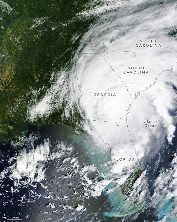
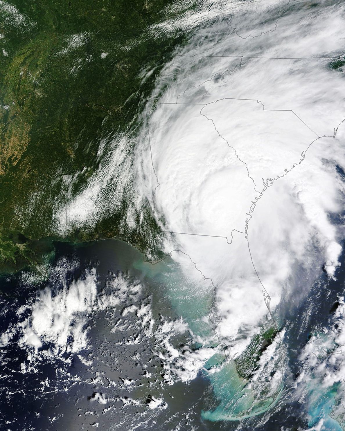
The Moderate Resolution Imaging Spectroradiometer (MODIS) on NASA’s Terra satellite acquired this image at 12:15 p.m. Eastern Time on August 30, several hours after Idalia made landfall. By this time, the storm had moved inland over southern Georgia and had weakened to a category 1 storm, with sustained winds of 140 kilometers (85 miles) per hour.
Damaging winds were expected in parts of Georgia and South Carolina through the evening of August 30. But wind is only one of the hazards posed by hurricanes. Heavy rain from Idalia was expected to cause flooding in parts of North Florida, Georgia, and the Carolinas. And strong winds are the primary cause of storm surge, which has already affected Florida’s Gulf Coast and was expected to begin affecting parts of the southeastern U.S. coast.
NASA’s Earth Applied Sciences Disasters program area has been activated in support of Hurricane Idalia. As new information becomes available, the team will be posting maps and data products on its open-access mapping portal.
References & Resources
- NASA Earth Observatory (2023, August 30) Idalia Roars Into the Gulf of Mexico. Accessed August 30, 2023.
- National Hurricane Center (2023, August 30) Hurricane Franklin Advisory Archive. Accessed August 30, 2023.
- National Hurricane Center (2023, August 30) Hurricane Idalia Advisory Archive. Accessed August 30, 2023.
NASA Earth Observatory images by Lauren Dauphin and Wanmei Liang , using GEOS-5 data from the Global Modeling and Assimilation Office at NASA GSFC and MODIS data from NASA EOSDIS LANCE and GIBS/Worldview . Story by Kathryn Hansen .